

Houston weather: Tuesday rain chances increase as temps reach 90s

Houston weather: Scattered storm chances increase Tuesday
Typical June heat and humidity will remain in place, but rain chances are on the rise with scattered storms possible today and on Wednesday. It will be warm again with highs in the low 90s.
HOUSTON - The chance of showers increases for Tuesday and Wednesday due to a plume of moisture moving into Southeast Texas.
Hot, humid, showery
Typical June heat and humidity will remain in place all week with daily highs ranging from 90-95 degrees. Meanwhile, a plume of moisture is being steered in our direction underneath a major "heat dome" over the East Coast of the country.
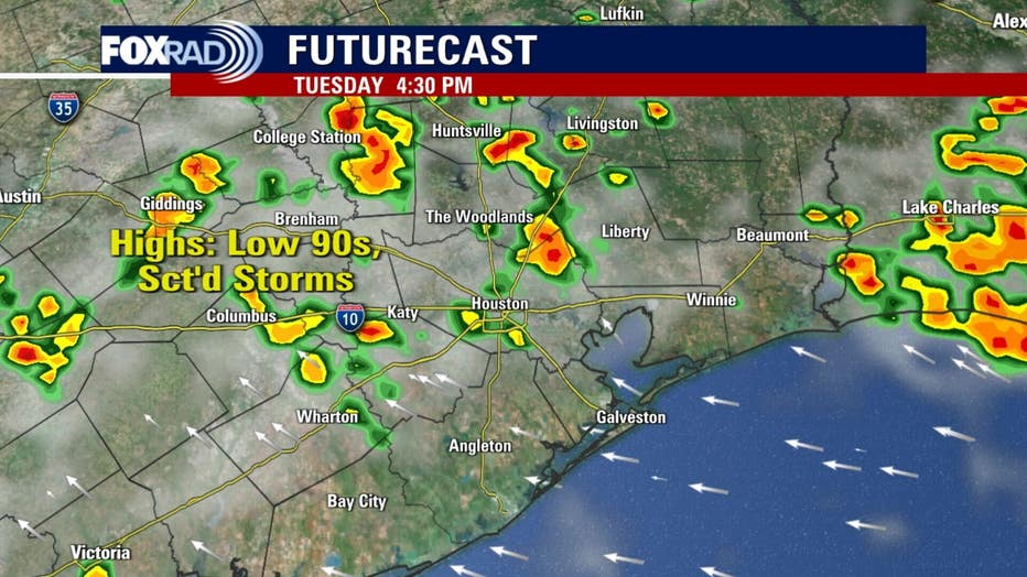
This plume should provide conditions for scattered showers and storms the rest of today and tomorrow. A few could be briefly heavy, nothing looks severe at this time.
Record-breaking heat across the country
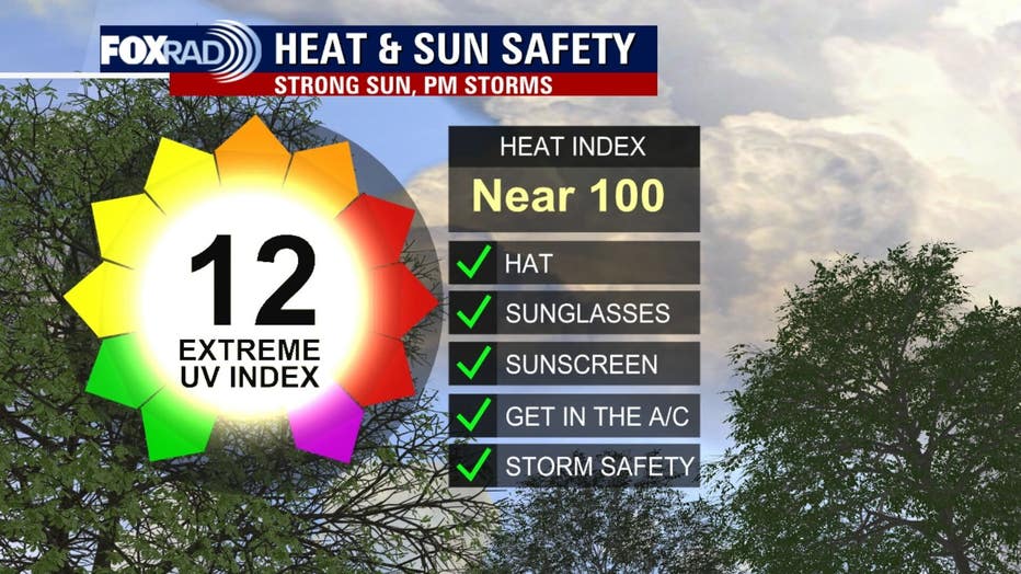
A heat dome to our north (that is steering rain in our direction) is going to bring extreme heat for cities like Washington, DC, Philly, New York, Pittsburgh, Detroit and Chicago.
Record highs are possible and heat index values will be dangerous. A friendly reminder to drink plenty of water, use sunscreen and take breaks inside the a/c.
Area of interest in the Atlantic is no threat
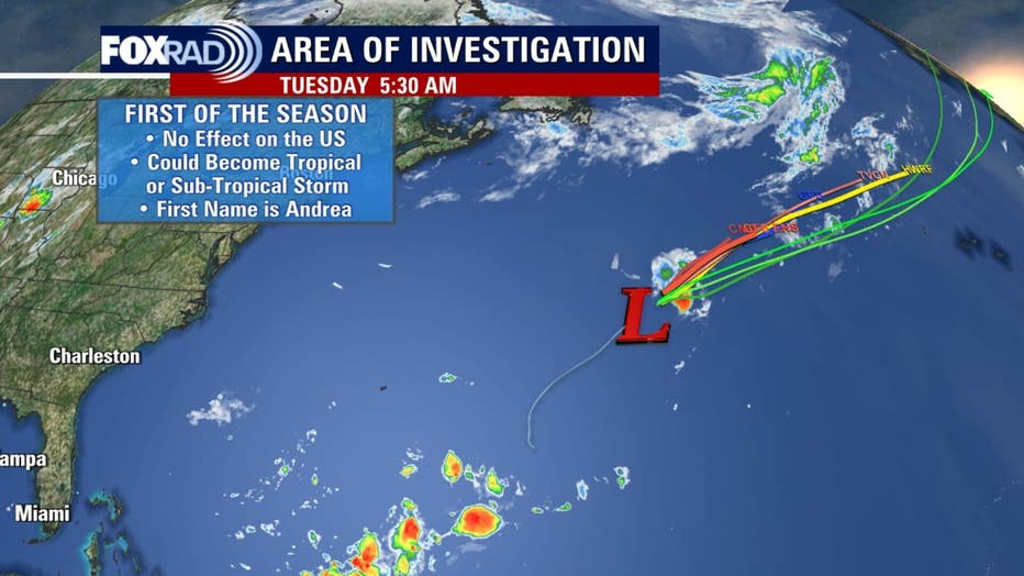
A small area of low pressure in the middle of the Atlantic Ocean could spin-up into a short-lived tropical depression or storm (or possibly a sub-tropical storm) over the next 48 hours or so. The first name on the list this year is Andrea, but just know that this system will have no effects on the US.
The Source: Your Gulf Coast Weather Authority