

Houston weather: Toasty temps, storm chances for 4th of July

Houston weather: Steamy temps and storm chances for July 4
The heat index could rise above 103 at times, but there could be a couple of afternoon storms to provide a temporary cool-down.
Hot with late-day storms
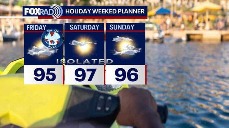
HOUSTON - Unsettled weather and higher levels of moisture that have been affecting central and west Texas over the last few days is drifting in our direction, so we've bumped the rain chances up for the rest of today.
Watch for spotty to scattered storms with isolated 2" downpours possible. Otherwise, plan on steamy air with heat index values above 100.
Steamy Independence Day
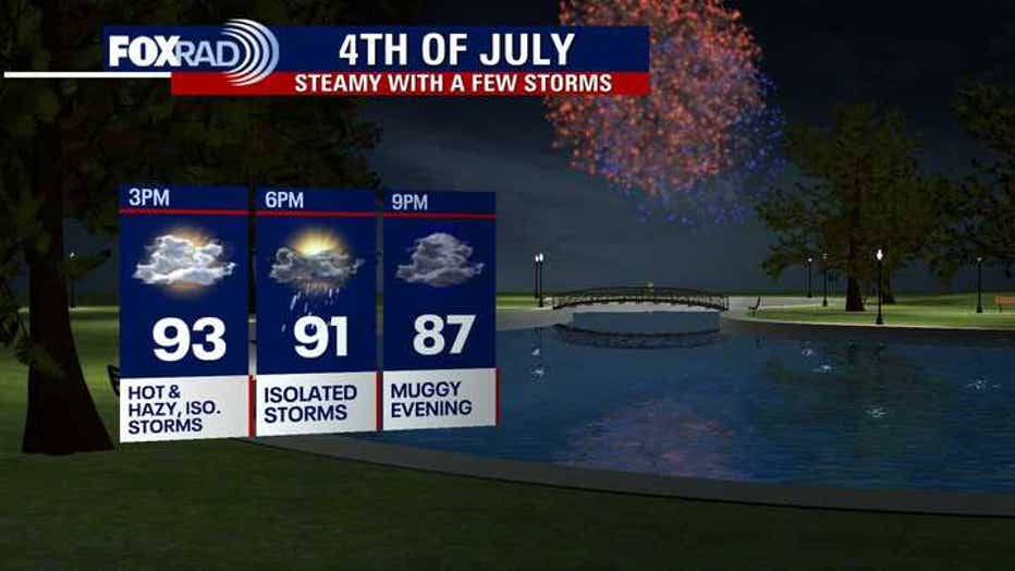
High temperatures for the 4th of July are looking very normal, but normal is hot, so expect highs in the mid 90s.
The heat index could rise above 103 at times, but there could be a couple of afternoon storms to provide a temporary cool-down.
Since so many people will be outdoors, be aware that some lightning will be possible, so if you hear thunder, head indoors.
Storms will most likely fizzle before fireworks time.
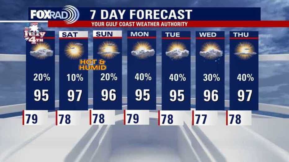
7-Day Forecast
Tropical storm could impact the Carolinas
The National Hurricane Center has a medium (60%) chance of a tropical depression or storm developing near NE Florida over the next few days.
But most of our models, including our exclusive Fox Weather Model, are showing a tropical storm forming and affecting the Carolinas by late this weekend.
No effects on Texas.

Watching Atlantic Basin near Florida for possible development
Across the Atlantic basin, Tropical Storm Chantal could form this weekend offshore of the Southeast U.S. An area of low pressure is expected to develop near Northeast Florida and drift up towards the Georgia and Carolina coasts. Regardless of development, heavy downpours will continue to impact parts of Florida and the Carolinas through the holiday weekend. There will be no impacts to Texas from this system.
The Source: Your Gulf Coast Weather Authority