

Houston weather updates: Strong storms pass through; rain chances continue Sunday
Houston weather: March 7 overnight forecast
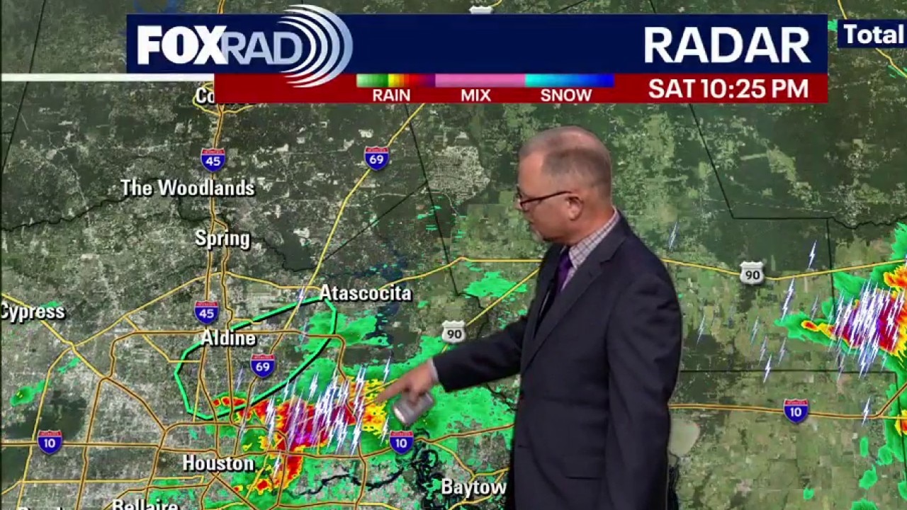
The strongest of Saturday's storms have passed through Greater Houston. Some areas may see some more rain on Sunday.
HOUSTON - A FOX 26 Storm Alert was in effect as a stalled front brought rounds of heavy rain and severe weather Saturday night.
Stormy Saturday night
A Flood Advisory is in effect for a part of Harris County until 12:15 a.m. Sunday.
If you're heading to the Rodeo, prepare for a few showers and downpours through Sunday afternoon.

Live updates
10 p.m.
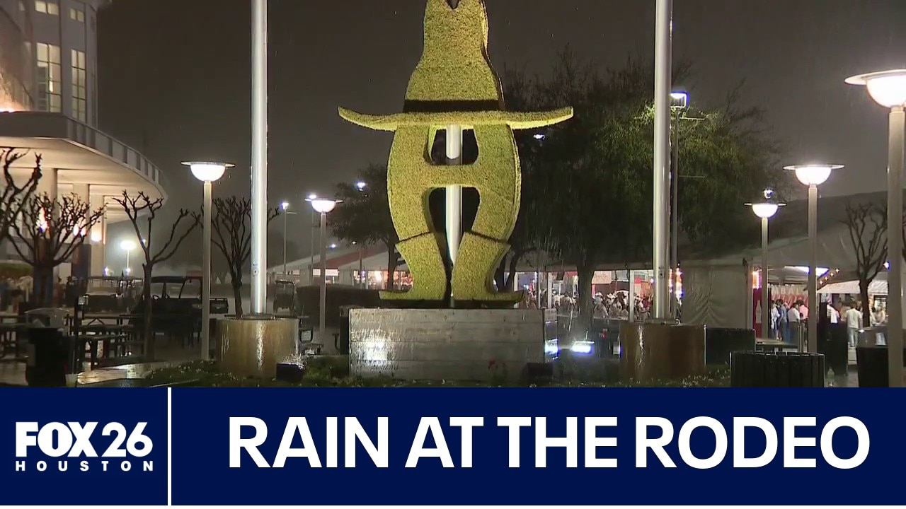
Houston Rodeo spirit rides on through storms
Saturday night’s storms reached the Houston Rodeo, but it did NOT rain on anyone's parade! FOX 26's McKenna Earnhart was on the fairgrounds before, during, and after the rain.
9:15 p.m.
A Flood Advisory has expired for Montgomery County, but it has shifted more into Harris County. It is now in effect until 12:15 a.m. Sunday.
9:10 p.m.
A FOX 26 camera was rolling when a driver tried to go through a flooded underpass in Houston's EaDo area.
8:52 p.m.
A Severe Thunderstorm Watch ended early for Colorado, Jackson, Matagorda, and Wharton counties. It was originally set to last until 11 p.m.
8:30 p.m.
TxDOT warned some Houston areas were being impacted by high water.
8 p.m.
Bush Airport (IAH) ended its weather-related ground stop.
Flights leaving the airport are delayed by close to two hours on average. Click here to check on flight times.
7:41 p.m.
Rodeo Houston announced that Saturday night's drone show is canceled due to the weather.
7:30 p.m.
Rodeo Houston paused outdoor activities due to the storms. They advised fairgoers to go inside.
7:15 p.m.
Harris County authorities say they're getting reports of flooded roadways in the following areas:
- NW Harris County: Hilton Head Lane and Barker Cypress Road
- North Harris County: Overland Trail and Wells Fargo Drive
- Aldine: Henry Road and Hollyvale Drive
- North Harris County: Aldine Bender Road near Aldine Westfield Road
Cold front next week
Unsettled weather lingers through early next week.
A stronger cold front arrives Tuesday night/ Wednesday with possible strong storms. This will usher in a cooler, drier air mass for the second half of the week, with overnight lows dropping back into the 50s.

The Source: Your Gulf Coast Weather Authority