

Houston weather: Scattered rain, high heat ahead of dry mid-week trend
HOUSTON - Deep Gulf moisture keeps scattered showers and thunderstorms in the forecast through the weekend and into Monday.
Daily rain chances
Rain will be hit-or-miss, with warm and humid conditions in between the storms.
A few thunderstorms could produce locally heavy rain over a short period of time. Brief street flooding, frequent lightning and gusty winds will be possible underneath the stronger storms.
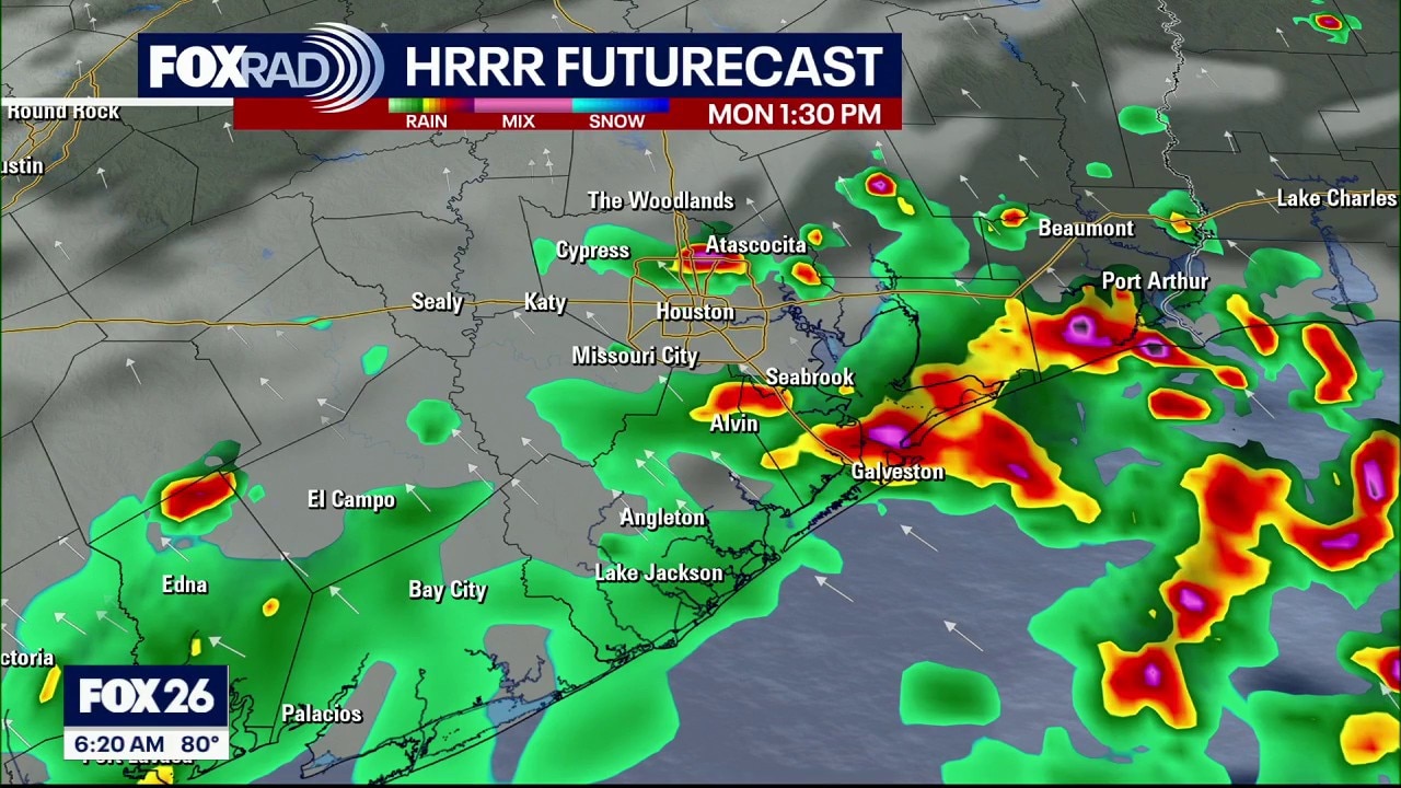
Houston weather: August 9 morning forecast
Daily highs reach the mid 90s, with heat index values above 100 away from scattered storms. A hotter and drier pattern could return by the middle of next week as rain chances begin to decrease and temps could ramp back into the upper 90s.
Always be ready to get inside quickly if lightning develops in your area.
7-Day Forecast
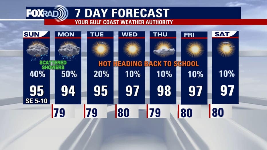
Daily highs reach the mid 90s, with heat index values above 100 away from scattered storms. A hotter and drier pattern could return by the middle of next week as rain chances begin to decrease and temps could ramp back into the upper 90s.
Tropical Outlook
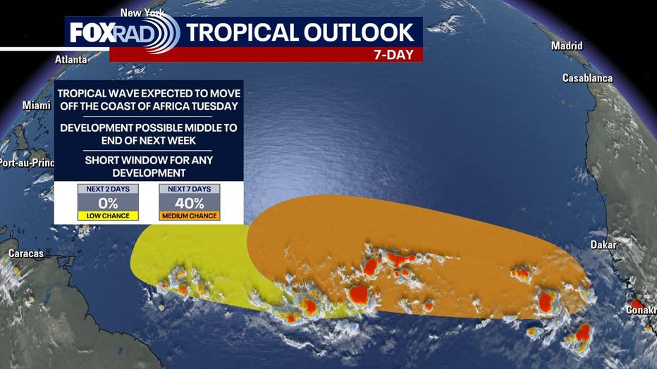
Tropical storms and hurricanes could develop over the next week, but chances are low. Tropical waves are common during this time of the hurricane season, but will likely not survive due to unfavorable conditions like dry air and wind shear. There are currently two areas for possible development by the National Hurricane Center. One with a low chance for development and another with a medium chance during the end of the upcoming week. Continue to stay alert as hurricane season runs through the end of November.
The Source: Information in this article is from the FOX 26 Houston weather team.