

Houston weather: More rain chances ahead of midweek cold front
Houston weather: March 8 evening forecast
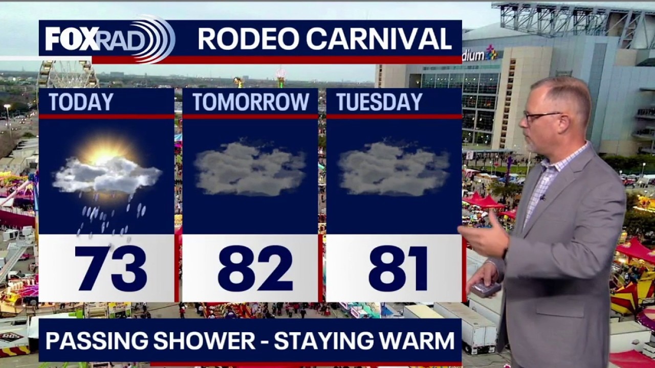
Skies remain cloudy Sunday night and fog will be around the Houston area for Monday morning. Passing showers and a rumble of thunder will be possible in the morning with a chance for a stray shower in the afternoon.
HOUSTON - Unsettled weather lingers through early next week.
Overcast Monday
Skies remain cloudy Sunday night and fog will be around the Houston area for Monday morning. Passing showers and a rumble of thunder will be possible in the morning with a chance for a stray shower in the afternoon.

Cold front mid-week
About a 20%-30% chance for a few showers Monday and Tuesday.
A stronger cold front arrives Tuesday night/ Wednesday with possible strong storms.
Our friends in North and Central Texas are under a 2/5 risk for severe storms on Tuesday.
Nice end to the week
The mid-week front will usher in a cooler, drier air mass for the second half of the week and next weekend.
As of now, we can expect clear sunny skies, lower humidity, highs in the 70s with overnight lows dropping back into the 50s. Perfect for those on Spring Break.
Enjoy!

The Source: Your Gulf Coast Weather Authority