

Houston weather: Warm Monday afternoon, storms possible Tuesday
Houston weather: Chilly morning, warm Monday afternoon
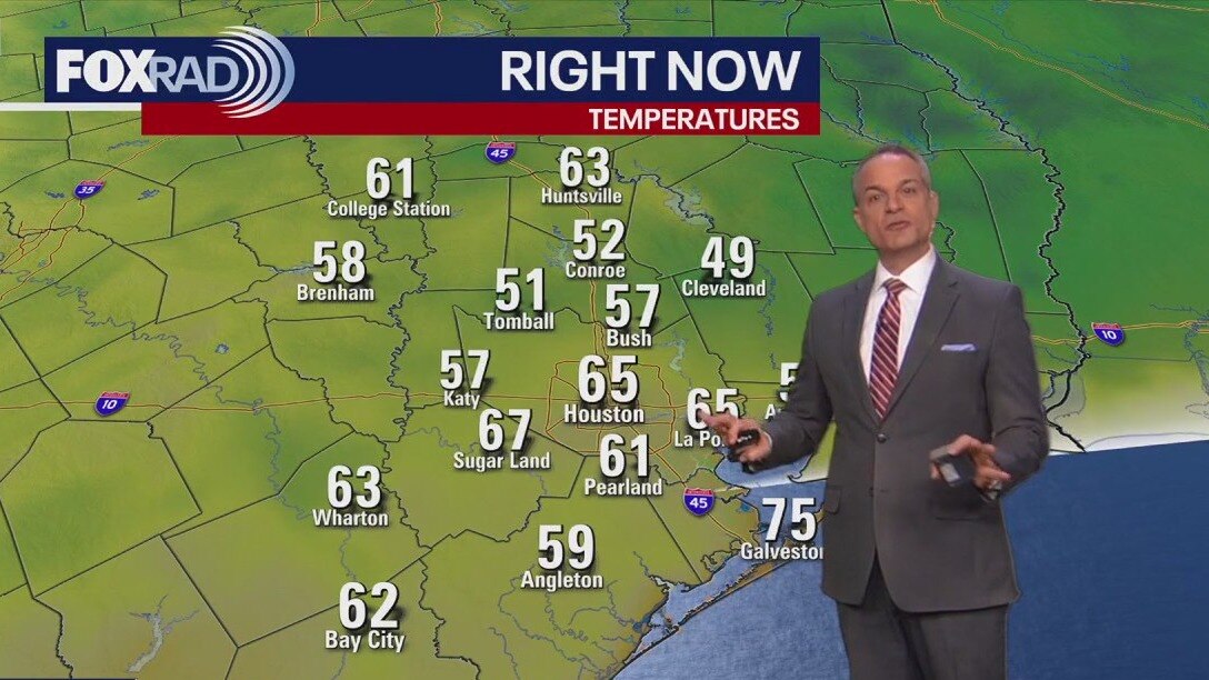
Stepping out the door this morning, the temperature is a little chilly with lows in the 50s and 60s. However, as we move into the afternoon it'll warm up to the recent highs of 90s with some sunshine.
HOUSTON - Stepping out the door this morning, the temperature is a little chilly with lows in the 50s and 60s but as we move into the afternoon it'll warm up with some sunshine.
Very cool, then hot

Following a crisp Monday morning with lows in the 50s, heat will return surprisingly quickly today as highs head back to near 90. You'll notice increasing humidity by the afternoon which will keep temps tonight about 10 degrees warmer and set the stage for some rain tomorrow.
Storms return for Tuesday

Tuesday ramps up with a cold front fueling a decent chance for afternoon scattered thunderstorms, especially south of Houston. Rain will most likely hold off until after 1 p.m., so prepare for the chance for rain after school Tuesday.
Unseasonably muggy air will surge in Tuesday, so as another front moves in, it will have plenty of moisture to work with. We should get a decent cool-down for Wednesday afternoon.
Round of downpours possible after late week

A stalling front could spark storms on Friday, Saturday and possibly early Sunday, with at least 1–2 inches of rain in spots. Texas fire danger has prompted burn bans for 152 counties, but rain could help in some areas this week.
Still, please avoid anything that could cause a spark near dry vegetation until further notice.
The Source: Your Gulf Coast Weather Authority