

Houston weather: Intense heat expected through mid-week, storm chances returning on Friday
INTENSE HEAT THROUGH MID‑WEEK
HOUSTON - Expect sizzling daytime highs of 97–99 today through Thursday with heat index values above 100. Morning lows remain steamy. Although no heat advisories are in effect, be careful not to overexert yourself outside, stay hydrated and get in the AC when possible.
STORM CHANCES RETURN FRIDAY
Moisture from the Gulf will surge into Southeast Texas on Thursday night and into Friday, boosting rain and storm chances to 50%, especially during afternoon and evening hours.
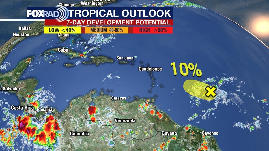
TROPICS REMAIN FAIRLY QUIET
The National Hurricane Center confirms no active threats in the Gulf for now. Meanwhile, Invest 94L only has a 10% chance for development into a tropical depression over the next 7 days; it poses no immediate threat to the Gulf. The plume of moisture expected in Houston on Friday has a slight chance of spinning up into a depression as it moves along the northern Gulf, but that is highly uncertain at this point.
The Source: Information above from Your Gulf Coast Weather Authority Team.