

Houston weather: Heat, haziness continues for the weekend
Houston weather: June 27 morning forecast
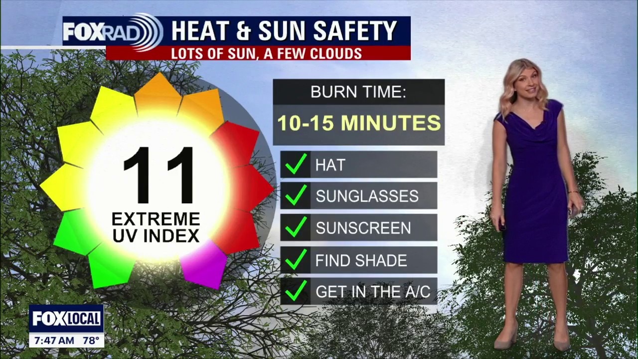
Typical June heat continues across Houston through the weekend and again for Monday’s World Cup Match. Highs stay in the 90s with heat index values above 100 each afternoon, so fans heading to the stadium or FIFA Fan Fest should plan for steamy conditions.
HOUSTON - Hazy skies and high temps continue as we're expecting the thickest batch of Saharan Dust late this weekend for southeast Texas.
Summer heat continues
Typical June heat continues across Houston through the weekend and again for Monday’s World Cup Match. Highs stay in the 90s with heat index values above 100 each afternoon, so fans heading to the stadium or FIFA Fan Fest should plan for steamy conditions.

Dusty skies dominate
Saharan dust remains likely across Southeast Texas, which could give the sky a hazy or milky look at times.
Expect a noticeable increase in hazy skies on Monday with the thickest plume of dust moving overhead. Rain chances stay low, but the heat and humidity will make it feel more uncomfortable during the afternoon and early evening. If you have difficulty breathing, try not to be out during peak heating outs of the day on Monday.

Tropical activity stays limited
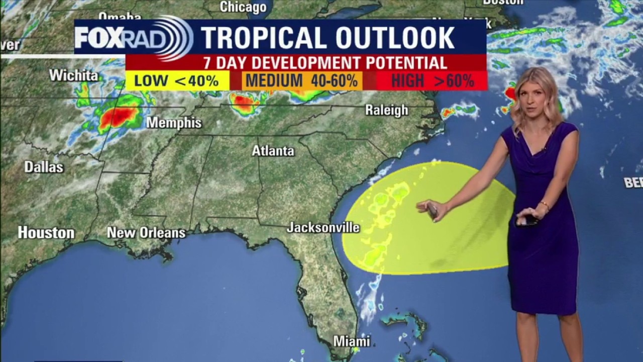
The same dry, dusty air should help limit tropical development across the Atlantic and Gulf. For now, there are no immediate tropical concerns for Southeast Texas, keeping the forecast focused on heat, haze, and mostly rain-free weather.
Tropical Weather Forecast: Sarahan Dust timing + new development potential
FOX 26 meteorologist Allison Gargaro gives the latest timing for Sarahan Dust heading to southeast Texas. She's also tracking a new tropical development in the southeast US.
There is, however, a 20% chance for tropical development off the southeastern US in the Atlantic next week. Overall chances remain low, but will be monitoring a stalled cold front very closely.
Folks in Florida can expect rounds of rain and tropical moisture next week.
This does not look to have any impacts on SE Texas.

The Source: Your Gulf Coast Weather Authority