

Houston weather: Winter Storm Warning issued through Tuesday. Will we see snow and ice?

Houston weather: What we know about possible snow, ice
Will it snow? Will schools be closed on Wednesday too? FOX 26 chief meteorologist Mike Iscovitz breaks down what we know and what we don't know about our upcoming weather.
HOUSTON - A blast of cold air is expected to move into Houston on Sunday, and we could see snow and ice early next week.
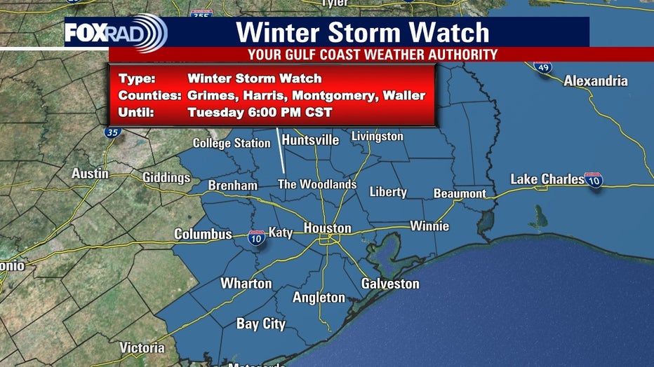
The National Weather Service has issued a winter storm watch from 6 p.m. on Monday through 6 p.m. on Tuesday, Jan. 21.
Weekend Forecast: Cold, Windy
Timeline:
Saturday will be fine to head to the store, gas station, whatever preps you need to make. It's going to be windy, cool and dry.
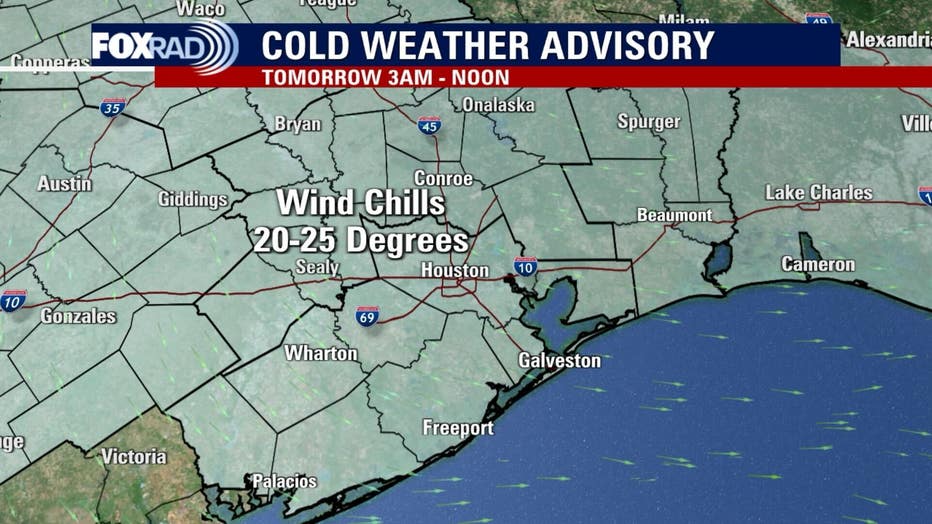
Temperatures will get chilly quickly after sunset and a Cold Weather Advisory goes into effect from 3 a.m. thorugh noon Sunday.

Warning, Watch, Advisory: What's the difference?
From January 29-22, a large part of Texas is expected to see temperatures dip below freezing. During that time and throughout the rest of winter, you will hear meteorologists use terms like warning, watch and advisory, but what do they mean?
The wind chill will be between 20 and 25 degrees.
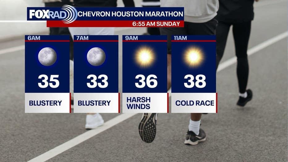
This year's marathon will be very blustery followed by frigid, but sunny weather for the MLK holiday. By the way, if the parade takes place, our friend, Nate "The Great" Griffin will be co-grand marshal.
Will Houston see snow?
Timeline:
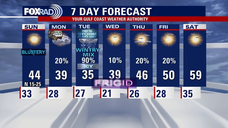
Beginning Monday night, some light snow could begin, especially northwest of Houston.
By Tuesday morning, there is a high chance for ice, snow and sleet. Roads will become hazardous, so plan to stay put if possible from Tuesday morning until midday Wednesday.
Plan for a Hard Freeze on Wednesday morning with temperatures in the teens and lower 20s across Southeast Texas.
READ MORE: LIST: Houston-area school districts closed Tuesday for arctic blast
7-Day Forecast
Cold Weather Safety

Tips/Tricks for preparing your home for freezing weather
FOX 26 caught up with Jason Garrett, owner of Pearce Scapes Landscapes and Sprinkler Systems, who provided some information on how you can better prepare your home for a freeze.
Protect the "four p's" of people, pets, plants and pipes.
Check out our content on Fox Local for details on how to prepare sprinkler systems, wrap pipes and stay safe in freezing weather.
Finally, never run a generator in or near your home, in the garage or close to windows. Carbon monoxide is colorless and odorless and deadly. Don't run your car in the garage with the door closed. Don't leave space heaters unwatched or near anything flammable.
Enough of the doom and gloom - let's hope for snow! The kids will love it.
The Source: Information in this article comes from the FOX 26 Weather team.