

Houston weather: Storm Alert for Valentine's Day
Houston weather: Feb. 13 evening forecast
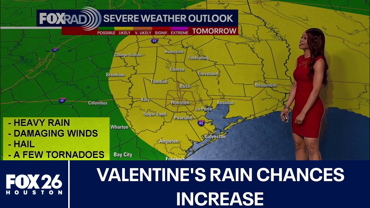
Houston has been placed under a higher 2 out of 5 risk for severe storms Saturday.
HOUSTON - Houston has been placed under a higher 2 out of 5 risk for severe storms Saturday.
FOX 26 Storm Alert
It feels more like April than February. Spring-like temperatures will help set the stage for strong to severe storms and heavy rain Saturday as a strong system rolls in.
Main window for the strongest storms appears to be 8pm Saturday until 2am Sunday. Damaging wind gusts near 60-70 mph will be the main threat although an isolated, brief tornado and some hail can't be ruled out.
Impacts on Valentine's, Mardi Gras plans
There will be a high chance for showers much of Saturday morning and Saturday afternoon for Mardi Gras in Galveston and Valentine's plans.
The threat for storms increases Saturday night, especially between 8 PM and midnight for Houston and 10 PM and 2 AM for Galveston.
Mardi Gras parades, concerts and parties could be impacted. So plan on delays and make sure to have a way to get alerts in case you need to get inside quickly.
Crisp, clear afterward
Behind the front, cooler and much drier air settles in.
Expect crisp mornings and clear, pleasant afternoons beginning Sunday and carrying into early next week — a refreshing return to more comfortable conditions.
But plan on the more intense heat returning as we climb to the middle 80s by Thursday afternoon.

The Source: Your Gulf Coast Weather Authority