

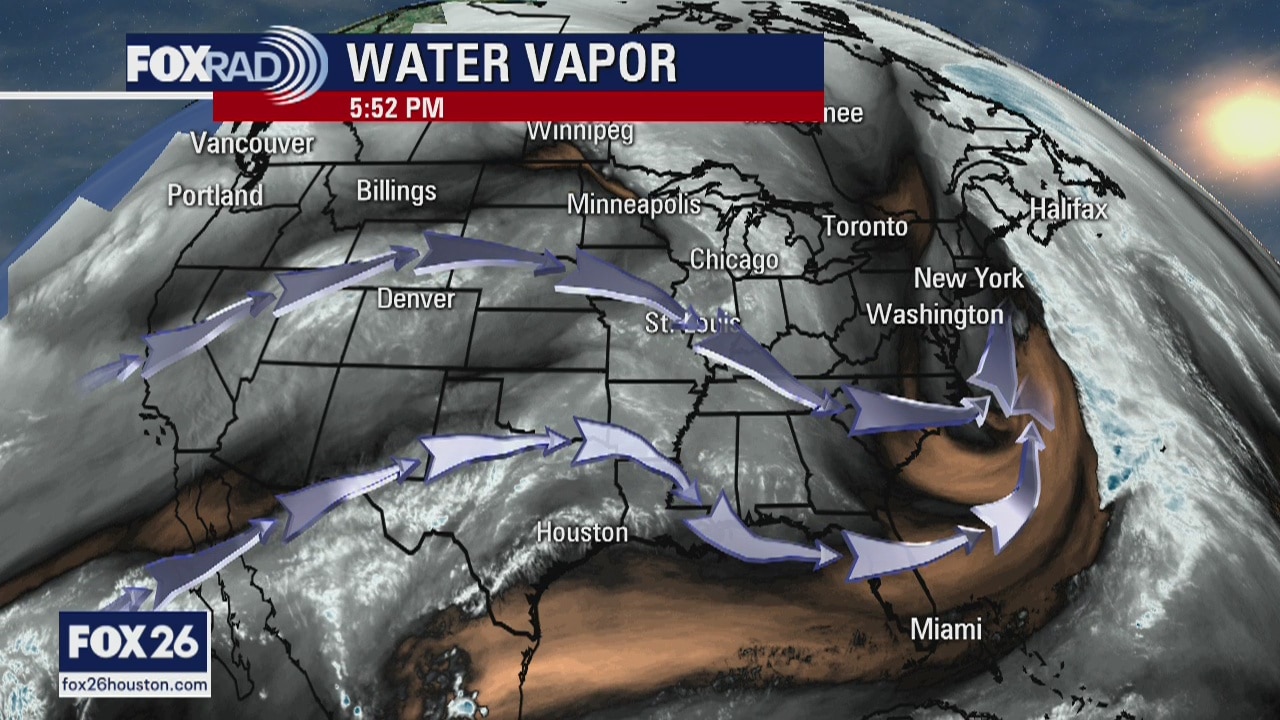
Friday Evening Weather Forecast
Your Gulf Coast Weather Authority Chief Meteorologist Dr. Jim Siebert gives you a look at chances of rain this weekend and next week.
Your Gulf Coast Weather Authority Chief Meteorologist Dr. Jim Siebert gives you a look at chances of rain this weekend and next week.
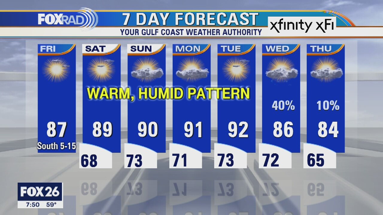
Friday weather forecast
Clear and cool this morning, then sunny and warm with highs in the mid to upper 80s.
Clear and cool this morning, then sunny and warm with highs in the mid to upper 80s.
Friday Morning Weather Forecast
Your Gulf Coast Weather Authority Chief Meteorologist Dr. Jim Siebert gives you a look at the warm weather expected on Friday.
Your Gulf Coast Weather Authority Chief Meteorologist Dr. Jim Siebert gives you a look at the warm weather expected on Friday.
Thursday Evening Weather Forecast
Your Gulf Coast Weather Authority Chief Meteorologist Dr. Jim Siebert gives you a look ahead at tonight's weather.
Your Gulf Coast Weather Authority Chief Meteorologist Dr. Jim Siebert gives you a look ahead at tonight's weather.
Thursday weather forecast
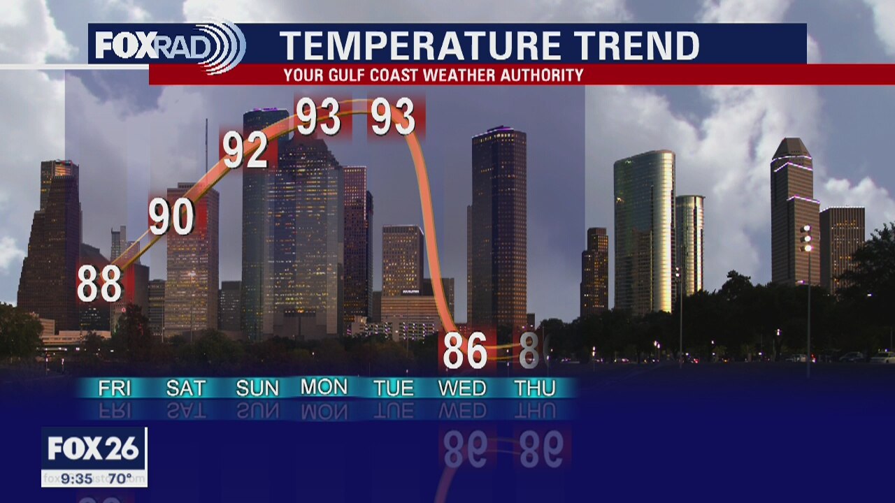
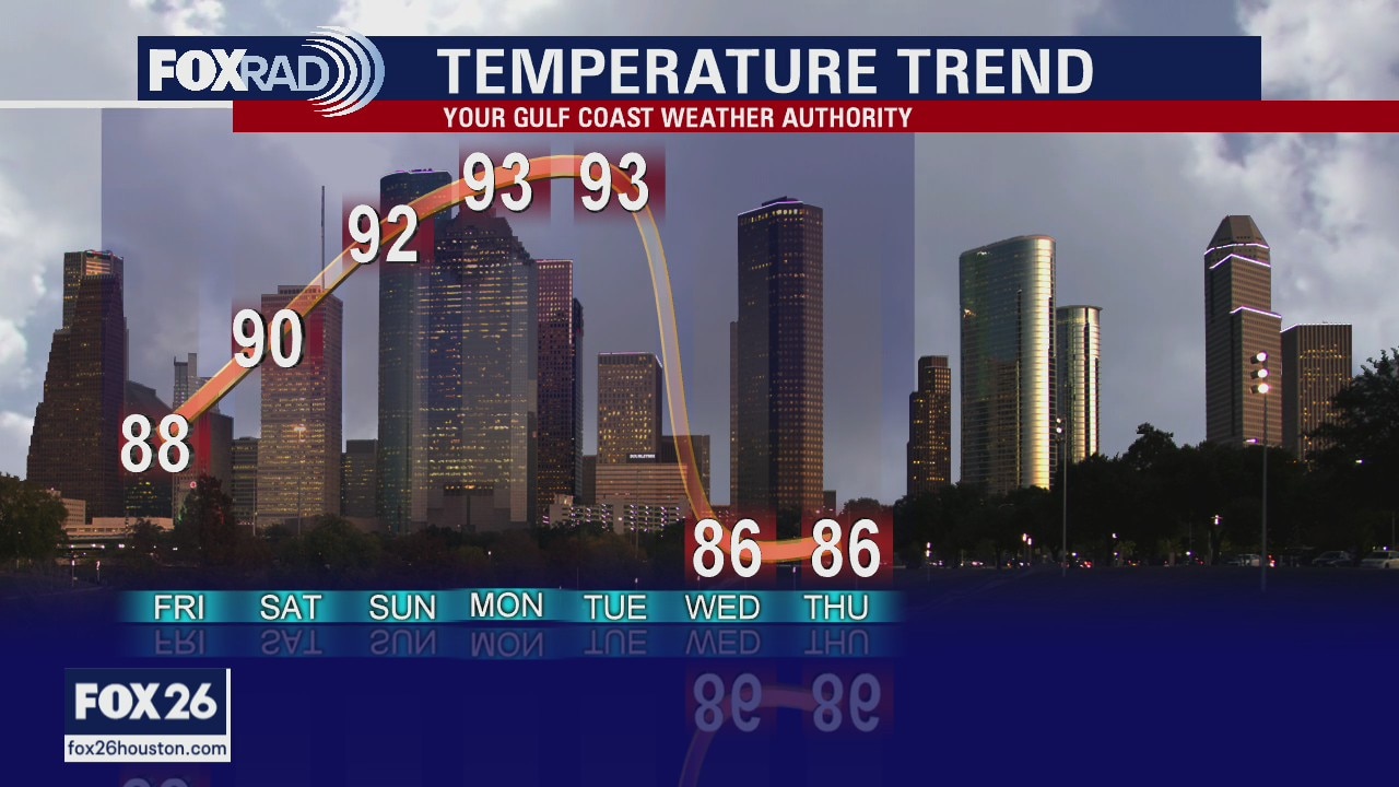
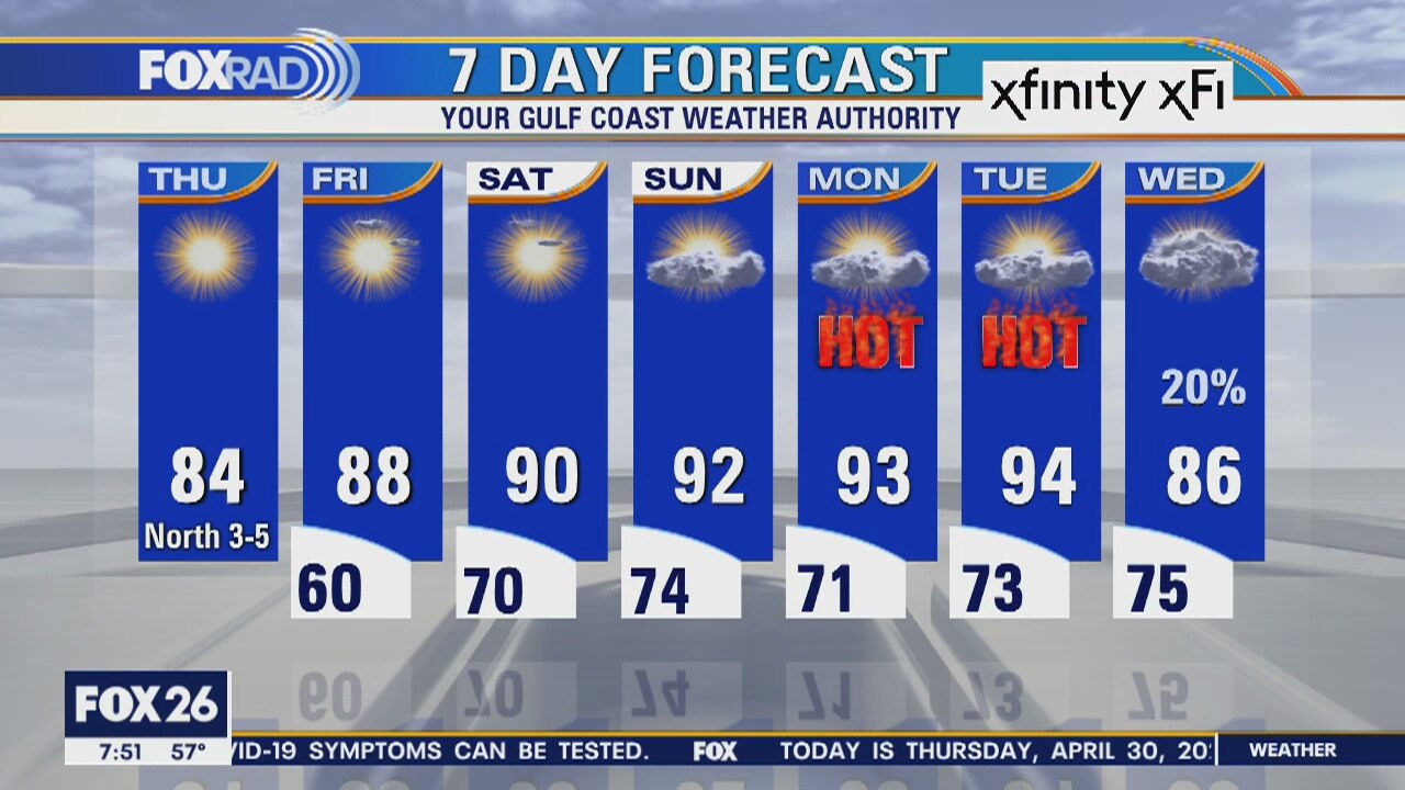
After big storms on Wednesday, a new airmass has arrived and drier air continues to filter in. Temperatures will warm into the low and mid 80s this afternoon under mostly sunny skies. Pretty for much warmer weather as we head toward the weekend. May 1st might be tomorrow, but it'll feel like June this weekend.
After big storms on Wednesday, a new airmass has arrived and drier air continues to filter in. Temperatures will warm into the low and mid 80s this afternoon under mostly sunny skies. Pretty for much warmer weather as we head toward the weekend. May 1st might be tomorrow, but it'll feel like June this weekend.
Thursday Morning Weather Forecast
Your Gulf Coast Weather Authority Chief Meteorologist Dr. Jim Siebert looks ahead to warm weather expected in our area this weekend.
Your Gulf Coast Weather Authority Chief Meteorologist Dr. Jim Siebert looks ahead to warm weather expected in our area this weekend.
Wednesday Evening Weather Forecast
Your Gulf Coast Weather Authority Chief Meteorologist Dr. Jim Siebert gives you a look at the warm weather expected in the Houston area this week.
Your Gulf Coast Weather Authority Chief Meteorologist Dr. Jim Siebert gives you a look at the warm weather expected in the Houston area this week.
Severe Weather Update Wednesday 8:00 a.m.
Still some rain in the area but most of the severe weather has pushed off south. Mike Iscovitz provides this weather update at 8:00 a.m. Wednesday
Still some rain in the area but most of the severe weather has pushed off south. Mike Iscovitz provides this weather update at 8:00 a.m. Wednesday
Severe weather update 7:00 a.m. Wednesday morning
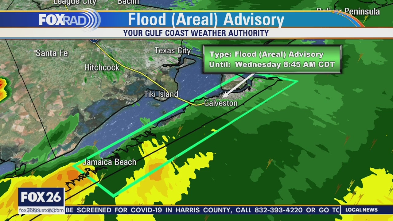
Severe weather moving out of the area, flood advisories in effect for parts of Galveston and Brazoria counties.
Severe weather moving out of the area, flood advisories in effect for parts of Galveston and Brazoria counties.
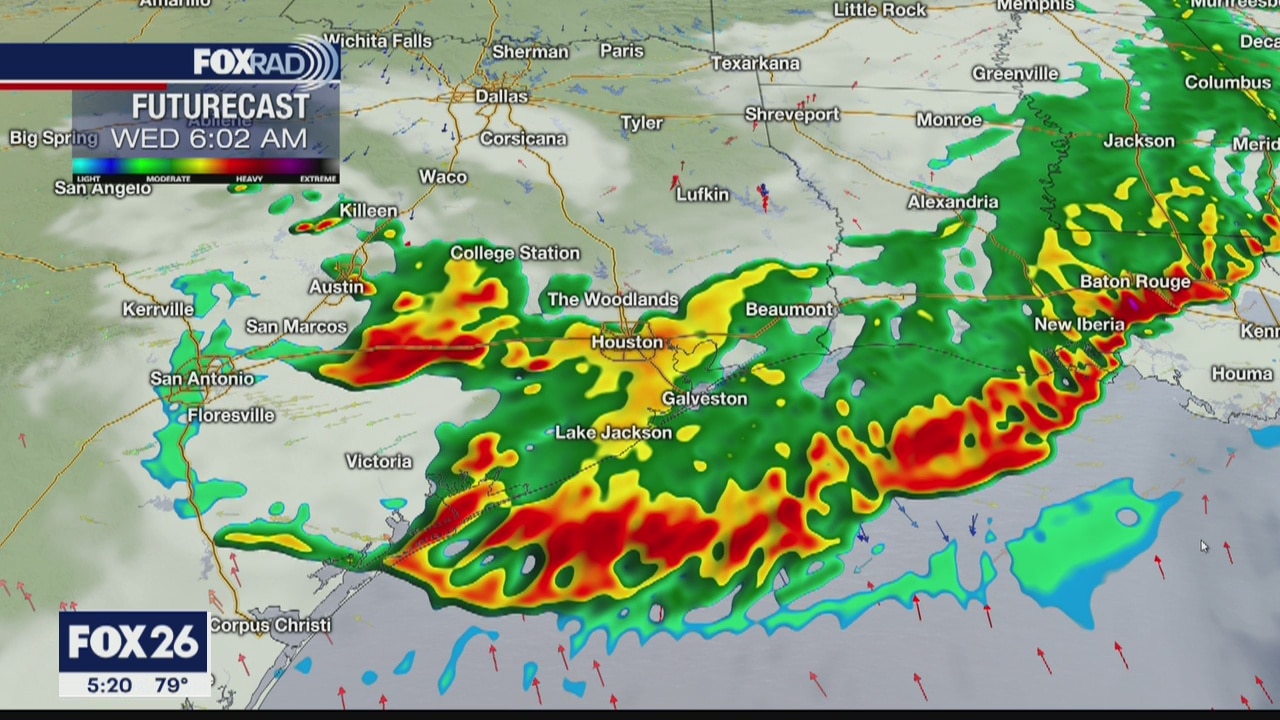
Severe weather threat ending update 6:00 a.m.
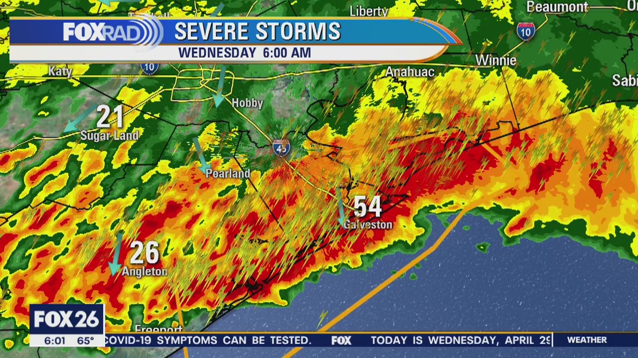
Severe weather ending as line of fast moving thunderstorms move south and out into the Gulf of Mexico. Weather update at 6:00 a.m. Wednesday
Severe weather ending as line of fast moving thunderstorms move south and out into the Gulf of Mexico. Weather update at 6:00 a.m. Wednesday
Severe weather 5am Wednesday
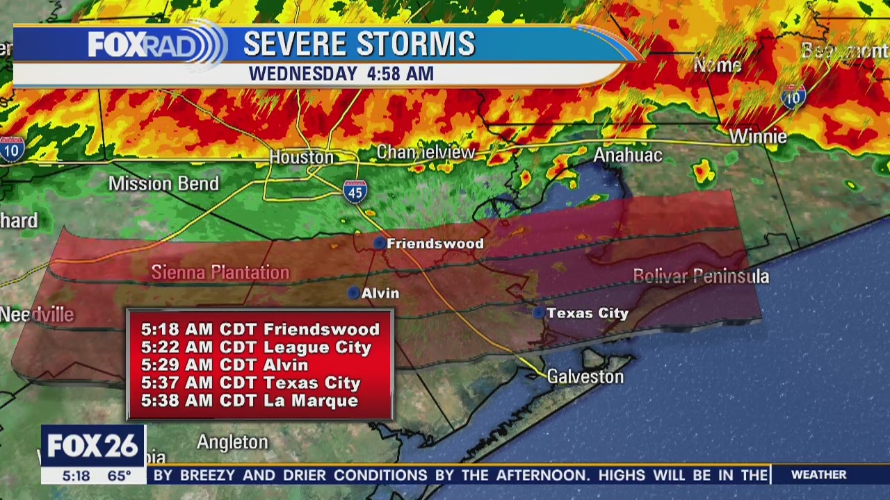
Severe weather in southeast Texas on Wednesday morning. Severe Thunderstorm warning in effect until 5:15 a.m.
Severe weather in southeast Texas on Wednesday morning. Severe Thunderstorm warning in effect until 5:15 a.m.
Severe weather update 6:00 a.m. Wednesday
Mike Iscovitz provides an update on the fast moving thunderstorms moving through southeast Texas on Wednesday morning.
Mike Iscovitz provides an update on the fast moving thunderstorms moving through southeast Texas on Wednesday morning.
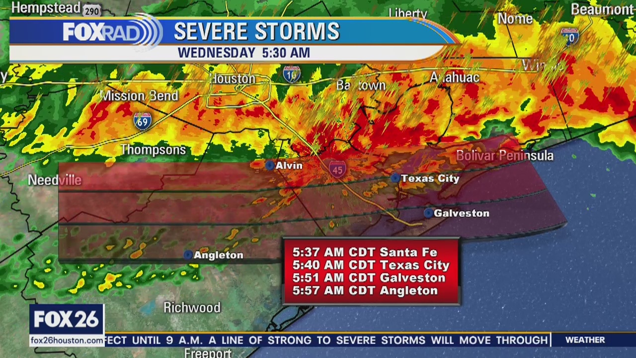
Severe weather update 5:30 a.m. Wednesday morning
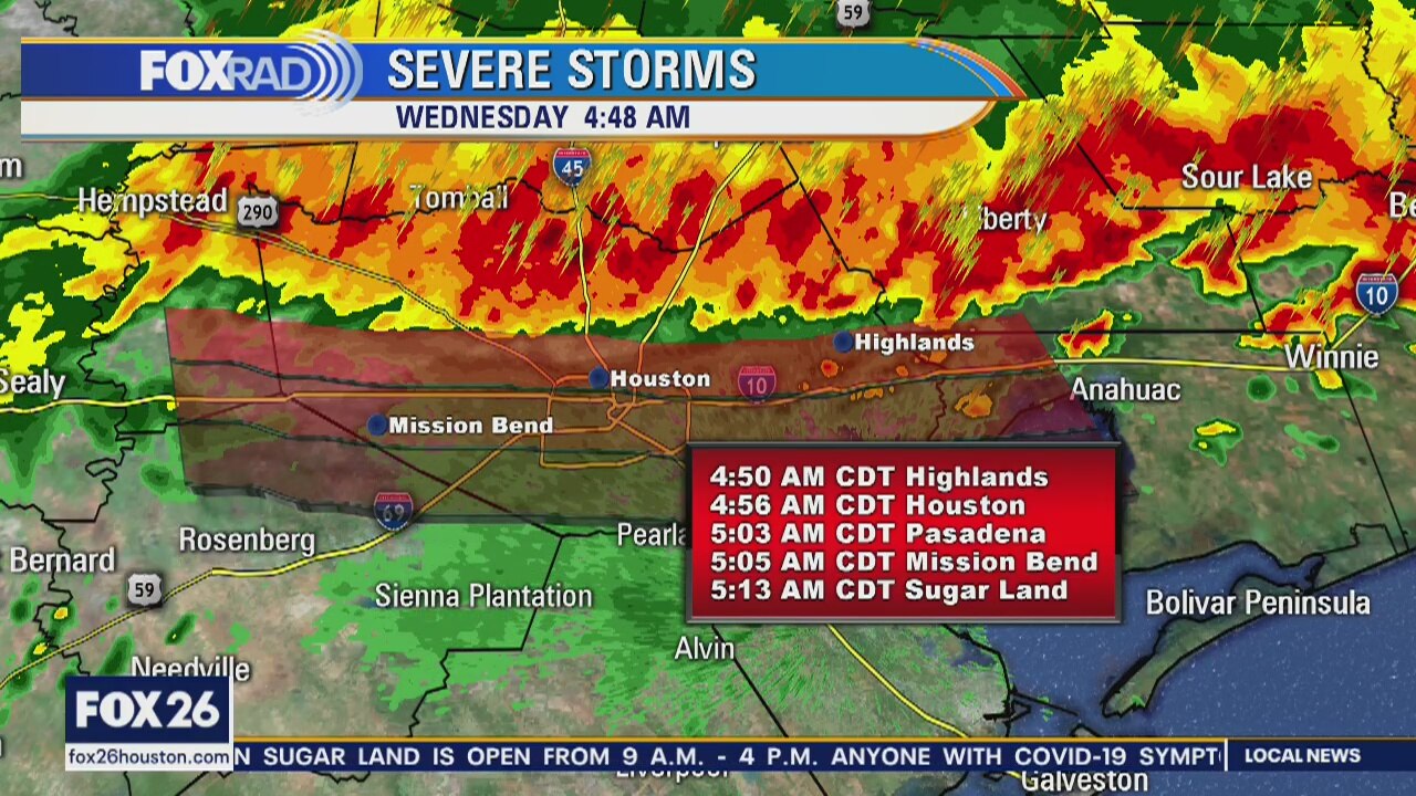
Severe thunderstorms moving quickly throught southeast Texas on Wednesday morning. 5:30 a.m. update Strong winds and power outages associated with these storms.
Severe thunderstorms moving quickly throught southeast Texas on Wednesday morning. 5:30 a.m. update Strong winds and power outages associated with these storms.
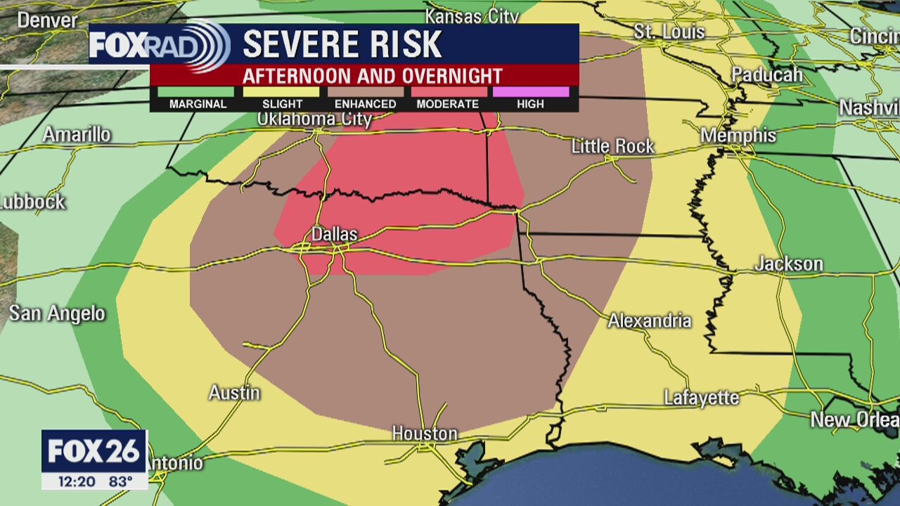
Tuesday weather forecast
The main concern for us over the next 24 hours will be the high potential for a line of thunderstorms early Wednesday morning. Today will be warm and humid with scattered showers and a few storms during the afternoon. A line of storms is expected to form in Oklahoma and move toward our area bringing the chance for high winds and heavy rain between midnight and 7 a.m. tomorrow. Beyond that, we?re looking sunny and warm.
The main concern for us over the next 24 hours will be the high potential for a line of thunderstorms early Wednesday morning. Today will be warm and humid with scattered showers and a few storms during the afternoon. A line of storms is expected to form in Oklahoma and move toward our area bringing the chance for high winds and heavy rain between midnight and 7 a.m. tomorrow. Beyond that, we?re looking sunny and warm.
Monday evening weather forecast
There may be a few light showers on Tuesday, but storms will be likely early Wednesday morning as a fast-moving front arrives. The storms will be mostly gone by 9 a.m. and the rest of the week looks quiet, but warmer into the weekend.
There may be a few light showers on Tuesday, but storms will be likely early Wednesday morning as a fast-moving front arrives. The storms will be mostly gone by 9 a.m. and the rest of the week looks quiet, but warmer into the weekend.
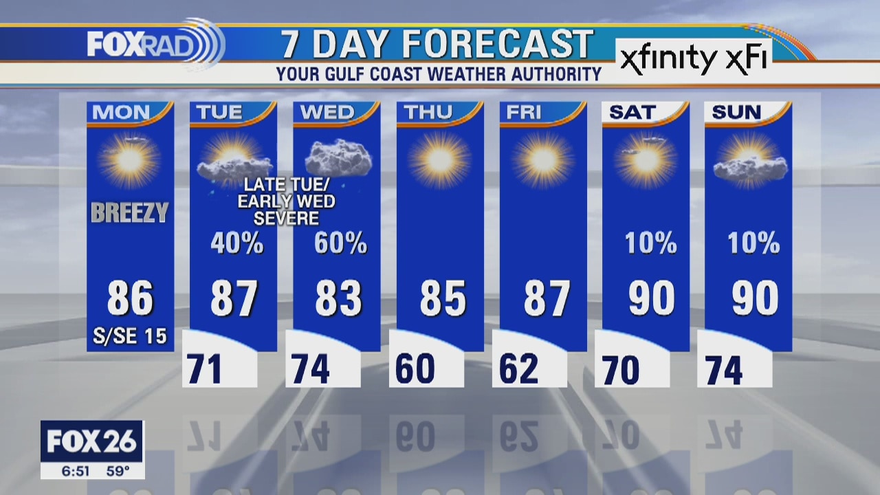
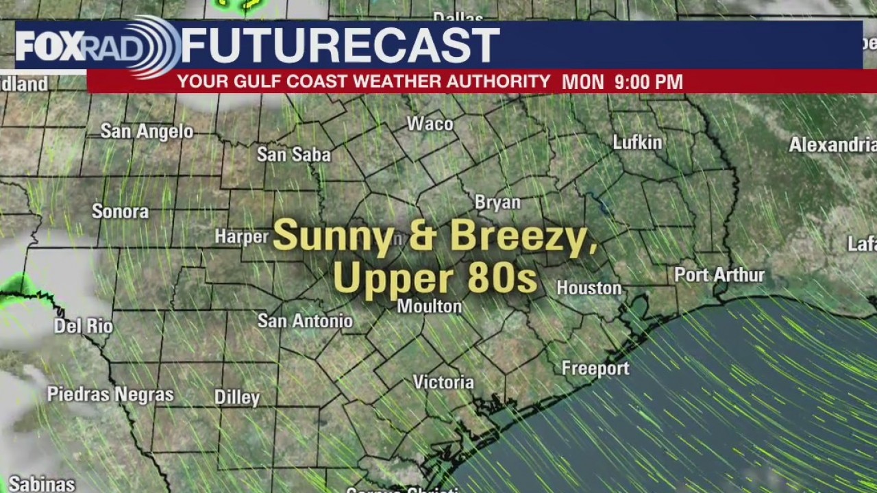
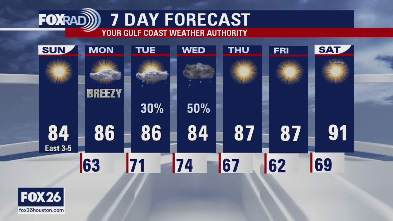
Monday weather forecast
We?re off to a great start this week with a breezy mild Monday. A disturbance is expected to sweep across the country late tomorrow, so we will have a brief chance for severe storms late Tuesday through early Saturday. Hail and high winds are possible. Beyond that, our weather should return to a pleasant pattern.
We?re off to a great start this week with a breezy mild Monday. A disturbance is expected to sweep across the country late tomorrow, so we will have a brief chance for severe storms late Tuesday through early Saturday. Hail and high winds are possible. Beyond that, our weather should return to a pleasant pattern.
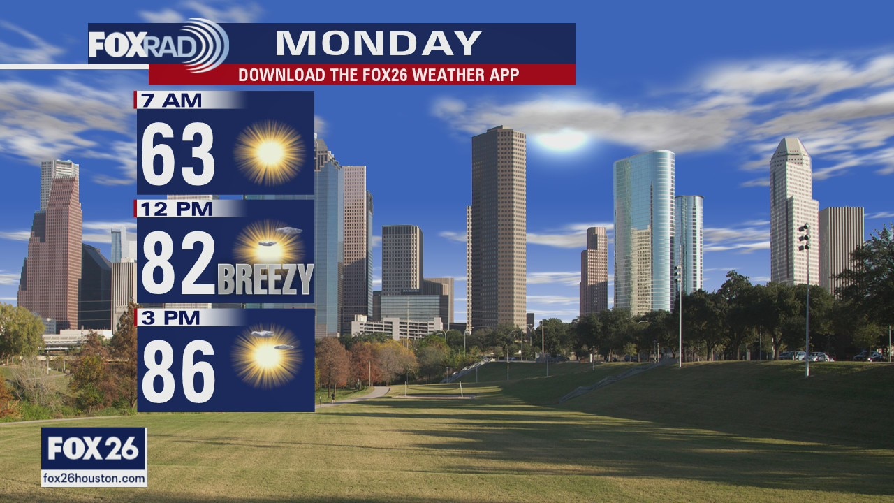
Monday Morning Weather Forecast
Your Gulf Coast Weather Authority Meteorologist John Dawson details the clear weather expected for Monday.
Your Gulf Coast Weather Authority Meteorologist John Dawson details the clear weather expected for Monday.
Sunday Evening Weather Forecast
Your Gulf Coast Weather Authority Meteorologist John Dawson details when the Houston area will see rainfall again.
Your Gulf Coast Weather Authority Meteorologist John Dawson details when the Houston area will see rainfall again.
Houston area weather forecast 4/26
The storms from Saturday have moved out and today is looking sunny and dry. Temperatures will warm into the low and mid 80s. Our next rain chance arrives Tuesday and Wednesday. Some storms are possible, but the severe threat appears to be to our north. We'll watch it, though.
The storms from Saturday have moved out and today is looking sunny and dry. Temperatures will warm into the low and mid 80s. Our next rain chance arrives Tuesday and Wednesday. Some storms are possible, but the severe threat appears to be to our north. We'll watch it, though.