

Brief storms moving through today
A line of storms will move through our area around midday and briefly bring the chance for downpours, lightning and high wind. It will be followed by breezy and dry conditions for the afternoon and evening. Beyond today, the rest of the week and this weekend all look great with dry air, high near 70 and low in the upper 40s.
A line of storms will move through our area around midday and briefly bring the chance for downpours, lightning and high wind. It will be followed by breezy and dry conditions for the afternoon and evening. Beyond today, the rest of the week and this weekend all look great with dry air, high near 70 and low in the upper 40s.
Wednesday morning weather forecast
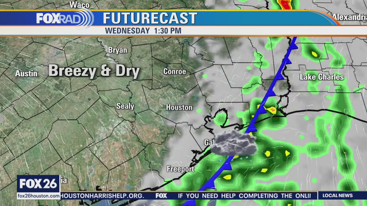
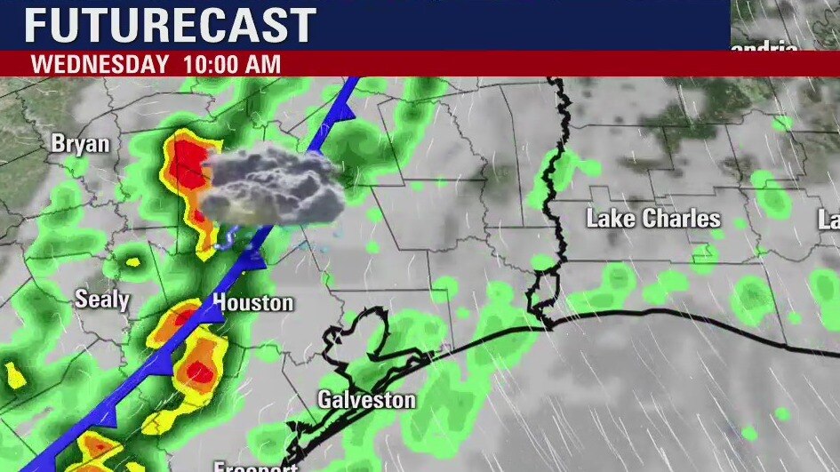
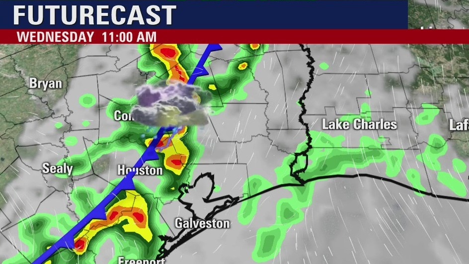
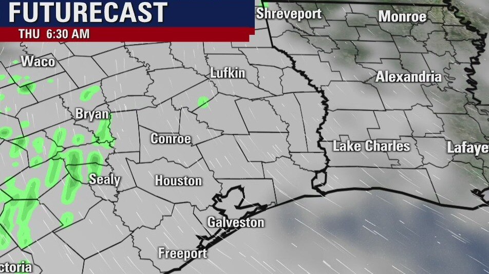
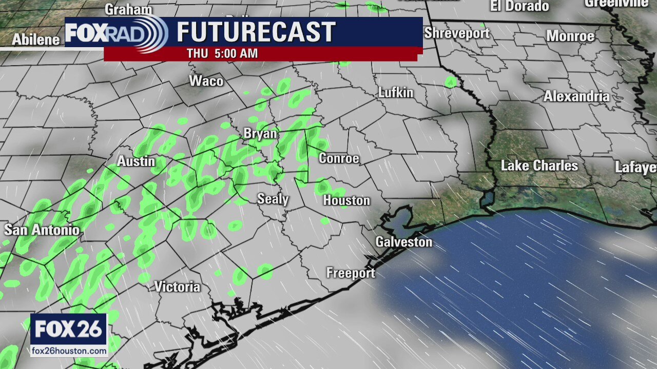
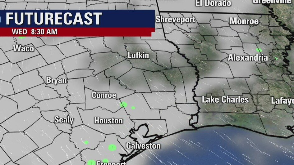
A quick moving cold front will swing through Southeast Texas early Wednesday morning. It is expected to move through the downtown Houston area between 10am - Noon. Expect some rain with the front and there is a chance that an isolated thunderstorm may become strong to severe. If strong storms form, the main hazard will be strong, gusty winds. The front should clear the coast by 3pm and it will be breezy and clearing skies the rest of the day. The rest of the week looks cooler with lots of sunshine.
A quick moving cold front will swing through Southeast Texas early Wednesday morning. It is expected to move through the downtown Houston area between 10am - Noon. Expect some rain with the front and there is a chance that an isolated thunderstorm may become strong to severe. If strong storms form, the main hazard will be strong, gusty winds. The front should clear the coast by 3pm and it will be breezy and clearing skies the rest of the day. The rest of the week looks cooler with lots of sunshine.
Tuesday evening weather forecast
A quick moving cold front will swing through Southeast Texas early Wednesday morning. It is expected to move through the downtown Houston area between 10am - Noon. Expect some rain with the front and there is a chance that an isolated thunderstorm may become strong to severe. If strong storms form, the main hazard will be strong, gusty winds. The front should clear the coast by 3pm and it will be breezy and clearing skies the rest of the day. The rest of the week looks cooler with lots of sunshine.
A quick moving cold front will swing through Southeast Texas early Wednesday morning. It is expected to move through the downtown Houston area between 10am - Noon. Expect some rain with the front and there is a chance that an isolated thunderstorm may become strong to severe. If strong storms form, the main hazard will be strong, gusty winds. The front should clear the coast by 3pm and it will be breezy and clearing skies the rest of the day. The rest of the week looks cooler with lots of sunshine.

Fog followed by Wednesday's cold front
The rest of spring break is shaping up nicely with one big exception: a cold front tomorrow will bring us a round of storms and there is even a brief chance for strong or severe storms around midday. Look for fog and mist today with high humidity, the aforementioned front Wednesday, then a beautiful pattern for Thursday through the weekend.
The rest of spring break is shaping up nicely with one big exception: a cold front tomorrow will bring us a round of storms and there is even a brief chance for strong or severe storms around midday. Look for fog and mist today with high humidity, the aforementioned front Wednesday, then a beautiful pattern for Thursday through the weekend.
Tuesday morning weather forecast
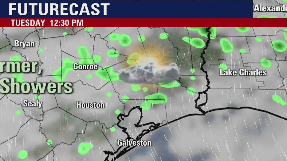
Temperatures remain mild for Houston tonight and tomorrow. Look for some patchy dense fog again on Tuesday morning. Cold front on Wednesday will bring some showers and isolated storms. The end of the week is looking fantastic here in Southeast Texas.
Temperatures remain mild for Houston tonight and tomorrow. Look for some patchy dense fog again on Tuesday morning. Cold front on Wednesday will bring some showers and isolated storms. The end of the week is looking fantastic here in Southeast Texas.
Monday evening weather forecast
Temperatures remain mild for Houston tonight and tomorrow. Look for some patchy dense fog again on Tuesday morning. Cold front on Wednesday will bring some showers and isolated storms. The end of the week is looking fantastic here in Southeast Texas.
Temperatures remain mild for Houston tonight and tomorrow. Look for some patchy dense fog again on Tuesday morning. Cold front on Wednesday will bring some showers and isolated storms. The end of the week is looking fantastic here in Southeast Texas.
Few showers possible as warm front pushes through
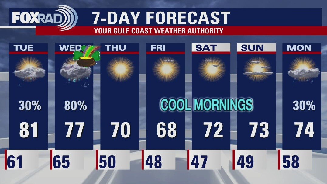
A warm front will push through the area this afternoon and as it does, a few showers will be possible, especially along the coast. Highs should warm well into the upper 70s and low 80s. We stay warm on Tuesday until a cold front arrives on Wednesday and cools us off beginning Thursday.
A warm front will push through the area this afternoon and as it does, a few showers will be possible, especially along the coast. Highs should warm well into the upper 70s and low 80s. We stay warm on Tuesday until a cold front arrives on Wednesday and cools us off beginning Thursday.
Foggy start followed by warm front, few showers
We're dealing with some patchy dense fog this morning, especially north of Houston and then along the coast. A dense fog advisory for several of our counties will expire at 9 a.m. and that's when we expect to start warming. A warm front will push through the area this afternoon and as it does, a few showers will be possible, especially along the coast. Highs should warm well into the upper 70s and low 80s. We stay warm on Tuesday until a cold front arrives on Wednesday and cools us off beginning Thursday.
We're dealing with some patchy dense fog this morning, especially north of Houston and then along the coast. A dense fog advisory for several of our counties will expire at 9 a.m. and that's when we expect to start warming. A warm front will push through the area this afternoon and as it does, a few showers will be possible, especially along the coast. Highs should warm well into the upper 70s and low 80s. We stay warm on Tuesday until a cold front arrives on Wednesday and cools us off beginning Thursday.

Houston-area weather forecast: March 14th
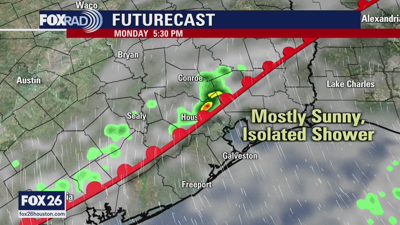
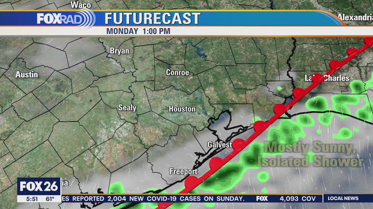
As we wait for a cold front to move through this afternoon, showers will continue on and off all day. Temperatures are mild this morning, but will begin to drop as the front arrives. The cooler air will be short lived as that cold front returns as a warm front on Monday. A few showers will be possible on Monday, mainly south of I-10. Our next cold front is still on schedule to arrive Wednesday and behind that one is when the clearing really begins. Highs will be more seasonal, reaching the low 70s through the weekend and the official start to Spring.
As we wait for a cold front to move through this afternoon, showers will continue on and off all day. Temperatures are mild this morning, but will begin to drop as the front arrives. The cooler air will be short lived as that cold front returns as a warm front on Monday. A few showers will be possible on Monday, mainly south of I-10. Our next cold front is still on schedule to arrive Wednesday and behind that one is when the clearing really begins. Highs will be more seasonal, reaching the low 70s through the weekend and the official start to Spring.

Houston-area weather forecast: March 13th
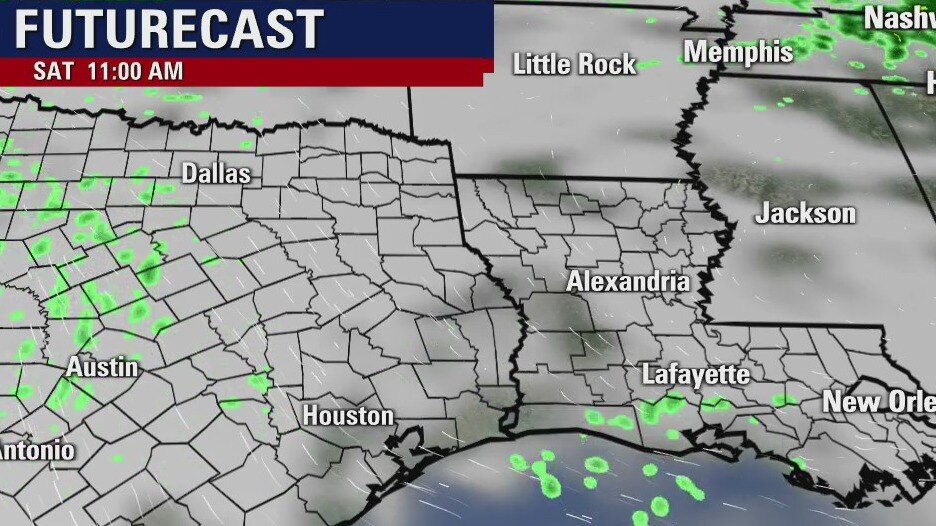
Saturday will be mild with limited rain chances. Highs, areawide, will likely warm into the upper 70s and low 80s. While very active weather is expected in the panhandle of Texas today, we're expecting rain in Houston as we head into the afternoon on Sunday. A few showers may strengthen to thunderstorms as the cold front moves through tomorrow, but no severe weather is expected. The next cold front will arrive on Wednesday where we will likely see noticeably cooler temperatures.
Saturday will be mild with limited rain chances. Highs, areawide, will likely warm into the upper 70s and low 80s. While very active weather is expected in the panhandle of Texas today, we're expecting rain in Houston as we head into the afternoon on Sunday. A few showers may strengthen to thunderstorms as the cold front moves through tomorrow, but no severe weather is expected. The next cold front will arrive on Wednesday where we will likely see noticeably cooler temperatures.
Saturday morning weather forecast
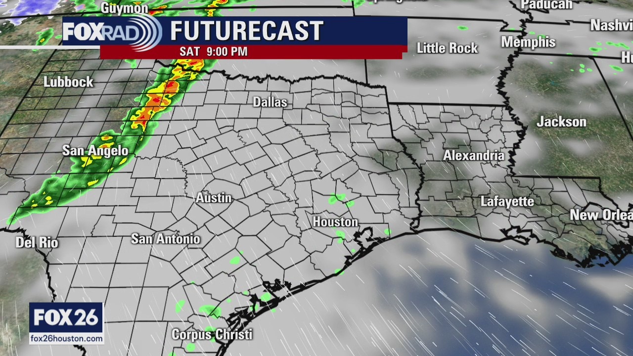
It will be warm and breezy again on Saturday, but a weak front gets here on Sunday. It looks rainy on Sunday with generally light showers and a few storms when the front arrives in the afternoon. Another weak front will arrive on Wed. and so will a chance for some scattered showers.
It will be warm and breezy again on Saturday, but a weak front gets here on Sunday. It looks rainy on Sunday with generally light showers and a few storms when the front arrives in the afternoon. Another weak front will arrive on Wed. and so will a chance for some scattered showers.
Warm and breezy weekend with showers
It will be warm and breezy again on Saturday, but a weak front gets here on Sunday. It looks rainy on Sunday with generally light showers and a few storms when the front arrives in the afternoon. Another weak front will arrive on Wed. and so will a chance for some scattered showers.
It will be warm and breezy again on Saturday, but a weak front gets here on Sunday. It looks rainy on Sunday with generally light showers and a few storms when the front arrives in the afternoon. Another weak front will arrive on Wed. and so will a chance for some scattered showers.
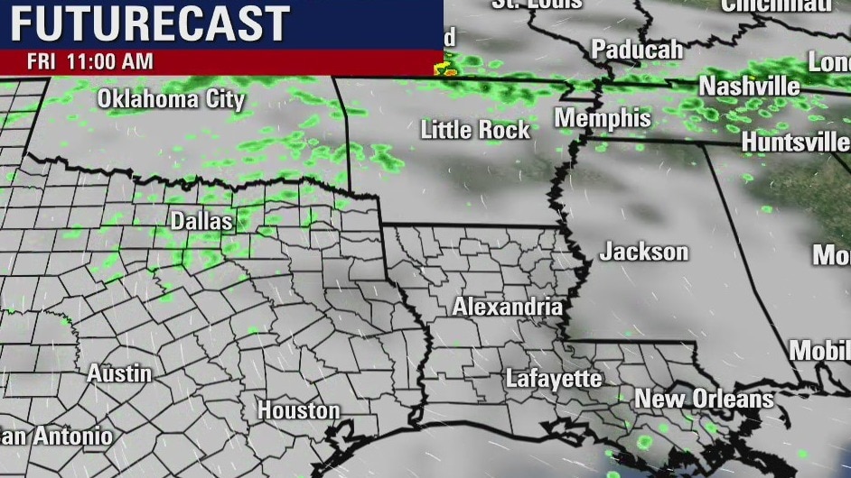
Friday weather forecast
Shower chances will remain very slight again today with highs likely reaching the upper 70s and low 80s. Our attention is really focused on the weekend as we expect a cold front to move through on Sunday. A small line of showers and even a few thunderstorms will be possible Sunday afternoon. Another front will likely move through on Wednesday with more rain possible then.
Shower chances will remain very slight again today with highs likely reaching the upper 70s and low 80s. Our attention is really focused on the weekend as we expect a cold front to move through on Sunday. A small line of showers and even a few thunderstorms will be possible Sunday afternoon. Another front will likely move through on Wednesday with more rain possible then.
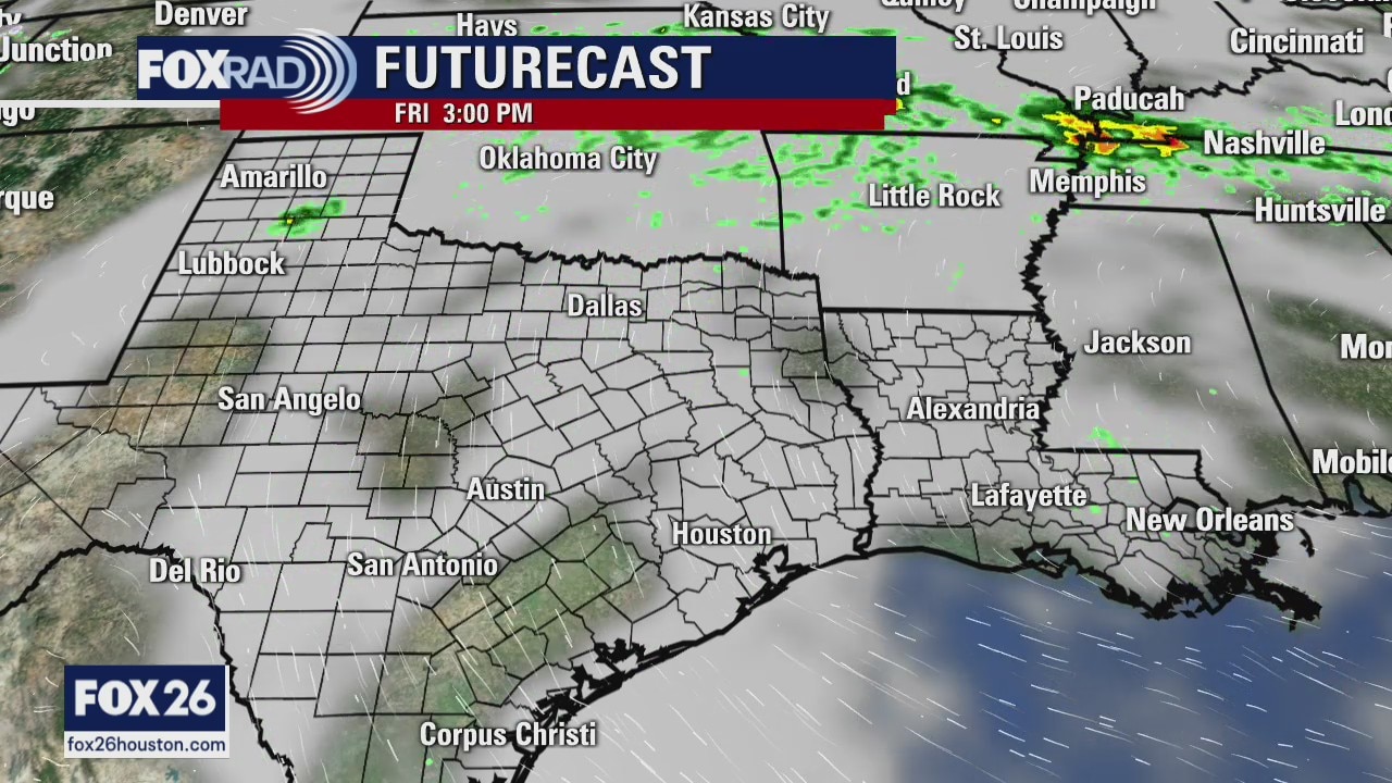
Friday morning weather forecast
Friday and Saturday will be warm and breezy with highs in the low 80s. A weak front will arrive on Sunday bringing rain into SE Texas and the temps will drop a bit. The coming week will be a mix of 70s and 80s, plus some scattered showers.
Friday and Saturday will be warm and breezy with highs in the low 80s. A weak front will arrive on Sunday bringing rain into SE Texas and the temps will drop a bit. The coming week will be a mix of 70s and 80s, plus some scattered showers.
Warm and breezy days ahead
Friday and Saturday will be warm and breezy with highs in the low 80s. A weak front will arrive on Sunday bringing rain into southeast Texas and the temperatures will drop a bit. The coming week will be a mix of 70s and 80s, plus some scattered showers.
Friday and Saturday will be warm and breezy with highs in the low 80s. A weak front will arrive on Sunday bringing rain into southeast Texas and the temperatures will drop a bit. The coming week will be a mix of 70s and 80s, plus some scattered showers.
Thursday weather forecast
Temperatures haven't cooled all that much overnight and so we're starting off on a mild note. Highs will warm into the upper 70s and low 80s today with a stray sprinkle possible this afternoon and then again Friday. Our best shot at seeing rain still looks to be Sunday as a cold front will move through. While Monday might be a bit cooler, our warmer weather will return pretty quickly with highs approaching 80 by the middle of next week.
Temperatures haven't cooled all that much overnight and so we're starting off on a mild note. Highs will warm into the upper 70s and low 80s today with a stray sprinkle possible this afternoon and then again Friday. Our best shot at seeing rain still looks to be Sunday as a cold front will move through. While Monday might be a bit cooler, our warmer weather will return pretty quickly with highs approaching 80 by the middle of next week.
Thursday morning weather forecast
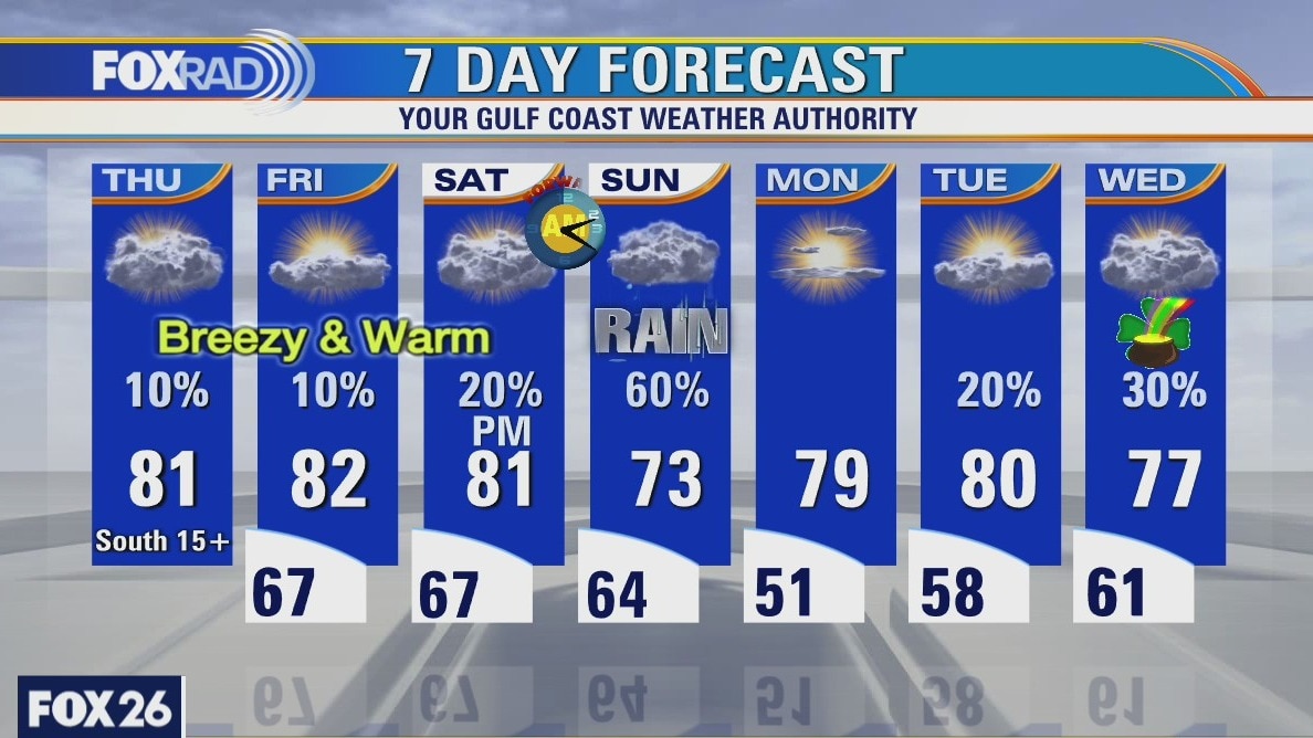
It will continue to be warm and breezy until Sunday when a weak front will push through SE Texas. We may see a few drops of rain over the rest of the week, but Sunday will have the best chance for showers, but not severe weather. Next week looks to have more rain during the middle of the week.
It will continue to be warm and breezy until Sunday when a weak front will push through SE Texas. We may see a few drops of rain over the rest of the week, but Sunday will have the best chance for showers, but not severe weather. Next week looks to have more rain during the middle of the week.
Warm and breezy with a slight chance of rain
It will continue to be warm and breezy until Sunday when a weak front will push through SE Texas. We may see a few drops of rain over the rest of the week, but Sunday will have the best chance for showers, but not severe weather. Next week looks to have more rain during the middle of the week.
It will continue to be warm and breezy until Sunday when a weak front will push through SE Texas. We may see a few drops of rain over the rest of the week, but Sunday will have the best chance for showers, but not severe weather. Next week looks to have more rain during the middle of the week.

Wednesday weather forecast
Welcome to a windy Wednesday. Persistent gulf breezes will continue a pattern of higher humidity, isolated showers and mild mornings. Look for just a few light showers for the next few days with rainy weather expected briefly on Sunday with the passage of a weak cold front.
Welcome to a windy Wednesday. Persistent gulf breezes will continue a pattern of higher humidity, isolated showers and mild mornings. Look for just a few light showers for the next few days with rainy weather expected briefly on Sunday with the passage of a weak cold front.
Wednesday morning weather forecast
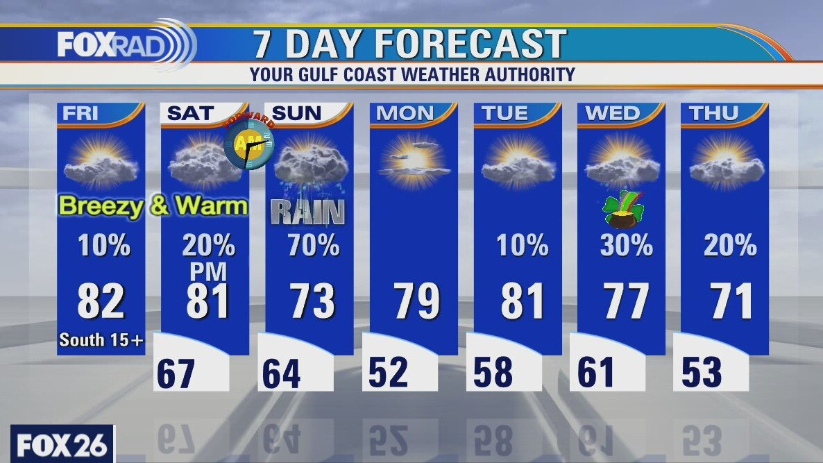
It will be warm and breezy across SE Texas through the end of the week. Rain chances go up later on Saturday and Sunday, but will be mostly gone by early Monday. Highs will be in the 80s and lows in the 60s until the end of the weekend.
It will be warm and breezy across SE Texas through the end of the week. Rain chances go up later on Saturday and Sunday, but will be mostly gone by early Monday. Highs will be in the 80s and lows in the 60s until the end of the weekend.