

Isaias downgraded to tropical storm as it bears down on East Coast — here’s what you need to know
LOS ANGELES - Isaias was downgraded to a tropical storm Tuesday morning as it bears down on the East Coast.
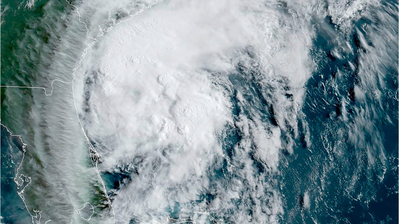
Isaias pushed ashore into the Carolinas late Monday, bringing heavy rainfall, damaging winds and life-threatening storm surge to the East Coast.
The tropical storm formed from a large tropical wave, which developed off the West Coast of Africa in late July.
As of Monday afternoon, Isaias had wind speeds of 75 mph, which indicates hurricane strength.
Joel Cline, tropical program coordinator with the National Weather Service, said the center of the storm system was never aligned. “For it (Isaias) to be as well-tracked and as well-forecasted as it was and has been to this point is really pretty amazing,” Cline said.
What are the threats from Isaias?
The main threats from Isaias will include heavy rain, gusty winds up to 70 mph, storm surge, and flash flooding spanning from Georgia up the coast.
Gusts could cause power outages and tree damage. Areas that could experience loss of power or down trees include the Carolinas, mid-Atlantic, New York and New England.
Wind gusts could reach hurricane strength levels, and are expected to be highest near the coast.
Isaias could also produce isolated and short-lived tornadoes along the East Coast.
Charleston, South Carolina is expected to see 2-3 inches by Monday evening, and Wilmington, North Carolina could see 3-5 inches. New York and New England could see 2-4 inches of rain.
Rainfall amounts between 3-6 inches will be possible with the system, with potential localized rainfall totals around 8 inches.
RELATED: Fears of Hudson River flooding Lincoln Tunnel after water gushes in
Showers are likely to persist through Thursday, as the system rapidly weakens and moves up the coast.
“There’s a good bit of rain already from this up in central North Carolina, as well as coastal South Carolina,” Cline said. “The way it’s looking now, once it comes ashore, it will move into the coastal plain area of North Carolina, and so it should stay inland — close to the coast — but more over land.”
Where is Isaias headed?
As of late Monday afternoon, Isaias was spinning off the coast South Carolina and is expected to make landfall in the Carolinas Monday evening. The storm is expected to maintain hurricane strength as it makes landfall on the coast.
The storm was moving north-northeast at 16 mph and will continue to move up the Eastern seaboard, impacting coastlines as far north as Maine.
"There were originally warnings posted for South Florida, but they were quickly taken down, as the track was forecast further north," Cline said.
Hurricane warnings were in effect for portions of upper South Carolina and lower North Carolina.
A warning means conditions are expected within the next 36 hours.
Tropical storm warnings and watches extended as far north as Maine.Outer rain bands from Isaias were already sweeping into sections of the Carolinas as the storm continued to churn in the Atlantic basin.
RELATED: COVID-19 killed more in Florida, Texas in 1 month than hurricanes did in entire US over 20 years
On Friday, North Carolina Gov. Roy Cooper declared a state of emergency in preparation for the storm.
According to the Associated Press, Isaias killed two people in the Caribbean and roughed up the Bahamas.
Isaias also caused “uprooted trees, destroyed crops and homes, and caused widespread flooding and small landslides in the Dominican Republic and Puerto Rico,” the Associated Press said.