

Invest 95-L to bring much needed rain to Houston area
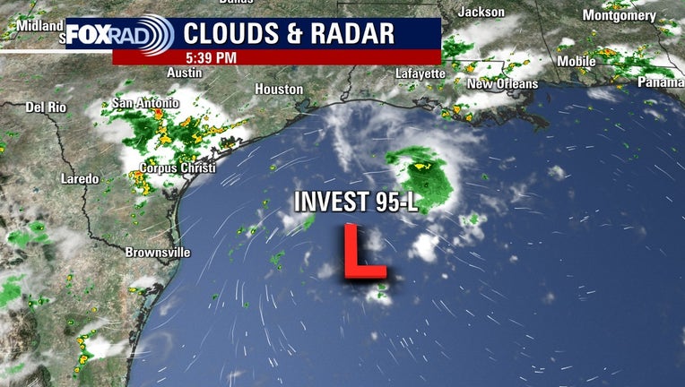
Radar showing current location of Invest 95-L as of 5:30 p.m. Tuesday afternoon.
HOUSTON - Disorganized showers and storms continue over the northwest Gulf, and satellite imagery shows that brief surface circulations have been coming and going today within a broad area of lower pressure - this often indicates that a cluster of storms is slowly coming together, but is still too disorganized to be a tropical depression or storm.
The National Hurricane Center has identified this area as Invest 95-L. This cluster of storms will continue to move slowly towards the southwest, eventually moving onshore. There is some potential for it to become a tropical depression before it does so.
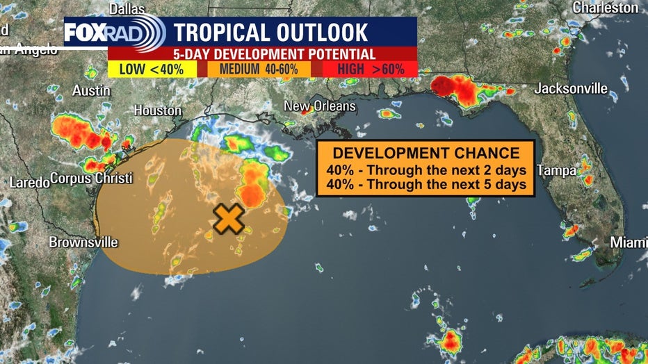
Current forecast shows a 40% chance of development over the next two and five days.
Regardless of whether we get a designation of a tropical depression or not, the main impact in our area will be rainfall Thursday and Friday. Currently, the best chance and highest amounts of rain are expected southwest of the Houston metro, closer to the Matagorda Bay area. Forecast confidence is a bit low, as expectations can change depending on where a storm's center forms (if one does at all), its intensity, and precise track.
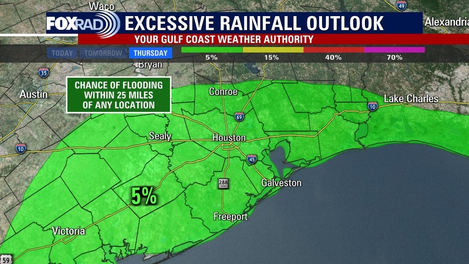
Outlook for excessive rainfall in the Houston area due to Invest 95-L.
As of 7 p.m. Tuesday, the National Hurricane Center gives Invest 95-L a 40% chance to develop into a tropical depression or tropical storm over the next two days. This system will move slowly westward or southwestward and approach the coast of Texas during the next day or two. Slow development of the low is possible, and it could become a short-lived tropical depression near the coast before it moves inland on Wednesday night or Thursday.
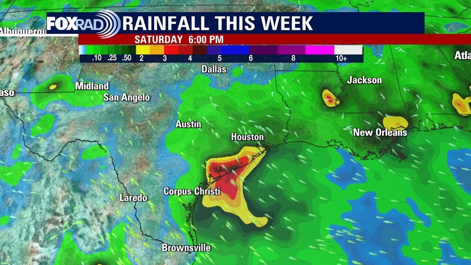
Estimated rainfall forecast through Saturday from Invest 95-L.
Regardless of development, heavy rain will be possible along the Texas coast later this week.