

Houston weather: Storms possible Tuesday, Arctic Cold coming

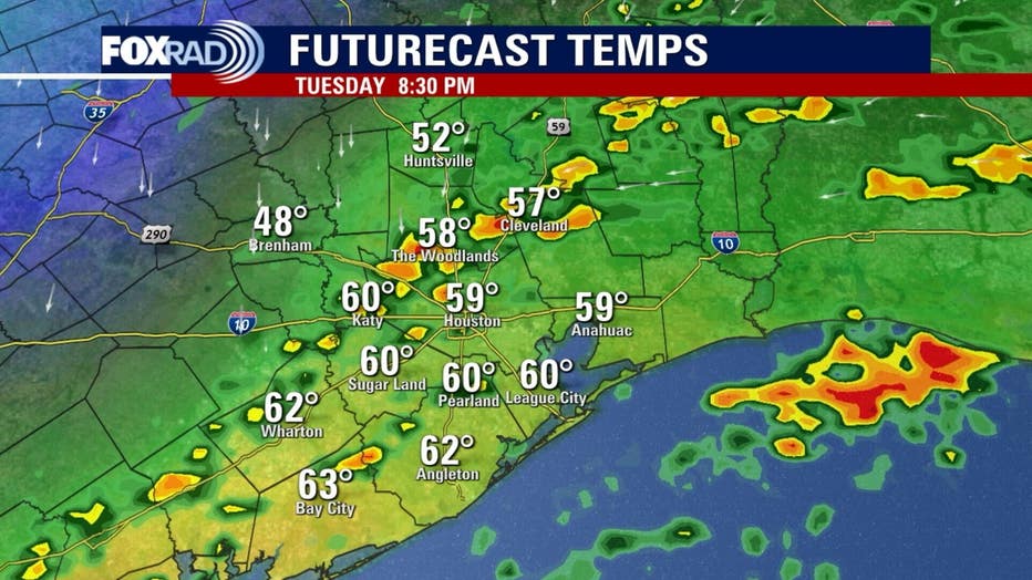
Houston weather: Cool Tuesday morning in the 50s
Tuesday morning will be cool and weather will be breezy and reasonably mild in the mid to upper 60s, but with increasing rain into the afternoon. There is a slight chance for a few strong storms this evening as our strong cold front moves through.
HOUSTON - Cool Tuesday morning, then a milder day with increasing showers and storms by the afternoon and evening with highs in the mid-60s. The weather will turn much colder tonight.
Incoming Houston cold front
Another Arctic Cold Coming:
Today's weather will be breezy and reasonably mild in the mid to upper 60s, but with increasing rain into the afternoon. There is a slight chance for a few strong storms this evening as our strong cold front moves through. The primary risk will is isolated hail.
Arctic Blast Through Friday:
A Cold Weather Advisory is in effect from 3 a.m. to 10 a.m. tomorrow morning for communities like Huntsville, College Station, Sealy and Wharton - this warns of wind chills near 15 to 20 degrees.
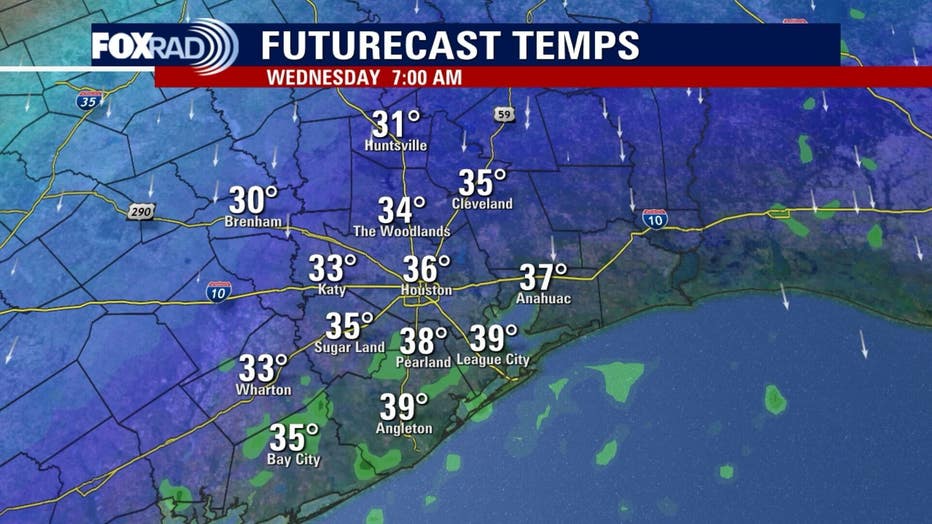
Early Thursday will bring us the coldest air with a hard freeze possible. Wind chills could drop to 10 degrees! Actual air temperatures will be cold enough to protect the "four P's" including covering your plants.
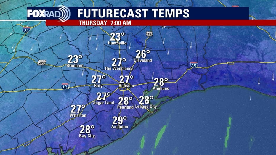
Daily high temps will only reach the 40s tomorrow through Friday and Friday morning could bring another light freeze. Showers could return by late Friday as well with storms likely on Saturday.
Big Warming Trend:
Beginning Sunday, highs will return to the 60s and by Monday our highs should return well into the 70s and some low 80s will be possible next week.
The Source: Your Gulf Coast Weather Authority