

Houston weather: Light precipitation chances continue through the night
Houston weather: April 12 overnight forecast
FOX 26's John Dawson talks the latest weather conditions as we enter the week but expecting mid to high 80s for much of the week.
HOUSTON - A few showers and storms will be possible through the day, but coverage will be limited.
Isolated strong storms move North

The setup is very uncertain, but any storm that develops could become strong quickly. Isolated hail and gusty winds are the main concerns, with a very low tornado risk.

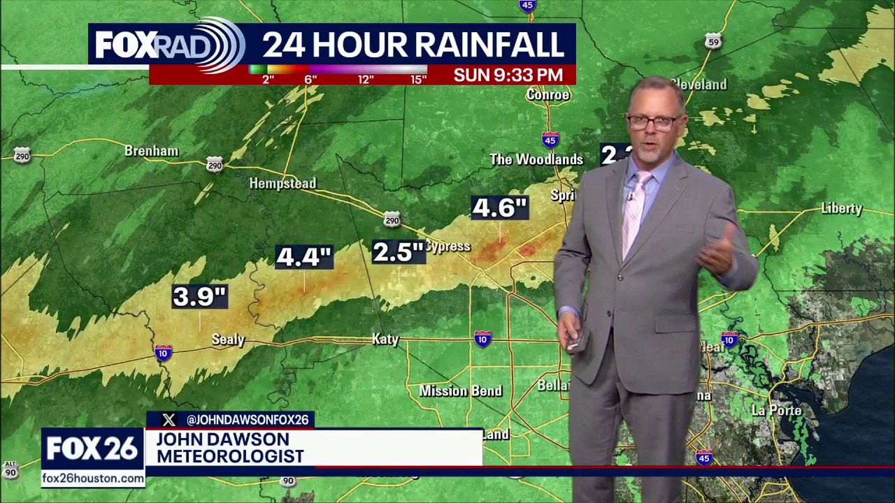
The National Weather Service says three to four inches of rain have fallen, and they're expecting another one to three inches.
A Flood Watch was issued earlier for Waller, Montgomery, and Harris County, among other counties northwest of Houston. The National Weather Service says the watch will be in effect through Monday morning.

Areas with the highest likelihood
The highest likelihood for storms were from the west and northwest of Houston, closer to College Station. Areas closer to the coast may stay mostly dry, with warm and humid conditions.

Warmer April week to come
Rain chances decrease heading into the new week with a warming trend settling in.
Expect highs climbing into the mid to upper 80s with muggy conditions sticking around.
A few isolated storms remain possible, but many areas will remain rain-free.

The Source: Your Gulf Coast Weather Authority