

Houston weather: Continuing to monitor Hurricane Isaias
MINIMAL IMPACTS FROM ISAIAS LOCALLY
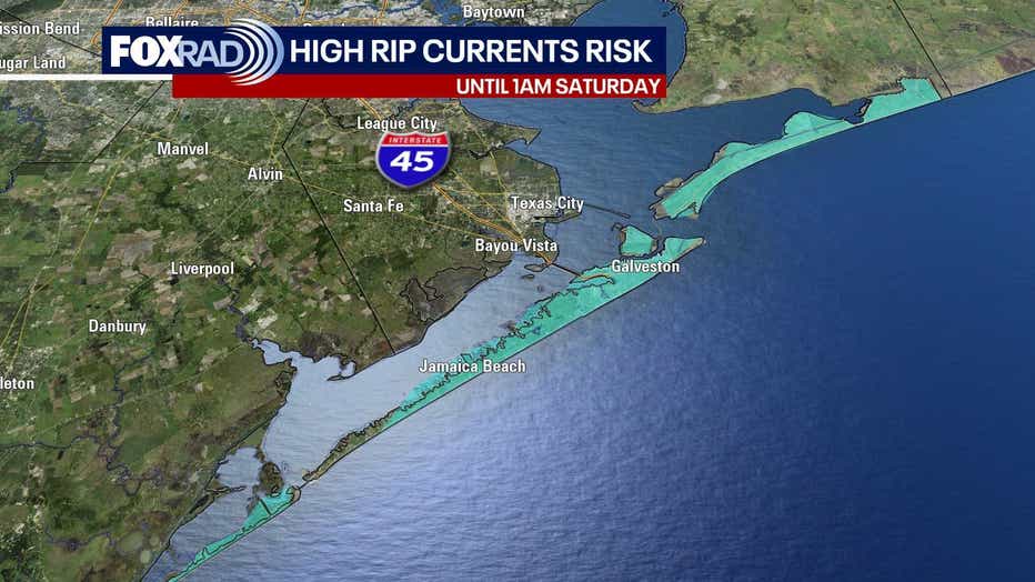
HOUSTON - Beautiful weather continues across the Houston area with mostly sunny skies, lower humidity and warm afternoons. Morning temperatures will be comfortable with a taste of fall, but highs will reach near 90 through the weekend. A few coastal showers are possible Friday and Saturday, but sunshine is the main story. There will be an increased threat for some bigger waves and a high rip currents risk for area beaches.
FIRST HURRICANE OF THE SEASON
Hurricane Isaias has become the first hurricane of the 2026 Atlantic season. The Category 2 storm now has winds of about 100 mph this Thursday afternoon and is expected to strengthen further as it moves across the Gulf. The exact peak intensity remains uncertain, but unfortunately, Isaias could be a strong hurricane when it approaches the northern Gulf Coast.
FLORIDA AND ALABAMA TARGETED
Isaias is expected to turn northeast and make landfall late Friday into early Saturday along the coast of Alabama or the Florida Panhandle. The greatest threats will be storm surge, heavy rain, and hurricane-force winds closer to the coast, then possible flooding for inland Alabama, Georgia and Mississippi. Tornadoes are always a concern with a landfalling tropical system. Flooding will also be possible as far north as Tennessee and as far east as the Carolinas. The storm will stay well east of Texas, with no direct impacts in Houston. Be aware that large waves will approach our beaches, so rip currents are a threat this weekend for beachgoers.
The Source: Information for this story is from Your Gulf Coast Weather Authority Team.