

Houston weather: Severe T-Storm Watch replaces Tornado Watch; rain chances overnight

Houston weather: Overnight storms starting Wednesday night
Models are mixed on the intensity of storms, but there is potential for storms to move in from the north overnight tonight through early Thursday morning.
Severe Thunderstorm Watch now in effect
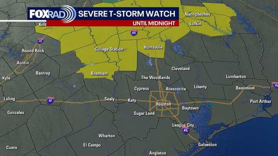
Tornado Watch has been replaced with a Severe Thunderstorm Watch until midnight for the following northern counties in our area - Trinity, Walker, Grimes & Washington counties.
Warm, Windy Wednesday - Overnight Rain
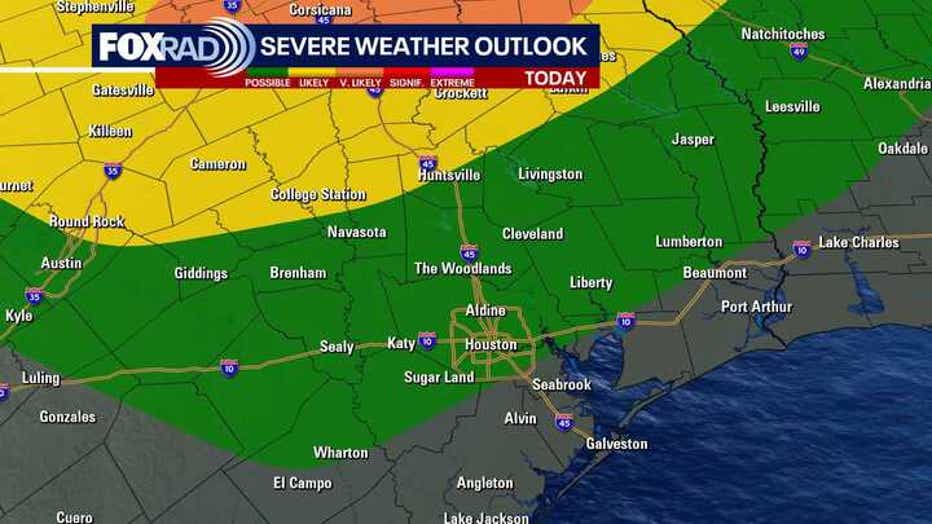
Typical late April Houston humidity remains in place today along with breezy south winds. Fast-moving small showers popped up during the morning and midday hours.
Meanwhile, severe storms and heavy rain slammed North Texas today. There's the potential that a line of storms could move in our direction by tonight. Models are mixed on the intensity of storms, but there is potential for storms to move in from the north overnight tonight through early Thursday morning.
Storms will likely get weaker as they drop south overnight, but stay alert for any potential warnings.
Daily chance for storms late-week
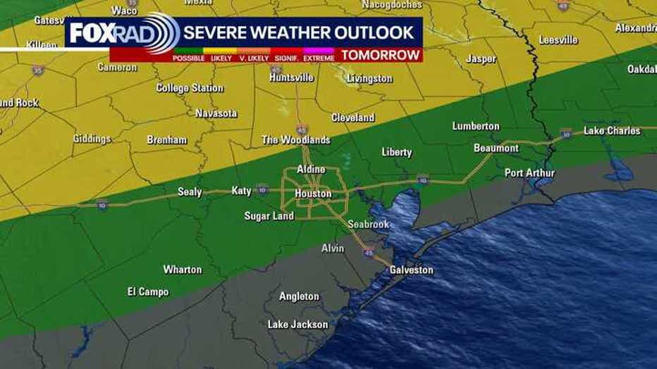
Beginning Thursday and continuing Friday and Saturday, conditions will be favorable for a daily wave of storms.
There could be a few strong/heavy ones as well, so make sure to stay weather-aware and check in for updates on our FOX LOCAL app.
The highest chance for severe weather will be north of the Houston area, but don't let your guard down here.
Looking ahead to next week
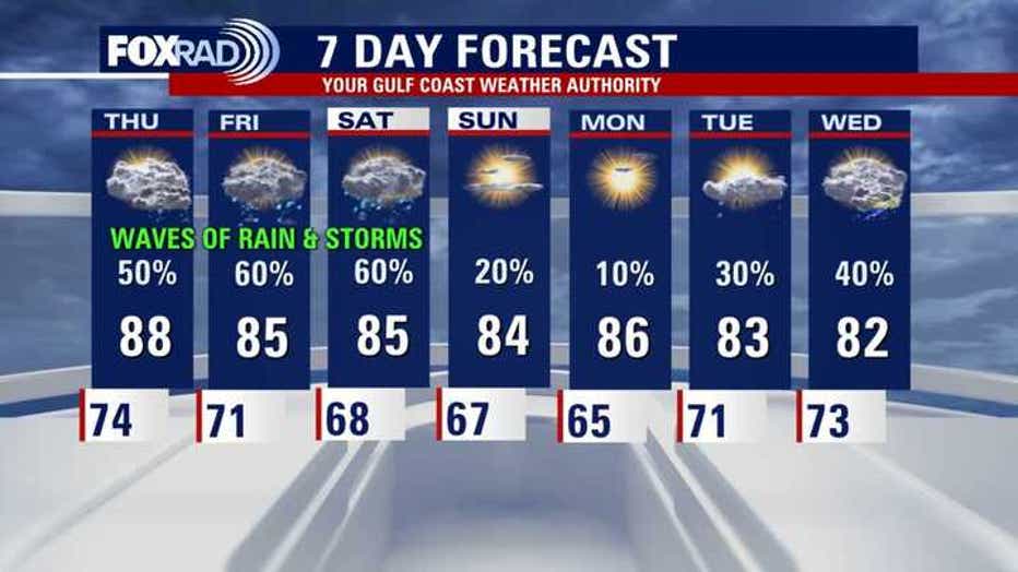
Storm chances get much lower for the second half of the weekend and for Monday before they start to ramp up again by the middle of next week. Make sure to take advantage of the dry time before storms start to increase again.
The Source: Your Gulf Coast Weather Authority