

Houston weather: Heat wave kicks off Tuesday as index nears 100s

Houston weather: Tuesday heat index could reach 100
Tuesday will be windy and that will help to return humidity very quickly. With forecast highs in the mid and possibly upper 90s, current records could be broken by several degrees. The heat index will get close to 100 today, but will range from about 100 to 103 for the rest of the week.
HOUSTON - Tuesday will be windy and that will help to return humidity very quickly as we face an incoming heat wave.
Heat dome takes over
Record highs for the next several days are in the low to mid 90s for Houston and those records are likely to be tied and probably broken. With forecast highs in the mid and possibly upper 90s, current records could be broken by several degrees.
The last time we were this hot in mid-May was 2018 when we had several days in the mid 90s. Today will be windy and that will help to return humidity very quickly.
Heat index above 100 each day
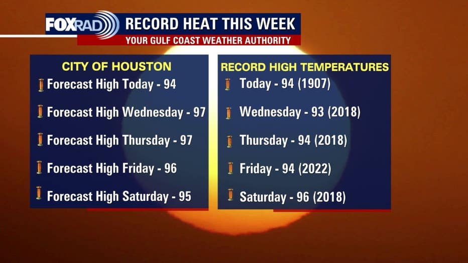
The heat index, also sometimes called the "feels like" temperature, will get close to 100 today, but will range from about 100 to 103 for the rest of the week. Even morning temperatures will feel much warmer than the thermometer will show due to summerlike humidity increasing each day.
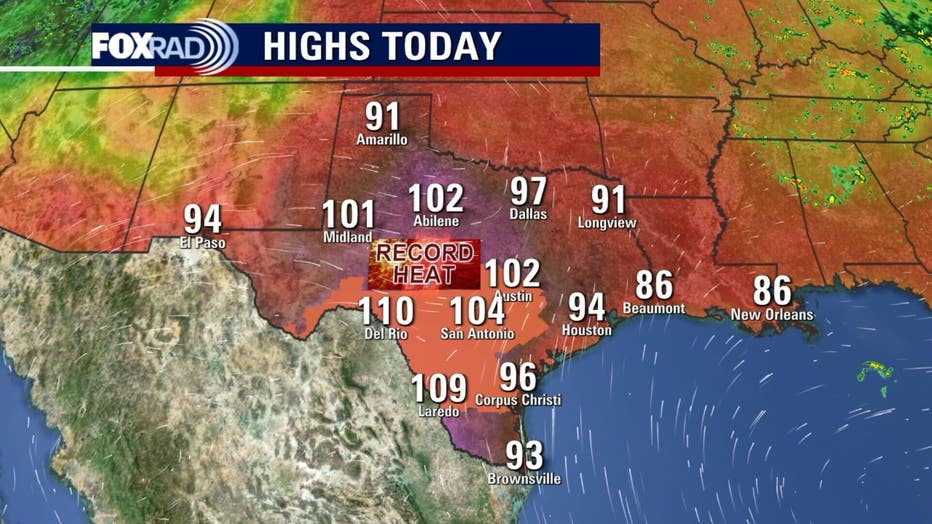
Extreme heat for central, south Texas
Record highs will be smashed in places like San Antonio and Austin as highs should exceed 100 today and tomorrow and could rise as high as 105. Current records are in the mid to upper 90s there. Heat Advisories are in effect from Austin to the Rio Grande Valley today.
The Source: Your Gulf Coast Weather Authority.