

Houston weather: Memorial Day heat in the 90s, storm chances

Houston weather: Warm Memorial Day morning in the 80s
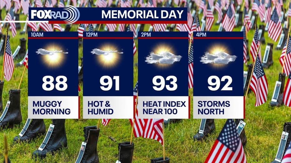
It's Memorial Day and the weather in Houston will be hot and humid again with highs in the mid-90s. Showers and storms beginning midday through the evening, especially north.
HOUSTON - Today will be hot and humid with highs reaching the low to mid 90s and a heat index near 100. Showers and storms to begin midday through the evening, especially north of Houston.
Memorial Day outlook
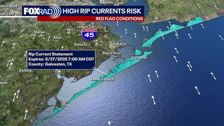
A southeast breeze around 10–15 mph, gusting above 25 mph, will persist throughout the day...that means rip currents are likely at our beaches.
Please stay aware, swim near lifeguards, or if you are going to beaches without guards, please be careful and don't venture too far into the water unless you are a strong swimmer.
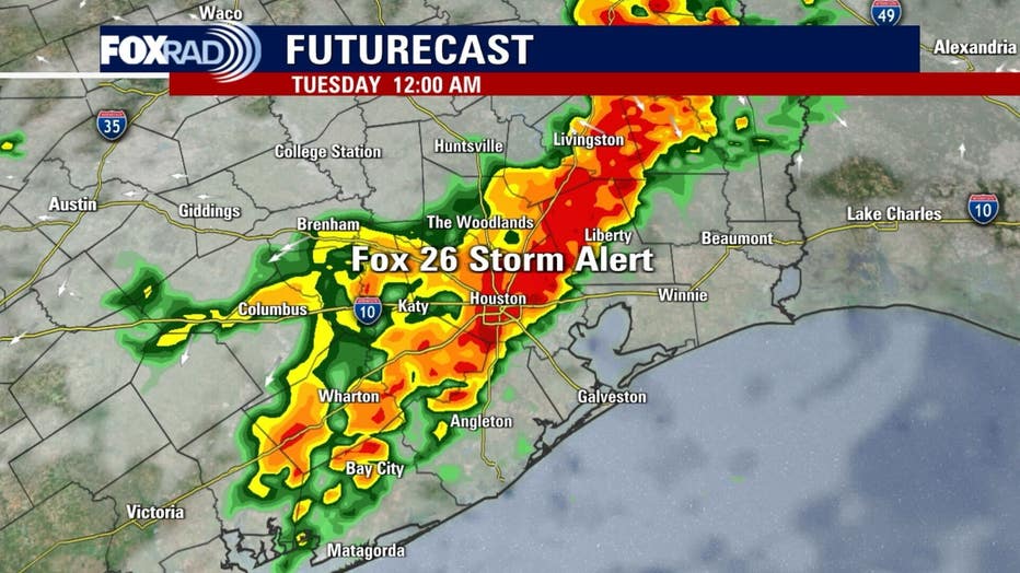
There's a 30% chance of isolated showers or thunderstorms developing after noon for the greater Houston area. By evening, rain chances increase to 50%, with scattered showers and thunderstorms possible overnight.
Due to this, a Fox 26 Storm Alert is in effect for overnight tonight. Some storms could produce gusty winds and brief heavy downpours.
Off and on storms Tuesday - Thursday
Tuesday brings early morning and late afternoon thunderstorms with highs near 90.
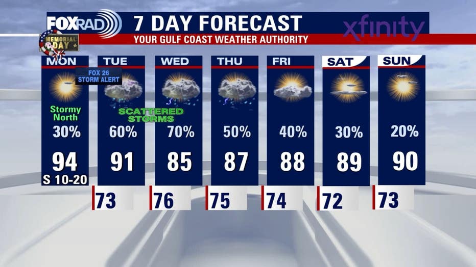
The unsettled pattern continues into Wednesday, with showers and thunderstorms and highs in the mid to upper 80s. Thursday looks muggy with scattered showers and thunderstorms again. Friday and Saturday bring isolated showers and thunderstorms, with highs back to around 90.
The Source: Your Gulf Coast Weather Authority