

Houston weather: Severe weather alerts due to heavy rain

Houston weather: Severe storm watch Friday; rain chances continue overnight
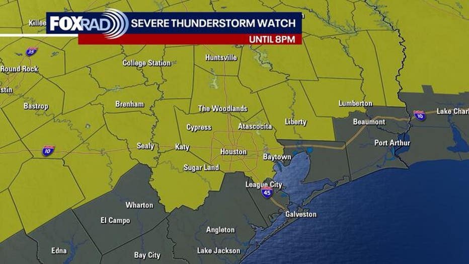
A Thunderstorm Watch is in effect until 8 p.m. Friday for Harris, Fort Bend, Grimes, Montgomery, Liberty, Waller, Polk, San Jacinto, Walker, and Washington counties.
HOUSTON - Friday is a FOX 26 Storm Alert Day. This evening's storms could be severe with highs in the mid 80s.
Severe Weather Alerts
All severe weather alerts that were issued for Friday have been canceled.
Watch vs. Warning
A watch means that conditions are favorable or that severe weather should be expected over the watch area during the time of the watch.
When a severe storm does form, a warning is issued for a smaller, specific area for a specific time. A warning means that there is an urgent threat for severe weather. You need to get to a safe place which is a sturdy building on the lowest level as soon as possible and wait until the storm passes.
Nasty weather through tonight
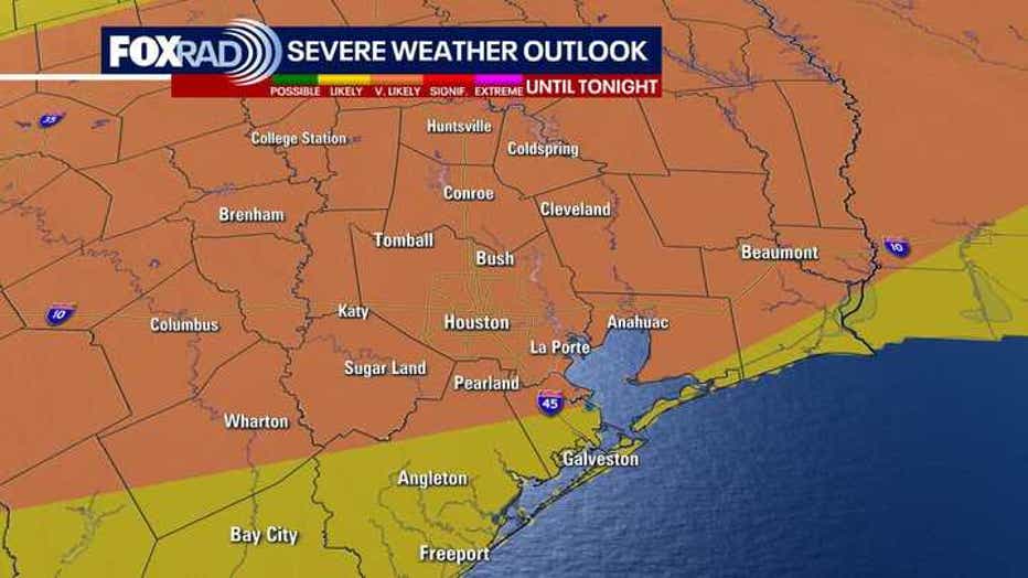
The National Weather Service has highlighted our entire area with an "enhanced" risk for severe weather - this generally means a very high chance for storms that could produce hail and/or damaging winds. The threat for a brief tornado is much lower but is not zero.
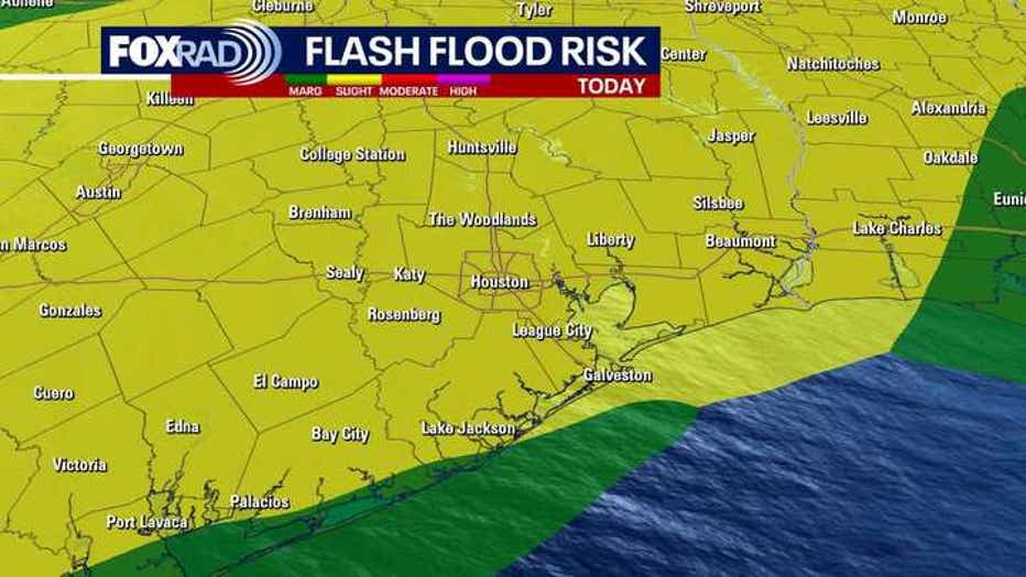
Along with the severe threat, more than 3" of rain is possible, so localized flooding is also a concern. The timing places the heaviest storms in our area from the afternoon through the evening.
Calming by tomorrow, Sunday
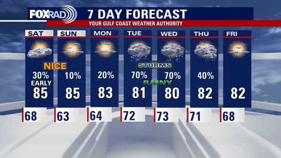
Showers will linger through Saturday morning, but the rest of the weekend should be mainly drying.
Our weather is expected to be nice and mild this weekend with lows in the 50s and 60s and highs in the 80s.
Storms will likely return by Tuesday of next week.
The Source: Your Gulf Coast Weather Authority