

Houston weather: Heat wave begins Tuesday with record highs possible this week

Houston weather: Heat wave starts Tuesday
A heat wave begins Tuesday and lasts all week. Here's what to expect.
HOUSTON - A heat wave begins Tuesday and lasts all week. Here's what to expect.
Sunny and dry today, some ozone
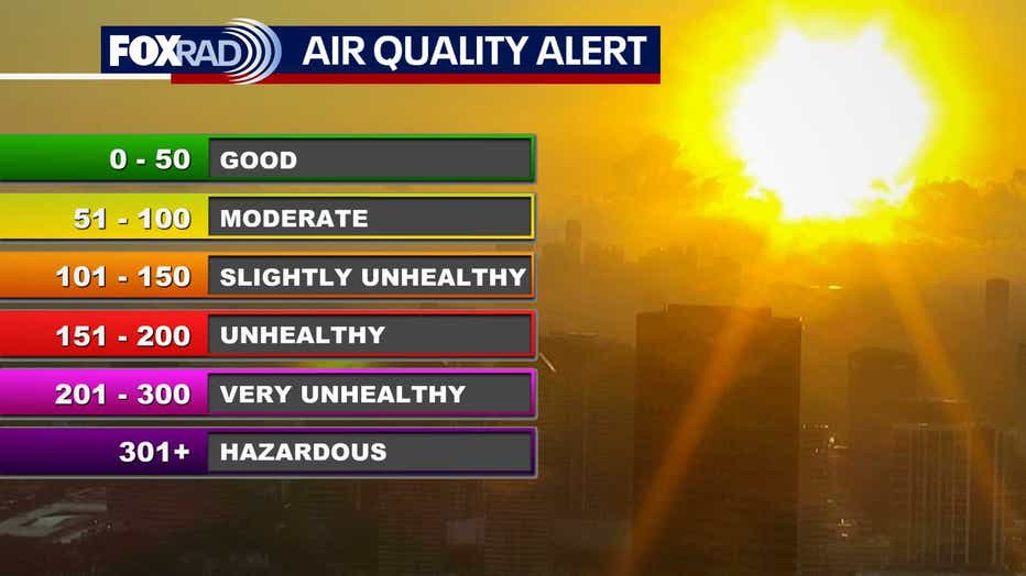
Ozone is a type of pollution that usually forms on sunny days with light winds (like today). Most of you won't notice it, but those with heart or lung conditions should avoid extended exertion outdoors.
An Ozone Action Day continues through this evening. Otherwise, weather the rest of today and tonight look outstanding. Humidity will remain fairly low with temperatures dipping to the 60s overnight.
Heat and humidity kick in
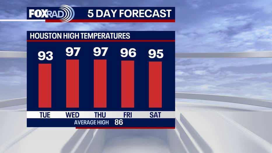
Beginning Tuesday and continuing through the weekend and beyond, the Houston area will feel a preview of summer. Look for afternoon high temperatures in the 90s with lows in the 70s.
Record highs this week are in the low to mid 90s, and with forecast highs in the mid 90s, we will probably have a few records tied or broken.
Rain chances remain very low and more likely for areas well north and west of Houston.
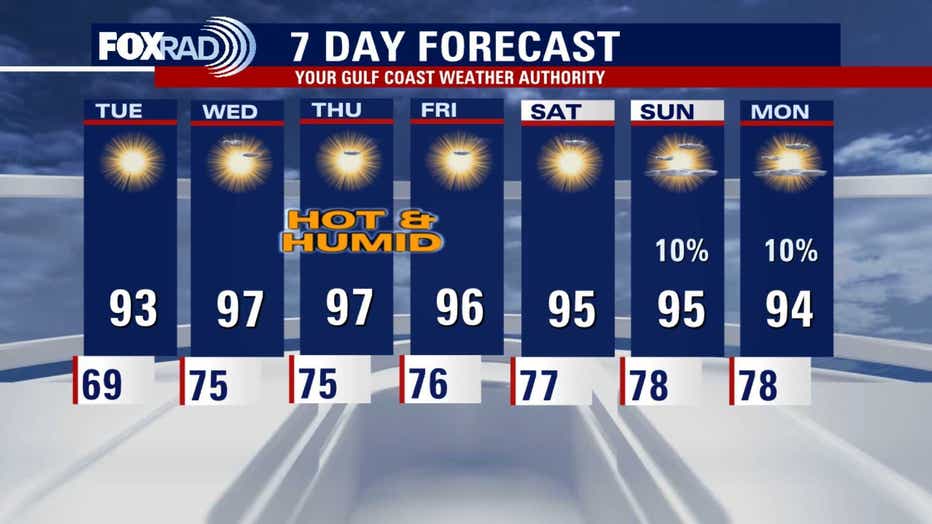
Extended outlook remains hot
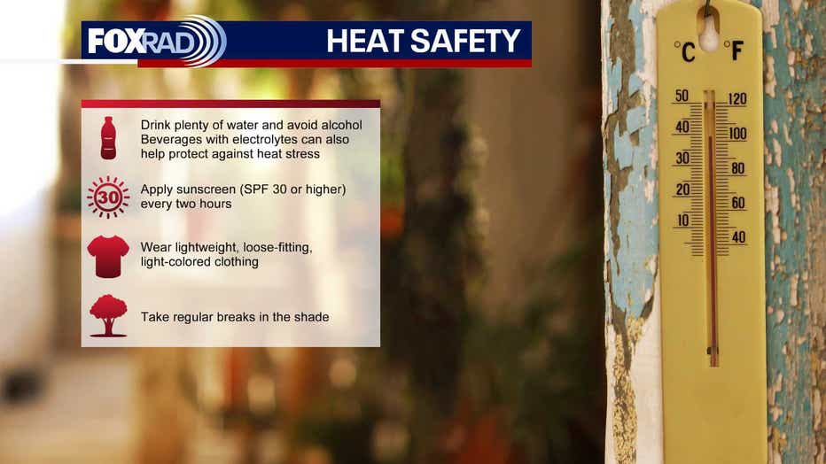
The outlook for late May shows that conditions should stay hotter than normal with highs each day probably stuck in the 90s. Humidity will also increase through the week. So the heat index or feels-like temperature will likely be around 100 from Wednesday through the weekend. Be careful in the heat!
The Source: The information in this article comes from the FOX 26 Weather Team.