

Houston weather: Weekend rain chances dry before heat dome

Houston: Your July 19 evening forecast
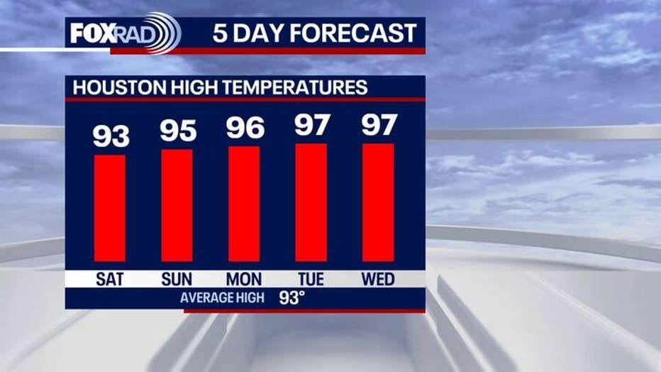
Saturday's isolated storms will be the highest rain chances for a while as the start of a heat wave arrives Sunday.
HOUSTON - This weekend will be a bit of a mixed bag with muggy air and a few storms on Saturday, followed by the start of a heat wave on Sunday.
Isolated storms Saturday, heating up Sunday
Saturday saw a few storms that were brief downpours for some folks. That's the highest rain chance for a while as the start of a heat wave arrives Sunday.
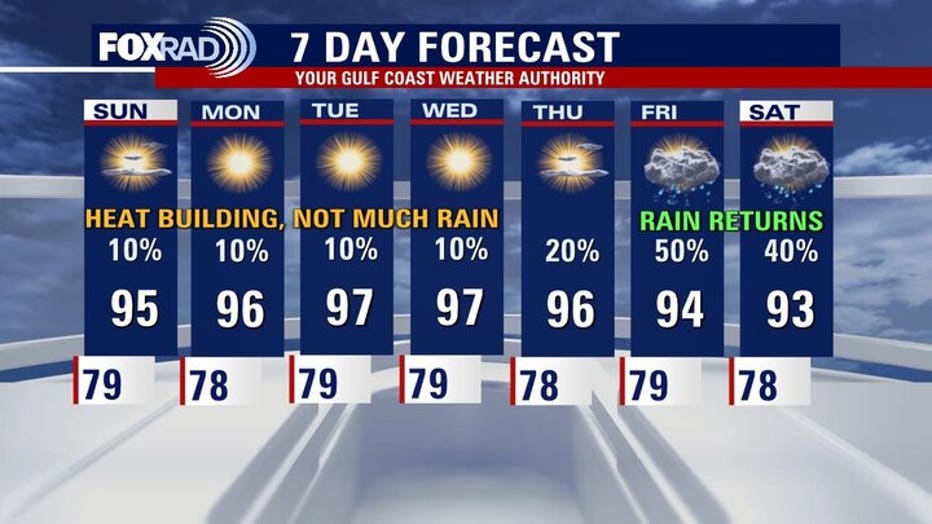
Look for high temperatures in the middle 90s when the heat index will rise above 100° for much of the day. The rain chances drop to less than 10% for the end of the weekend and most of the week ahead.
Heat dome builds next week
Next week looks mostly dry with lots of sunshine and high temperatures rising into the upper 90s across southeast Texas.
A heat dome setting up in the central U.S. will help temperatures soar across a good portion of the country.
Low-end rain chances and lots of sunshine will have us focusing on the intense heat and humidity.
So far this year, the warmest temperature measured at Bush Intercontinental was 98 degrees on June 8th.
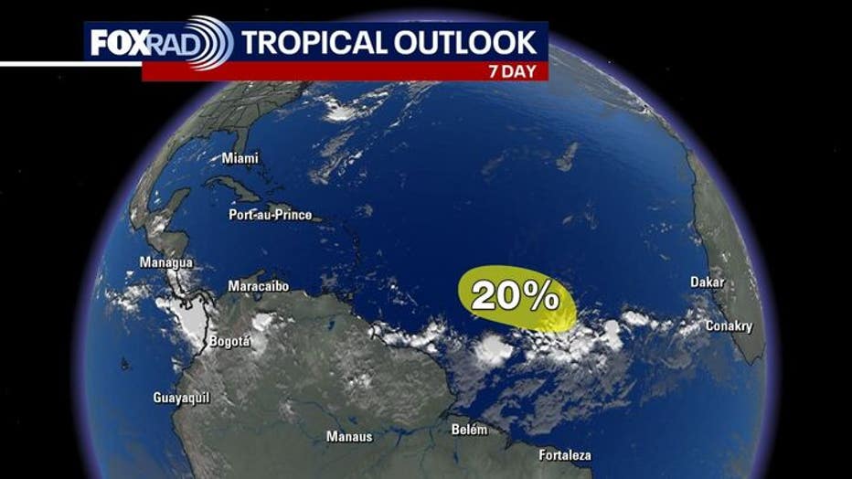
Monitoring a tropical wave in the Atlantic

Tropical Weather Update - July 19, 2025
A tropical wave interacting with a broad area of low pressure is producing disorganized showers and thunderstorms more than 900 miles west-southwest of the Cabo Verde Islands. Environmental conditions appear marginally conducive for gradual development of this system during the next few days as it moves westward to west-northwestward around 10 mph.
The National Hurricane Center is monitoring a tropical wave in the Atlantic Ocean, about 900 miles west of the Cabo Verde Islands. Environmental conditions will be marginal for any further development.
There is a 20% chance over the next 7 days.
We're still in a time of hurricane season where it's not at all unusual to have little to no activity, but as we head into the month of August, you can expect that activity to pick up quite a bit.
Click over to the FOX 26 daily tropical update for a full explanation of unsettled weather in the Gulf later in the week.
The Source: Your Gulf Coast Weather Authority