


Houston weather: Very cold Wednesday morning, chilly afternoon
It's very cold around Southeast Texas on Wednesday morning. Clear skies mean plenty of sunshine in the afternoon but still only a high temperature of around 60 degrees.
It's very cold around Southeast Texas on Wednesday morning. Clear skies mean plenty of sunshine in the afternoon but still only a high temperature of around 60 degrees.

Very cold Wednesday morning, chilly afternoon
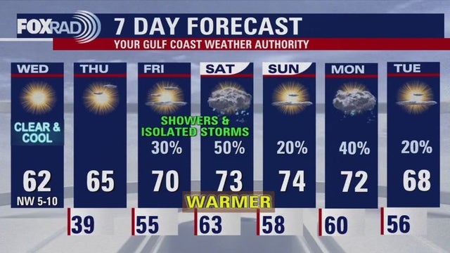
Very cold around Southeast Texas on Wednesday morning. Clear skies mean plenty of sunshine in the afternoon but still only a high temperature of around 60 degrees. Upper 30s should return for most of the area for Thursday morning. Below normal temperatures remain in place until Friday, when warmer air returns for the weekend. Unfortunately, it looks like the rain chances also returning for the weekend.
Very cold around Southeast Texas on Wednesday morning. Clear skies mean plenty of sunshine in the afternoon but still only a high temperature of around 60 degrees. Upper 30s should return for most of the area for Thursday morning. Below normal temperatures remain in place until Friday, when warmer air returns for the weekend. Unfortunately, it looks like the rain chances also returning for the weekend.

The chill is here! | FOX 26 Houston Weather Forecast
Get ready for the first widespread freeze of the season for our northern counties! FREEZE WATCH has been upgraded to a FREEZE WARNING from 3-8 AM Wednesday for Montgomery, Walker, Trinity, Madison, San Jacinto, Washington, Grimes, Polk, Austin, Waller & Brazos counties. Temperatures tonight in these areas will likely dip to 28-32 degrees. So make sure to protect sensitive plants, cover pipes, check on your pets and throw on a few extra layers yourself! Houston and coastal areas should escape the freezing temperatures this time around. Upper 30s are likely for Houston tonight and tomorrow. Wind Advisory is also in place for coastal areas through midnight with wind gusts up to 40 mph possible. High pressure will settle in tonight and tomorrow which will cause wind to settle down and mostly clear conditions will prevail. Below normal temperatures stick around through Thursday before warmer weather returns this weekend. Rain also returns Friday and Saturday with only isolated showers expected Sunday. Keep track of our roller coaster weather as we go through this holiday season by downloading our app for your phone and smart TV, FOX Local!
Get ready for the first widespread freeze of the season for our northern counties! FREEZE WATCH has been upgraded to a FREEZE WARNING from 3-8 AM Wednesday for Montgomery, Walker, Trinity, Madison, San Jacinto, Washington, Grimes, Polk, Austin, Waller & Brazos counties. Temperatures tonight in these areas will likely dip to 28-32 degrees. So make sure to protect sensitive plants, cover pipes, check on your pets and throw on a few extra layers yourself! Houston and coastal areas should escape the freezing temperatures this time around. Upper 30s are likely for Houston tonight and tomorrow. Wind Advisory is also in place for coastal areas through midnight with wind gusts up to 40 mph possible. High pressure will settle in tonight and tomorrow which will cause wind to settle down and mostly clear conditions will prevail. Below normal temperatures stick around through Thursday before warmer weather returns this weekend. Rain also returns Friday and Saturday with only isolated showers expected Sunday. Keep track of our roller coaster weather as we go through this holiday season by downloading our app for your phone and smart TV, FOX Local!

FOX 26 Houston Weather Forecast, Dec. 10
Get ready for the first widespread freeze of the season for our northern counties! FREEZE WATCH has been upgraded to a FREEZE WARNING from 3-8 AM Wednesday for Montgomery, Walker, Trinity, Madison, San Jacinto, Washington, Grimes, Polk, Austin, Waller & Brazos counties. Temperatures tonight in these areas will likely dip to 28-32 degrees. So make sure to protect sensitive plants, cover pipes, check on your pets and throw on a few extra layers yourself! Houston and coastal areas should escape the freezing temperatures this time around. Upper 30s are likely for Houston tonight and tomorrow. Wind Advisory is also in place for coastal areas through midnight with wind gusts up to 40 mph possible. High pressure will settle in tonight and tomorrow which will cause wind to settle down and mostly clear conditions will prevail. Below normal temperatures stick around through Thursday before warmer weather returns this weekend. Rain also returns Friday and Saturday with only isolated showers expected Sunday. Keep track of our roller coaster weather as we go through this holiday season by downloading our app for your phone and smart TV FOX Local!
Get ready for the first widespread freeze of the season for our northern counties! FREEZE WATCH has been upgraded to a FREEZE WARNING from 3-8 AM Wednesday for Montgomery, Walker, Trinity, Madison, San Jacinto, Washington, Grimes, Polk, Austin, Waller & Brazos counties. Temperatures tonight in these areas will likely dip to 28-32 degrees. So make sure to protect sensitive plants, cover pipes, check on your pets and throw on a few extra layers yourself! Houston and coastal areas should escape the freezing temperatures this time around. Upper 30s are likely for Houston tonight and tomorrow. Wind Advisory is also in place for coastal areas through midnight with wind gusts up to 40 mph possible. High pressure will settle in tonight and tomorrow which will cause wind to settle down and mostly clear conditions will prevail. Below normal temperatures stick around through Thursday before warmer weather returns this weekend. Rain also returns Friday and Saturday with only isolated showers expected Sunday. Keep track of our roller coaster weather as we go through this holiday season by downloading our app for your phone and smart TV FOX Local!

See what the Christmas season forecast has in store for the US
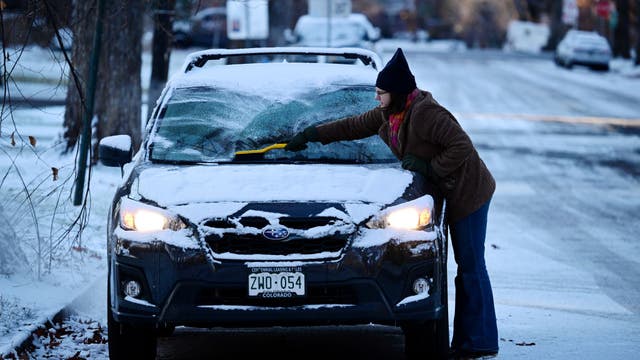
With just over two weeks before the arrival of holidays such as Christmas, Hanukkah and Kwanzaa, the forecast is looking rather complicated with at least one, if not more, pattern changes before the end of December.
With just over two weeks before the arrival of holidays such as Christmas, Hanukkah and Kwanzaa, the forecast is looking rather complicated with at least one, if not more, pattern changes before the end of December.

Malibu fire prompts evacuations at Pepperdine University
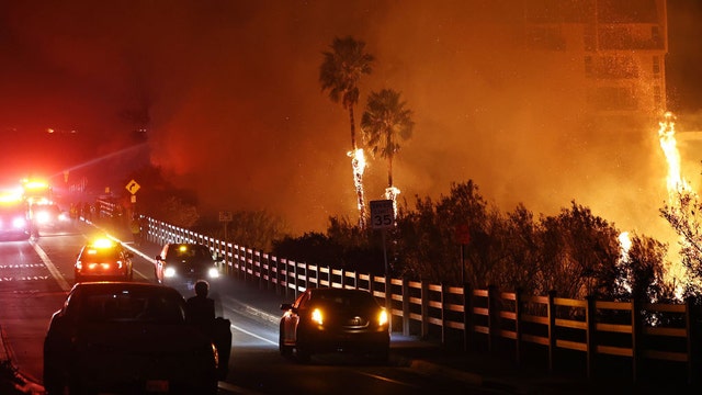
Thousands of Southern California residents are under evacuation orders and warnings as firefighters battle a wildfire in Malibu.
Thousands of Southern California residents are under evacuation orders and warnings as firefighters battle a wildfire in Malibu.
Massive wildfires burning in California
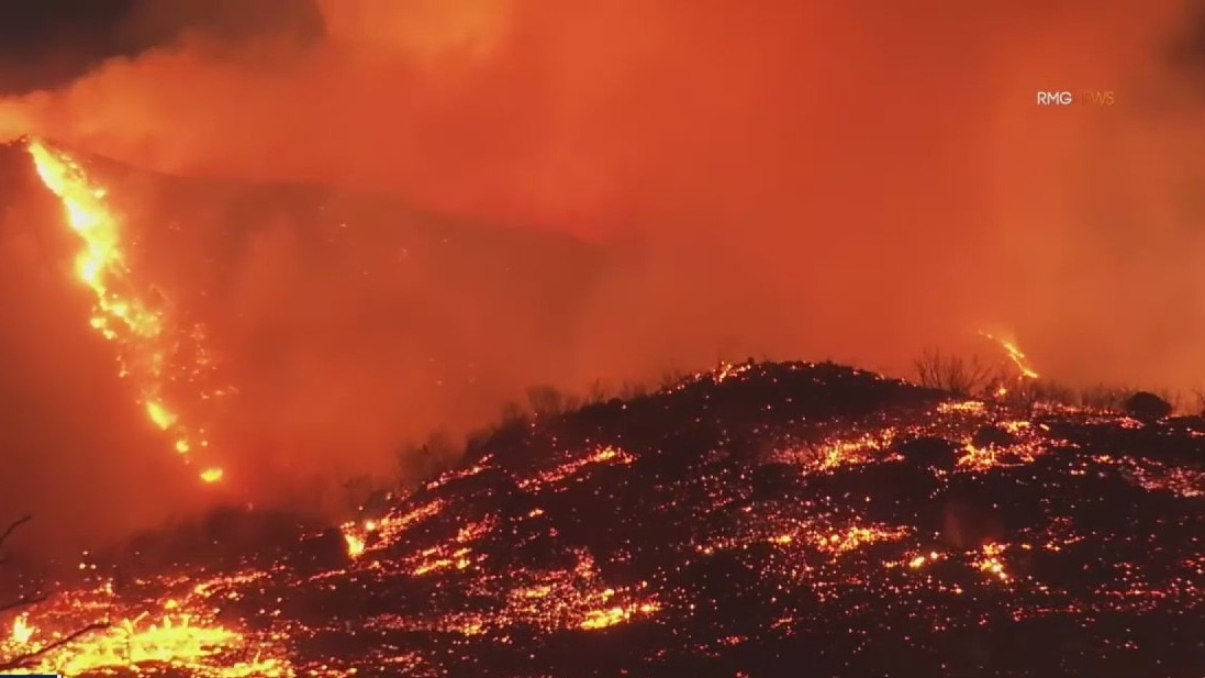
Meteorologist John Dawson discusses the massive wildfires burning in California which have led to mandatory evacuations in some areas. Plus, we take a look at the cooler weather coming into Houston.
Meteorologist John Dawson discusses the massive wildfires burning in California which have led to mandatory evacuations in some areas. Plus, we take a look at the cooler weather coming into Houston.
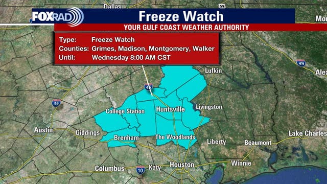

Houston weather: Cold front drops temps; Freeze Watch to the north
Tuesday will be breezy and cool across Southeast Texas as a cold front pushes to the coast. A freeze watch is in effect north of Houston Tuesday night through Wednesday morning.
Tuesday will be breezy and cool across Southeast Texas as a cold front pushes to the coast. A freeze watch is in effect north of Houston Tuesday night through Wednesday morning.

Houston weather: Dec. 10 forecast
Tuesday will be breezy and cool across Southeast Texas as a cold front pushes to the coast. Look for north winds 10-20 mph with temperatures in the 60s. Skies will be clearing during the afternoon as drier air arrives, setting up for a chilly night. Montgomery, Walker, Trinity, Madison, San Jacinto, Washington, Grimes, and Brazos county are under a FREEZE WATCH Tuesday night through Wednesday morning. The City of Houston should escape freezing temperatures this time around. But areas north of Houston like Brenham, Livingston, Huntsville and College Station could reach the freezing mark Wednesday morning and/or Thursday morning. Milder weather and a decent shot for rain should return just in time to potentially impact your weekend plans.
Tuesday will be breezy and cool across Southeast Texas as a cold front pushes to the coast. Look for north winds 10-20 mph with temperatures in the 60s. Skies will be clearing during the afternoon as drier air arrives, setting up for a chilly night. Montgomery, Walker, Trinity, Madison, San Jacinto, Washington, Grimes, and Brazos county are under a FREEZE WATCH Tuesday night through Wednesday morning. The City of Houston should escape freezing temperatures this time around. But areas north of Houston like Brenham, Livingston, Huntsville and College Station could reach the freezing mark Wednesday morning and/or Thursday morning. Milder weather and a decent shot for rain should return just in time to potentially impact your weekend plans.

FOX 26 Houston Weather Forecast
Get ready for more major weather changes over the next 24 hours! First, watch out for patchy fog which will likely develop again late from 10 pm until early Tuesday. Then get ready for another huge drop in temperatures! We'll go from near 80 today with highs only near the low 60s Tuesday. That's thanks to a cold front that drops in overnight. The front will only bring a 10-20% chance for rain with the best shot early Tuesday near the coast. Temperatures will remain below normal through Wednesday with highs in the 60s and lows in the 30s. Houston should escape freezing temperatures this time around. But areas north of Houston like Brenham, Livingston, Huntsville and College Station could reach the freezing mark Wednesday morning and/or Thursday morning. Milder weather and a decent shot for rain should return just in time to potentially impact your weekend plans. Keep track of the latest holiday weather where you live by downloading our app for your phone and smart TV, FOX Local!
Get ready for more major weather changes over the next 24 hours! First, watch out for patchy fog which will likely develop again late from 10 pm until early Tuesday. Then get ready for another huge drop in temperatures! We'll go from near 80 today with highs only near the low 60s Tuesday. That's thanks to a cold front that drops in overnight. The front will only bring a 10-20% chance for rain with the best shot early Tuesday near the coast. Temperatures will remain below normal through Wednesday with highs in the 60s and lows in the 30s. Houston should escape freezing temperatures this time around. But areas north of Houston like Brenham, Livingston, Huntsville and College Station could reach the freezing mark Wednesday morning and/or Thursday morning. Milder weather and a decent shot for rain should return just in time to potentially impact your weekend plans. Keep track of the latest holiday weather where you live by downloading our app for your phone and smart TV, FOX Local!

COLD nights on the way! | FOX 26 Houston Weather Forecast
Get ready for more major weather changes over the next 24 hours! First, watch out for patchy fog which will likely develop again late from 10 pm until early Tuesday. Then get ready for another huge drop in temperatures! We'll go from near 80 today with highs only near the low 60s Tuesday. That's thanks to a cold front that drops in overnight. The front will only bring a 10-20% chance for rain with the best shot early Tuesday near the coast. Temperatures will remain below normal through Wednesday with highs in the 60s and lows in the 30s. Houston should escape freezing temperatures this time around. But areas north of Houston like Brenham, Livingston, Huntsville and College Station could reach the freezing mark Wednesday morning and/or Thursday morning. Milder weather and a decent shot for rain should return just in time to potentially impact your weekend plans. Keep track of the latest holiday weather where you live by downloading our app for your phone and smart TV, FOX Local!
Get ready for more major weather changes over the next 24 hours! First, watch out for patchy fog which will likely develop again late from 10 pm until early Tuesday. Then get ready for another huge drop in temperatures! We'll go from near 80 today with highs only near the low 60s Tuesday. That's thanks to a cold front that drops in overnight. The front will only bring a 10-20% chance for rain with the best shot early Tuesday near the coast. Temperatures will remain below normal through Wednesday with highs in the 60s and lows in the 30s. Houston should escape freezing temperatures this time around. But areas north of Houston like Brenham, Livingston, Huntsville and College Station could reach the freezing mark Wednesday morning and/or Thursday morning. Milder weather and a decent shot for rain should return just in time to potentially impact your weekend plans. Keep track of the latest holiday weather where you live by downloading our app for your phone and smart TV, FOX Local!
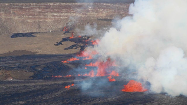

Earthquakes increase at Hawaii's Kilauea Volcano; scientists note increased level of unrest
The summit region had gone from experiencing 10 earthquakes per day to 20 per day, officials said during their weekly update on the volcano.
The summit region had gone from experiencing 10 earthquakes per day to 20 per day, officials said during their weekly update on the volcano.
Forecasting With Friends: Another cold front for Houston
Join the FOX 26 Weather Team as we talk all things weather. We have our eye on the next cold front on the way to Houston.
Join the FOX 26 Weather Team as we talk all things weather. We have our eye on the next cold front on the way to Houston.
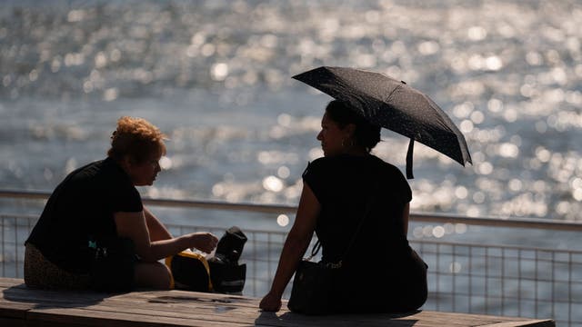

2024 closes out as world’s warmest year ever
The world is closing out its warmest year on record, and if the phrase sounds like a broken record, it is because the record was set just last year.
The world is closing out its warmest year on record, and if the phrase sounds like a broken record, it is because the record was set just last year.

Peak Design Travel Duffelpack 65L: Emergency Gear Test
Hurricane season is over, but we should stay ready for the unexpected. Meteorologist John Dawson is still reviewing products that could be helpful in stressful times. On today?s Emergency Gear Test, he talks about having a good way to store those supplies needed for disasters.
Hurricane season is over, but we should stay ready for the unexpected. Meteorologist John Dawson is still reviewing products that could be helpful in stressful times. On today?s Emergency Gear Test, he talks about having a good way to store those supplies needed for disasters.

Houston weather: Warm Monday ahead of cold front overnight
Houston weather today, December 9, and a look at our next cold front moving in overnight.
Houston weather today, December 9, and a look at our next cold front moving in overnight.

Houston weather: Big changes on the way for Southeast Texas
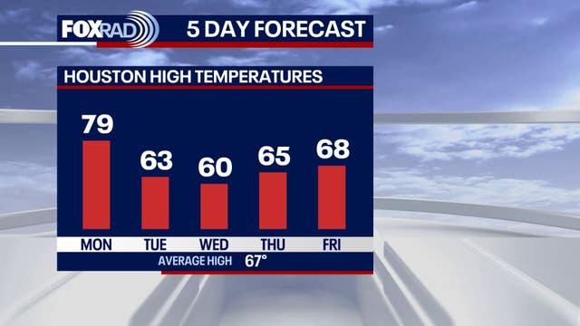
Big weather changes are on the way to Southeast Texas this week. Behind a gloomy and misty weekend, our skies will slowly be clearing. Highs will soar to the upper-70s if not 80 degrees. A cold front moves in overnight which will plummet temperatures to the low-60s and wake up temperatures in the 30s later this week. Keep your jackets handy as you will need them soon. Download the free FOX LOCAL app for the latest weather updates.
Big weather changes are on the way to Southeast Texas this week. Behind a gloomy and misty weekend, our skies will slowly be clearing. Highs will soar to the upper-70s if not 80 degrees. A cold front moves in overnight which will plummet temperatures to the low-60s and wake up temperatures in the 30s later this week. Keep your jackets handy as you will need them soon. Download the free FOX LOCAL app for the latest weather updates.


Houston weather: Another cold front on the way
A cold front sweeps through Tuesday, pushing temps back down below the seasonal averages.
A cold front sweeps through Tuesday, pushing temps back down below the seasonal averages.

Houston weather: Another cold front ahead
The rainy weekend is slowly coming to an end across Southeast Texas. Look for some low clouds and fog around Houston on Monday morning. The afternoon will be very warm with temps near 80 degrees. A cold front sweeps through Tuesday pushing temps back down below the seasonal averages. Get ready for some chilly mornings on Wednesday and Thursday!
The rainy weekend is slowly coming to an end across Southeast Texas. Look for some low clouds and fog around Houston on Monday morning. The afternoon will be very warm with temps near 80 degrees. A cold front sweeps through Tuesday pushing temps back down below the seasonal averages. Get ready for some chilly mornings on Wednesday and Thursday!

Houston weather: More rain Sunday, another cold front on the way
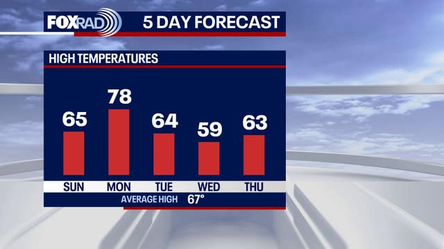
After another cold front sweeps through, afternoon highs will be back down to the 50s and 60s with wake up temperatures in the 30s likely later this week.
After another cold front sweeps through, afternoon highs will be back down to the 50s and 60s with wake up temperatures in the 30s likely later this week.