


FOX 26 Houston Weather Forecast
Air Quality Alert for higher ozone levels has been extended through Friday evening. Limit time outside if you are sensitive to this type of thing. Good news is that the tropics remain quiet for us with nothing expected to develop in the Gulf of Mexico through the rest of this week. However, we need some heat relief and that should arrive next week. Gulf moisture increases and rain chances go up too. Temperatures will be about 10 degrees cooler by the middle of next week with more widespread rain. Get the latest weather where you live on our FOX 26 weather app and our smart tv app Fox Local!
Air Quality Alert for higher ozone levels has been extended through Friday evening. Limit time outside if you are sensitive to this type of thing. Good news is that the tropics remain quiet for us with nothing expected to develop in the Gulf of Mexico through the rest of this week. However, we need some heat relief and that should arrive next week. Gulf moisture increases and rain chances go up too. Temperatures will be about 10 degrees cooler by the middle of next week with more widespread rain. Get the latest weather where you live on our FOX 26 weather app and our smart tv app Fox Local!

FOX 26 Houston Weather Forecast
Heat Advisory remains in place for Houston through 10 p.m. Heat index values around 110 are still likely Friday afternoon which could lead to heat illness. Air Quality Alert for higher ozone levels has been extended through Friday evening. Limit time outside if you are sensitive to this type of thing. Good news is that the tropics remain quiet for us with nothing expected to develop in the Gulf of Mexico through the rest of this week. However, we need some heat relief and that should arrive next week. Gulf moisture increases and rain chances go up too. Temperatures will be about 10 degrees cooler by the middle of next week with more widespread rain. Get the latest weather where you live on our FOX 26 weather app and our smart TV app Fox Local!
Heat Advisory remains in place for Houston through 10 p.m. Heat index values around 110 are still likely Friday afternoon which could lead to heat illness. Air Quality Alert for higher ozone levels has been extended through Friday evening. Limit time outside if you are sensitive to this type of thing. Good news is that the tropics remain quiet for us with nothing expected to develop in the Gulf of Mexico through the rest of this week. However, we need some heat relief and that should arrive next week. Gulf moisture increases and rain chances go up too. Temperatures will be about 10 degrees cooler by the middle of next week with more widespread rain. Get the latest weather where you live on our FOX 26 weather app and our smart TV app Fox Local!

Tropical update: Saharan dust hinders developments
Saharan dust is still hindering big time tropical systems from developing in the Atlantic for now. No tropical systems are expected over the next seven days with some drier air in place across the Atlantic. Caribbean Sea and Gulf of Mexico remain quiet also. Don't let your guard down because we are close to September which is typically the busiest month of hurricane season. Things could get going in a hurry so stay alert!
Saharan dust is still hindering big time tropical systems from developing in the Atlantic for now. No tropical systems are expected over the next seven days with some drier air in place across the Atlantic. Caribbean Sea and Gulf of Mexico remain quiet also. Don't let your guard down because we are close to September which is typically the busiest month of hurricane season. Things could get going in a hurry so stay alert!

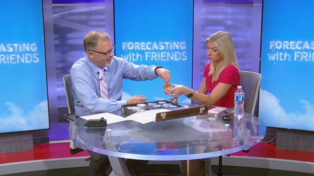
Fireworm threat in TX | Forecasting With Friends
Creepy crawlies on the Texas coast! We're talking about fireworms?tiny, venomous creatures that could turn your beach day into a nightmare. Find out how to stay safe and what to do if you encounter one.
Creepy crawlies on the Texas coast! We're talking about fireworms?tiny, venomous creatures that could turn your beach day into a nightmare. Find out how to stay safe and what to do if you encounter one.

Heat advisory continues | Fox Houston Weather Forecast
We hit the triple digits in Houston for the 6th day in a row yesterday and today, we'll get close. Our wind direction will be slightly different today from the southeast, so expect very high humidity and highs at least in the upper 90s. A heat advisory is in effect until 10pm. Watch for isolated showers and storms mainly near the coastline and south of Houston. Elsewhere in Texas, extreme heat continues for Central Texas after Austin hit 109 on Wednesday and that area will head back into the 100s again today. By this weekend and especially next week, steering currents will point in our direction from the Gulf of Mexico, so rain chances will increase and temperatures will return to normal. Also, we'll closely monitor the Gulf for any signs of tropical development. Elsewhere, the Atlantic Ocean is still in Saharan dust mode with no organized systems and in the Pacific, a hurricane will approach Hawaii this weekend.
We hit the triple digits in Houston for the 6th day in a row yesterday and today, we'll get close. Our wind direction will be slightly different today from the southeast, so expect very high humidity and highs at least in the upper 90s. A heat advisory is in effect until 10pm. Watch for isolated showers and storms mainly near the coastline and south of Houston. Elsewhere in Texas, extreme heat continues for Central Texas after Austin hit 109 on Wednesday and that area will head back into the 100s again today. By this weekend and especially next week, steering currents will point in our direction from the Gulf of Mexico, so rain chances will increase and temperatures will return to normal. Also, we'll closely monitor the Gulf for any signs of tropical development. Elsewhere, the Atlantic Ocean is still in Saharan dust mode with no organized systems and in the Pacific, a hurricane will approach Hawaii this weekend.

More heat on Thursday | FOX 26 Houston Weather Forecast
Excessive Heat Warning continues until 10pm tonight with heat index values up to 118 possible. It will be replaced with a Heat Advisory for everyone from 10pm tonight until 10pm Thursday night. Thursday will likely be our 7th triple digit day in Houston. Pattern will change some next week with more clouds, rain & cooler temperatures. So relief is in sight! Atlantic basin remains quiet with no tropical systems expected to develop the rest of this week.
Excessive Heat Warning continues until 10pm tonight with heat index values up to 118 possible. It will be replaced with a Heat Advisory for everyone from 10pm tonight until 10pm Thursday night. Thursday will likely be our 7th triple digit day in Houston. Pattern will change some next week with more clouds, rain & cooler temperatures. So relief is in sight! Atlantic basin remains quiet with no tropical systems expected to develop the rest of this week.

FOX 26 Houston Weather Forecast
Excessive Heat Warning continues until 10pm tonight with heat index values up to 118 possible. It will be replaced with a Heat Advisory for everyone from 10 p.m. tonight until 10 p.m. Thursday night. Thursday will likely be our seventh triple digit day in Houston. Pattern will change some next week with more clouds, rain & cooler temperatures. So relief is in sight! Atlantic basin remains quiet with no typical systems expected to develop the rest of this week.
Excessive Heat Warning continues until 10pm tonight with heat index values up to 118 possible. It will be replaced with a Heat Advisory for everyone from 10 p.m. tonight until 10 p.m. Thursday night. Thursday will likely be our seventh triple digit day in Houston. Pattern will change some next week with more clouds, rain & cooler temperatures. So relief is in sight! Atlantic basin remains quiet with no typical systems expected to develop the rest of this week.

Tropical update: No systems seen in Atlantic
We are getting closer to what is typically the busiest part of hurricane season. The good news is that no tropical systems are expected to develop over the next few days in the Atlantic basin. However, water temperatures are still warm and September could still be a really busy month for hurricanes. So stay alert! Eastern Pacific remains active with Category two hurricane Gilma and possibly Hector developing and threatening Hawaii by this weekend.
We are getting closer to what is typically the busiest part of hurricane season. The good news is that no tropical systems are expected to develop over the next few days in the Atlantic basin. However, water temperatures are still warm and September could still be a really busy month for hurricanes. So stay alert! Eastern Pacific remains active with Category two hurricane Gilma and possibly Hector developing and threatening Hawaii by this weekend.
Triple-digit heat continues | Forecasting With Friends
Houston is bracing for its sixth consecutive day of triple-digit temperatures, with an excessive heat warning in effect. As the city peaks in heat, relief may come next week with possible rain and cooler temps in the low 90s.
Houston is bracing for its sixth consecutive day of triple-digit temperatures, with an excessive heat warning in effect. As the city peaks in heat, relief may come next week with possible rain and cooler temps in the low 90s.

Heat index hits 112?F | Fox 26 Houston Forecast
Houston has hit 100 degrees for five days in a row and today could make day six. Even if we "only" hit 99, it will still continue a heat wave that will continue through the end of the week. Each day will bring a very slight chance for an isolated storms or two, but by early next week, low pressure will move in and bring more clouds, showers and temperatures closer to average. In the meantime, our heat index could reach as high as 112 today, so stay in the air conditioning as much as possible. Amazingly pleasant weather has moved into the Midwest and East Coast where lows this morning dropped to the 50s. In the tropics, Ernesto is gone and there is nothing urgent in the short term with Saharan dust across the Atlantic Ocean and no impressive tropical waves for now. In the Pacific Ocean, a hurricane could form and threaten Hawaii later this week.
Houston has hit 100 degrees for five days in a row and today could make day six. Even if we "only" hit 99, it will still continue a heat wave that will continue through the end of the week. Each day will bring a very slight chance for an isolated storms or two, but by early next week, low pressure will move in and bring more clouds, showers and temperatures closer to average. In the meantime, our heat index could reach as high as 112 today, so stay in the air conditioning as much as possible. Amazingly pleasant weather has moved into the Midwest and East Coast where lows this morning dropped to the 50s. In the tropics, Ernesto is gone and there is nothing urgent in the short term with Saharan dust across the Atlantic Ocean and no impressive tropical waves for now. In the Pacific Ocean, a hurricane could form and threaten Hawaii later this week.

Heat dome continues over Texas | FOX 26 Houston Weather Forecast
The next 2 days will continue to be very hot in southeast Texas. The EXCESSIVE HEAT WARNING currently runs through 10pm Wednesday. Moving towards the weekend, Houston is start to feel temperatures slide back down to normal for this time of year. Look for rain to return to the forecast at the start of the workweek.
The next 2 days will continue to be very hot in southeast Texas. The EXCESSIVE HEAT WARNING currently runs through 10pm Wednesday. Moving towards the weekend, Houston is start to feel temperatures slide back down to normal for this time of year. Look for rain to return to the forecast at the start of the workweek.

FOX 26 Houston Weather Forecast
The next two days will continue to be very hot in southeast Texas. The EXCESSIVE HEAT WARNING currently runs through 10pm Wednesday. Moving towards the weekend, Houston is start to feel temperatures slide back down to normal for this time of year. Look for rain to return to the forecast at the start of the workweek.
The next two days will continue to be very hot in southeast Texas. The EXCESSIVE HEAT WARNING currently runs through 10pm Wednesday. Moving towards the weekend, Houston is start to feel temperatures slide back down to normal for this time of year. Look for rain to return to the forecast at the start of the workweek.

Tropical update: What's coming after Ernesto?
Ernesto is done. Well, not completely done but just not a tropical cyclone any more. This post-tropical cyclone is moving toward the northeast near 40mph, and an even faster east-northeastern motion is expected during the next day or so.
Ernesto is done. Well, not completely done but just not a tropical cyclone any more. This post-tropical cyclone is moving toward the northeast near 40mph, and an even faster east-northeastern motion is expected during the next day or so.


Houston Excessive Heat Warning: Cooling centers open for Aug. 20
Here is a list of more than 50 cooling centers open in the Houston-area on Tuesday as an Excessive Heat Warning has the city HOT!
Here is a list of more than 50 cooling centers open in the Houston-area on Tuesday as an Excessive Heat Warning has the city HOT!
Triple-digit heat| Forecasting With Friends
Houston's heat wave continues with relief expected this weekend. Find out more about the weather changes and tropical updates.
Houston's heat wave continues with relief expected this weekend. Find out more about the weather changes and tropical updates.
Houston weather today: Extreme heat alert issued
The National Weather Service in Houston/Galveston has issued an Excessive Heat Warning for Southeast Texas, effective from 10:00 a.m. Tuesday morning until 10:00 p.m. Wednesday.
The National Weather Service in Houston/Galveston has issued an Excessive Heat Warning for Southeast Texas, effective from 10:00 a.m. Tuesday morning until 10:00 p.m. Wednesday.

5th Day of triple digits | Fox 26 Houston Weather Forecast
The heat is on! Today, our heat advisory has been upgraded to an Excessive Heat Warning. High temperatures today will exceed 100? in most inland areas with a heat index of 113 or higher, so stay in the AC as much as possible. Today will make the 5th day in a row of triple digits in Houston. When will we get some relief from all this heat? By this weekend, the dome of high pressure over Texas will weaken and an upper-level area of low pressure will move in from the Gulf (not a tropical system), so expect more clouds, showers and some thunderstorms, especially bu Sunday and Monday. The tropics remain very quiet as Ernesto moves quickly into the cold North Atlantic and there are no interesting tropical waves elsewhere. Don't let your guard down, because many more hurricanes are expected as we get to the end of August and through September.
The heat is on! Today, our heat advisory has been upgraded to an Excessive Heat Warning. High temperatures today will exceed 100? in most inland areas with a heat index of 113 or higher, so stay in the AC as much as possible. Today will make the 5th day in a row of triple digits in Houston. When will we get some relief from all this heat? By this weekend, the dome of high pressure over Texas will weaken and an upper-level area of low pressure will move in from the Gulf (not a tropical system), so expect more clouds, showers and some thunderstorms, especially bu Sunday and Monday. The tropics remain very quiet as Ernesto moves quickly into the cold North Atlantic and there are no interesting tropical waves elsewhere. Don't let your guard down, because many more hurricanes are expected as we get to the end of August and through September.

Excessive heat warning in effect on Tuesday | FOX 26 Houston Weather Forecast
Houston has had several days of triple digit afternoon highs and now there will be an EXCESSIVE HEAT WARNING for Tuesday. This is an upgrade from the Heat Advisory southeast Texas has been under for the past week. So use even more caution if you are working or playing outdoors.
Houston has had several days of triple digit afternoon highs and now there will be an EXCESSIVE HEAT WARNING for Tuesday. This is an upgrade from the Heat Advisory southeast Texas has been under for the past week. So use even more caution if you are working or playing outdoors.

Excessive heat on the way for Tuesday | FOX 26 Weather Forecast
Houston has had several days of triple digit afternoon highs and now there will be an EXCESSIVE HEAT WARNING for Tuesday. This is an upgrade from the Heat Advisory southeast Texas has been under for the past week. So use even more caution if you are working or playing outdoors.
Houston has had several days of triple digit afternoon highs and now there will be an EXCESSIVE HEAT WARNING for Tuesday. This is an upgrade from the Heat Advisory southeast Texas has been under for the past week. So use even more caution if you are working or playing outdoors.

Ernesto remains a hurricane in Atlantic | FOX 26 Tropical Weather Update
Ernesto is still a hurricane and still causing dangerous beach conditions along the northeast US coast and Atlantic Canada. The current forecast track takes Ernesto near Newfoundland tonight and early Tuesday.
Ernesto is still a hurricane and still causing dangerous beach conditions along the northeast US coast and Atlantic Canada. The current forecast track takes Ernesto near Newfoundland tonight and early Tuesday.