

Sunday Morning Forecast with Meteorologist Lena Maria
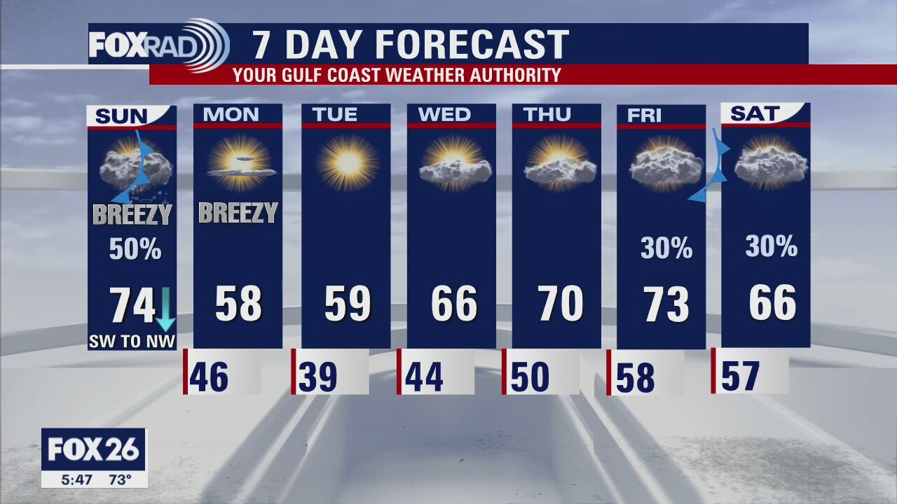
The weekend will end much quieter than it started, as we wait for a cold front to bring us dry, seasonable and quiet conditions at the start of the workweek. Temperatures will slowly increase as will cloud cover, but we stay mainly dry until our next front which looks to arrive by the weekend.
The weekend will end much quieter than it started, as we wait for a cold front to bring us dry, seasonable and quiet conditions at the start of the workweek. Temperatures will slowly increase as will cloud cover, but we stay mainly dry until our next front which looks to arrive by the weekend.
Saturday weather forecast with Meteorologist John Dawson
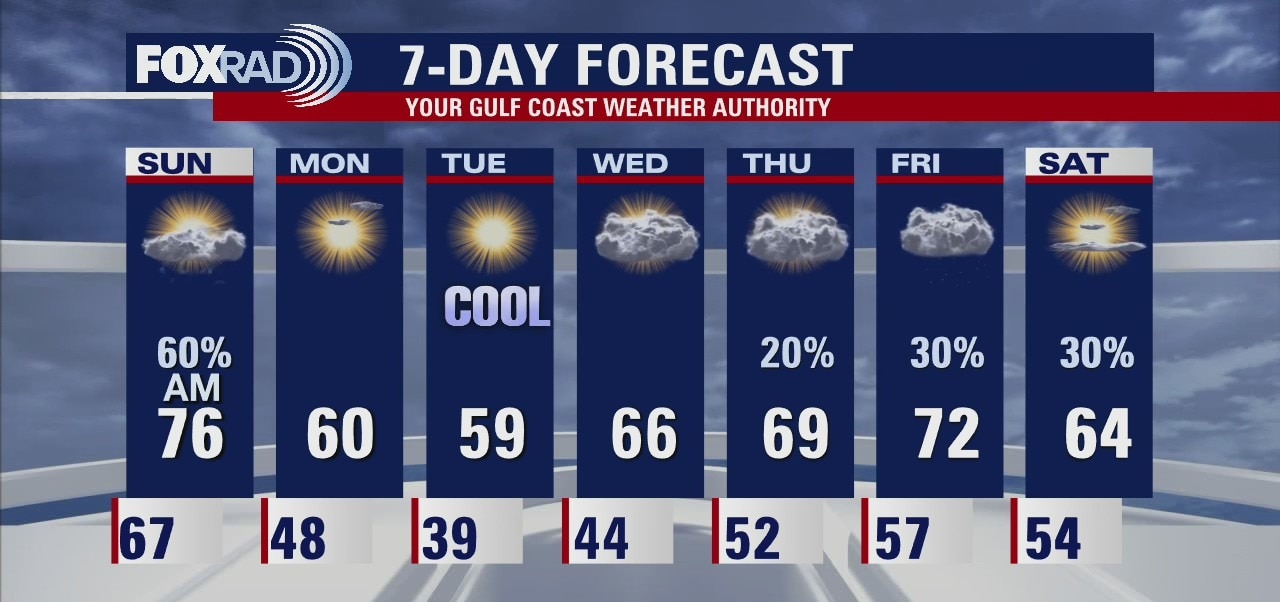
Storms around Houston should end around 10 p.m. Saturday but look for light rain and showers through lunch on Sunday. A weak front will clear out the rain at the end of the weekend. Southeast texas should see a quiet start to the workweek.
Storms around Houston should end around 10 p.m. Saturday but look for light rain and showers through lunch on Sunday. A weak front will clear out the rain at the end of the weekend. Southeast texas should see a quiet start to the workweek.
Saturday Morning Forecast with Meteorologist Lena Maria
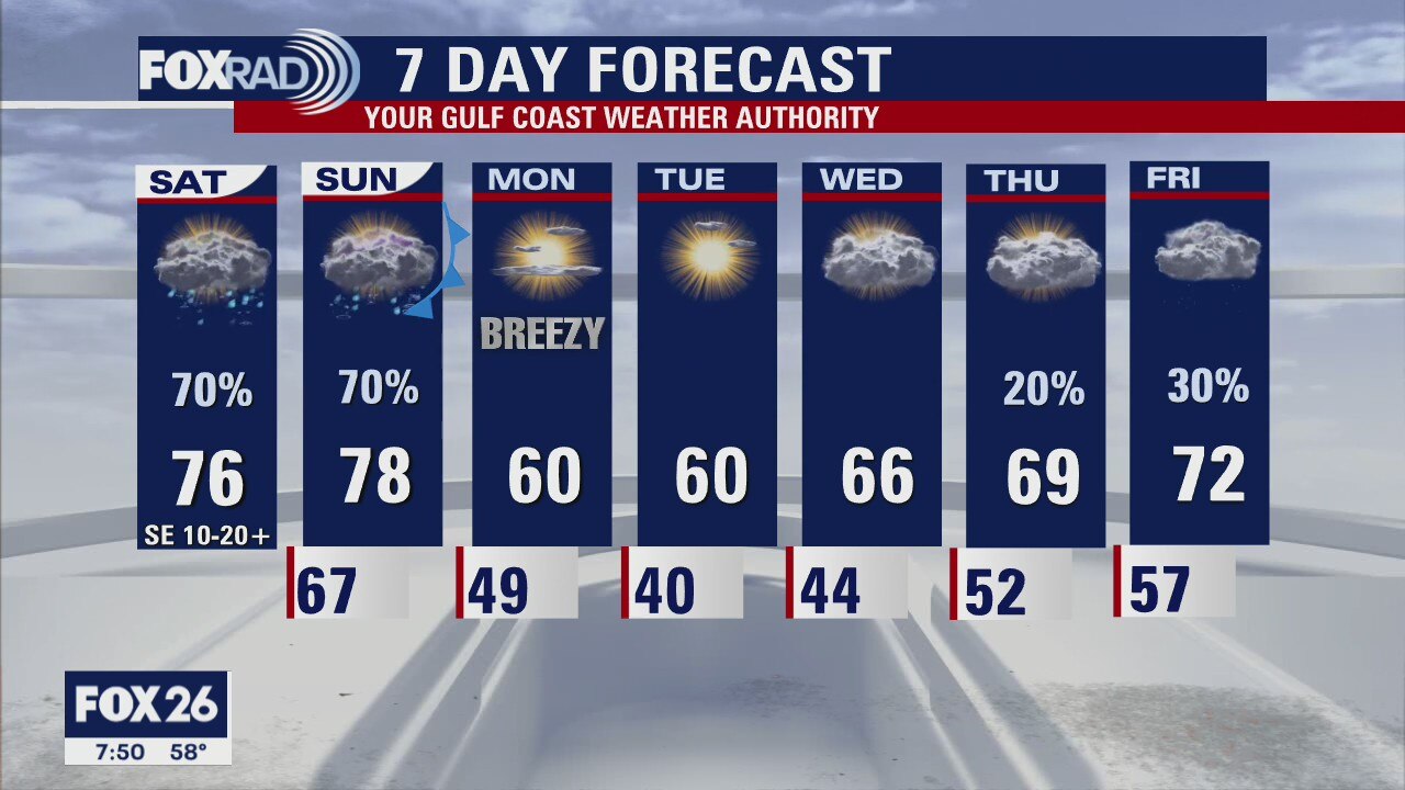
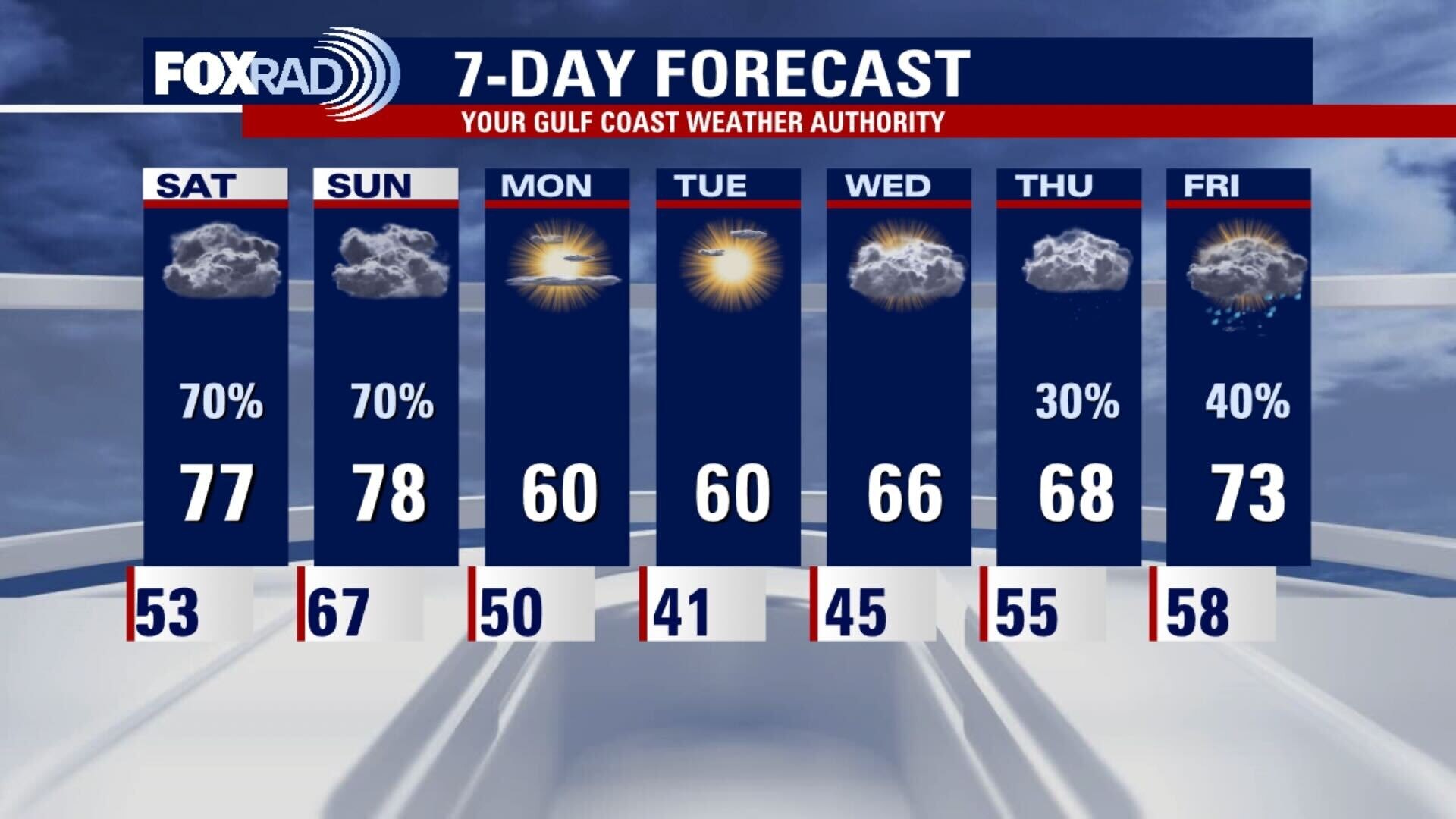
A warm front and coastal low brings us on and off showers and storms today and tomorrow, along with a marginal risk for severe weather. Be sure to stay weather aware and have a way to receive any watches or warnings that might get issued. A cold front late Sunday brings us seasonable, dry and quiet conditions at the start of the work week. Mild warming will kick in toward the end of the 7 day with the return of onshore flow, with increasing shower chances.
A warm front and coastal low brings us on and off showers and storms today and tomorrow, along with a marginal risk for severe weather. Be sure to stay weather aware and have a way to receive any watches or warnings that might get issued. A cold front late Sunday brings us seasonable, dry and quiet conditions at the start of the work week. Mild warming will kick in toward the end of the 7 day with the return of onshore flow, with increasing shower chances.
Saturday morning weather forecast
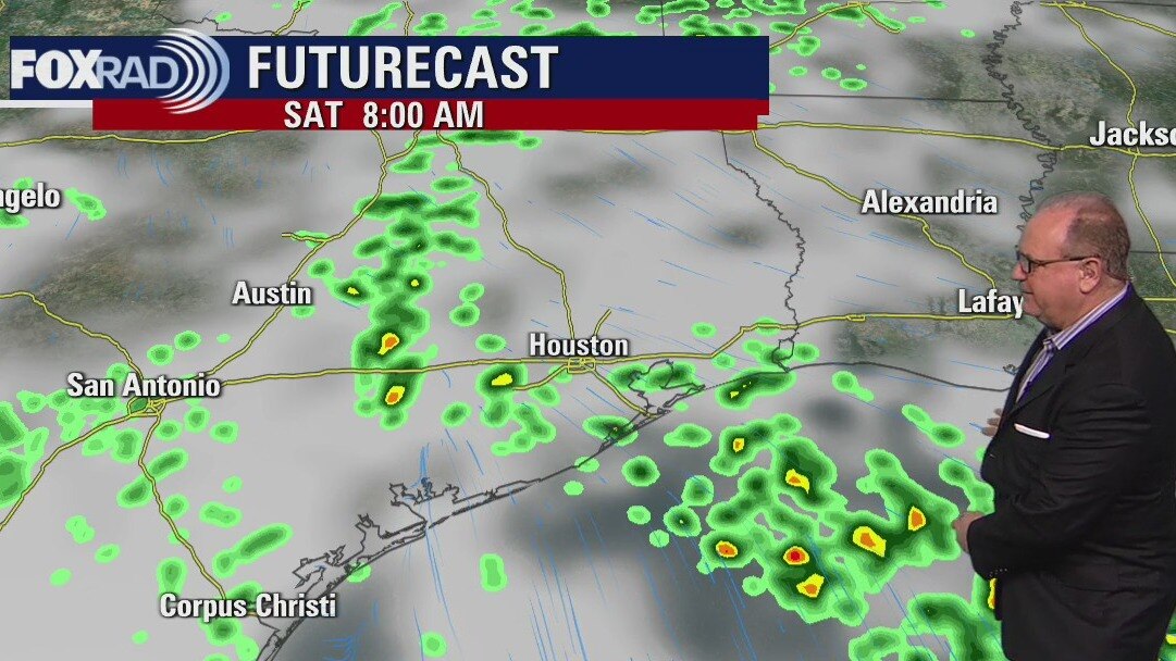
Rain and some strong storms will become likely from later on Saturday into early Sunday. Most areas can expect 1-2 inches of rain, but a few places could get 3-4 inches. A front arrives around midday on Sunday to help push the rain away from SE Texas.
Rain and some strong storms will become likely from later on Saturday into early Sunday. Most areas can expect 1-2 inches of rain, but a few places could get 3-4 inches. A front arrives around midday on Sunday to help push the rain away from SE Texas.
Friday evening weather forecast with Chief Meteorologist Dr. Jim Siebert
Rain and some strong storms will become likely from later on Saturday into early Sunday. Most areas can expect 1-2 inches of rain, but a few places could get 3-4 inches. A front arrives around midday on Sunday to help push the rain away from SE Texas.
Rain and some strong storms will become likely from later on Saturday into early Sunday. Most areas can expect 1-2 inches of rain, but a few places could get 3-4 inches. A front arrives around midday on Sunday to help push the rain away from SE Texas.
Friday weather forecast
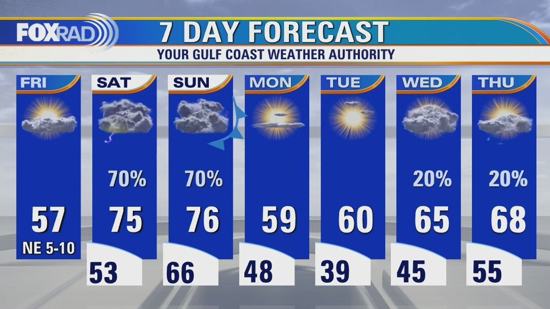
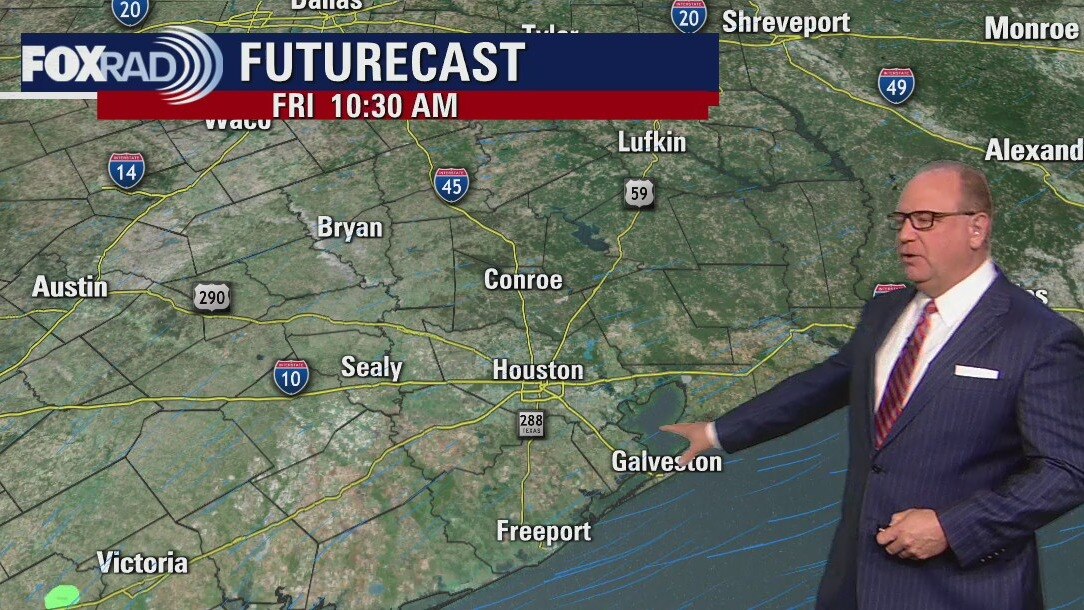
Lots of changes are on the way over the next few days. Today will be chilly and dry with an increase in clouds late in the day. An area of low pressure is expected to develop to our south and move up the coastline Saturday and Sunday bringing the risk for occasional heavy storms along with much warmer air. Cooler, drier air should return by Monday.
Lots of changes are on the way over the next few days. Today will be chilly and dry with an increase in clouds late in the day. An area of low pressure is expected to develop to our south and move up the coastline Saturday and Sunday bringing the risk for occasional heavy storms along with much warmer air. Cooler, drier air should return by Monday.
Friday morning weather forecast
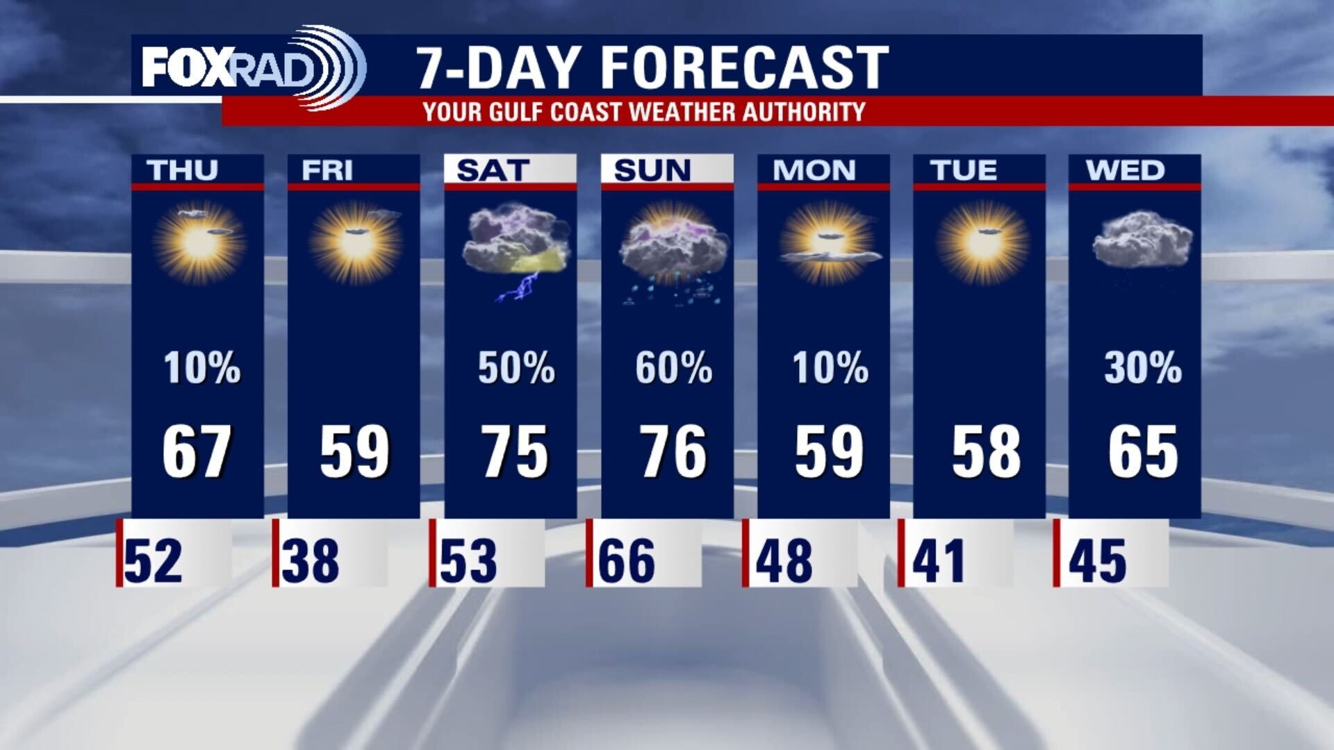
Temps will drop into the 30s tonight and highs on Friday will mostly be in the 50s. A quick warm-up over the weekend with temps back into the 70s, but rain will be likely from later on Saturday and early Sunday. Next week looks cool to start and then a little more mild.
Temps will drop into the 30s tonight and highs on Friday will mostly be in the 50s. A quick warm-up over the weekend with temps back into the 70s, but rain will be likely from later on Saturday and early Sunday. Next week looks cool to start and then a little more mild.
Thursday evening weather forecast with Chief Meteorologist Dr. Jim Siebert
Temps will drop into the 30s tonight and highs on Friday will mostly be in the 50s. A quick warm-up over the weekend with temps back into the 70s, but rain will be likely from later on Saturday and early Sunday. Next week looks cool to start and then a little milder.
Temps will drop into the 30s tonight and highs on Friday will mostly be in the 50s. A quick warm-up over the weekend with temps back into the 70s, but rain will be likely from later on Saturday and early Sunday. Next week looks cool to start and then a little milder.
Thursday weather forecast
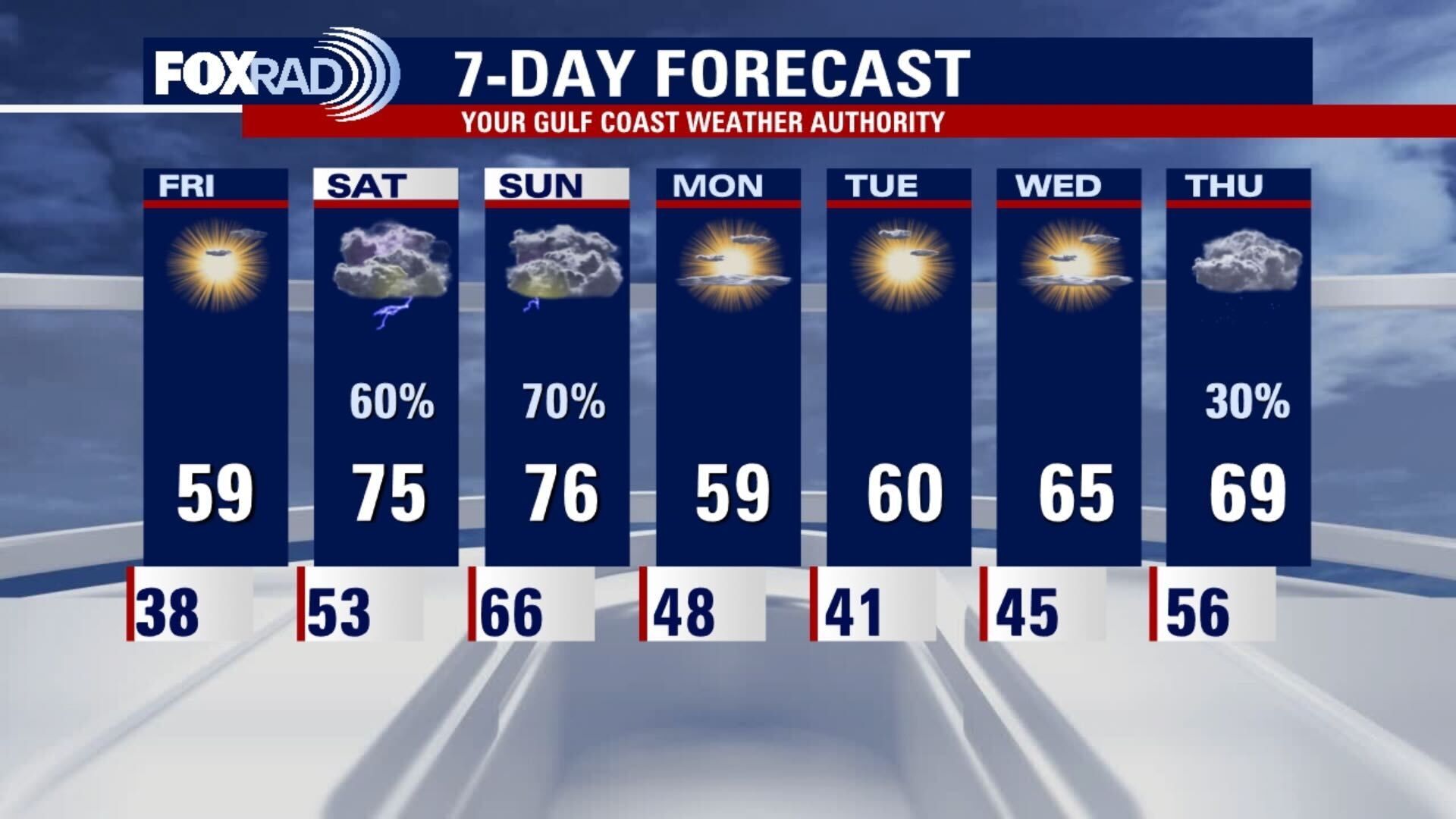
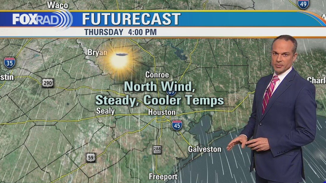
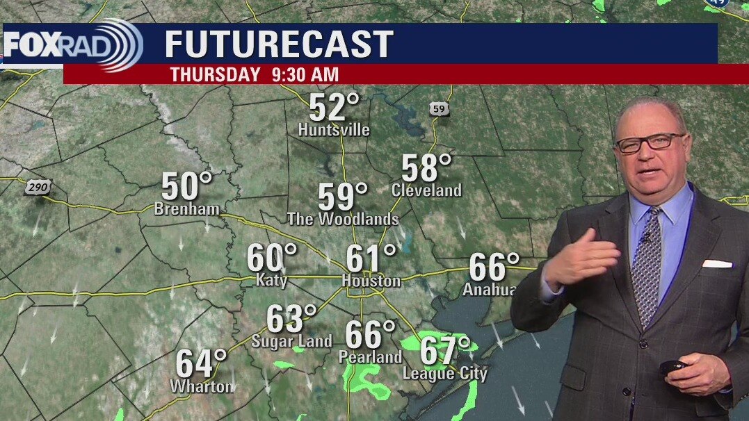
A cold front moving in today will bring a drier north breeze followed by a chilly night tonight. Lows could reach the mid to upper 30s Friday morning. Friday should remain cool and dry, but big changes await for the weekend. A south breeze will return humidity as another front approaches from the northwest, so rain is likely from Saturday afternoon through Sunday night. 2-3" of rain could fall in spots this weekend.
A cold front moving in today will bring a drier north breeze followed by a chilly night tonight. Lows could reach the mid to upper 30s Friday morning. Friday should remain cool and dry, but big changes await for the weekend. A south breeze will return humidity as another front approaches from the northwest, so rain is likely from Saturday afternoon through Sunday night. 2-3" of rain could fall in spots this weekend.
Thursday morning weather forecast
A cold front will arrive Thursday morning and will cool things down through Friday, but it won't be quite as cold as the last front. It warms over the weekend, but rain becomes likely and another front arrives in SE Texas on Sunday.
A cold front will arrive Thursday morning and will cool things down through Friday, but it won't be quite as cold as the last front. It warms over the weekend, but rain becomes likely and another front arrives in SE Texas on Sunday.
Wednesday evening weather forecast with Chief Meteorologist Dr. Jim Siebert
A cold front will arrive Thursday morning and will cool things down through Friday, but it won't be quite as cold as the last front. It warms over the weekend, but rain becomes likely and another front arrives in SE Texas on Sunday.
A cold front will arrive Thursday morning and will cool things down through Friday, but it won't be quite as cold as the last front. It warms over the weekend, but rain becomes likely and another front arrives in SE Texas on Sunday.
Wednesday weather forecast
A warm Wednesday by January standards, with a weak and dry cold front arriving overnight tonight. That will cool things down temporarily for Friday, but the front retrogrades back into the region as a warm front bringing us some soggy and mild conditions for the weekend. A surface cold front Sunday into Monday will bring that to an end, and bring us dry, cool weather at the start of next work week.
A warm Wednesday by January standards, with a weak and dry cold front arriving overnight tonight. That will cool things down temporarily for Friday, but the front retrogrades back into the region as a warm front bringing us some soggy and mild conditions for the weekend. A surface cold front Sunday into Monday will bring that to an end, and bring us dry, cool weather at the start of next work week.
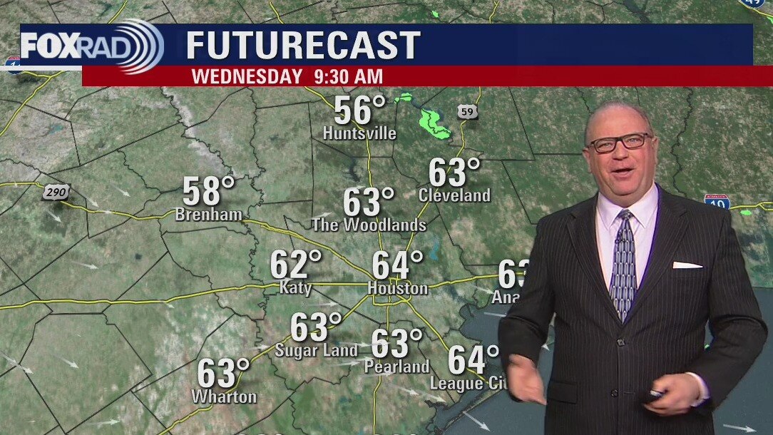
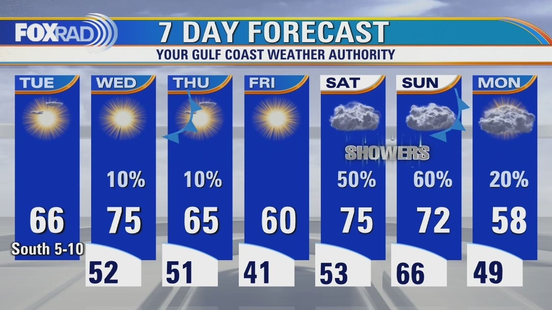
Wednesday morning weather forecast
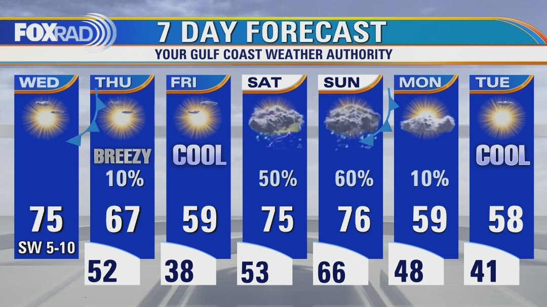
It will warm up quickly on Wednesday, but another front will arrive on Thursday to cool things down again. The chill won't last long as highs will reach back into the 70s over the weekend. There will be showers over the weekend as well.
It will warm up quickly on Wednesday, but another front will arrive on Thursday to cool things down again. The chill won't last long as highs will reach back into the 70s over the weekend. There will be showers over the weekend as well.
Tuesday evening weather forecast
It will warm up quickly on Wednesday, but another front will arrive on Thursday to cool things down again. The chill won't last long as highs will reach back into the 70s over the weekend. There will be showers over the weekend as well.
It will warm up quickly on Wednesday, but another front will arrive on Thursday to cool things down again. The chill won't last long as highs will reach back into the 70s over the weekend. There will be showers over the weekend as well.
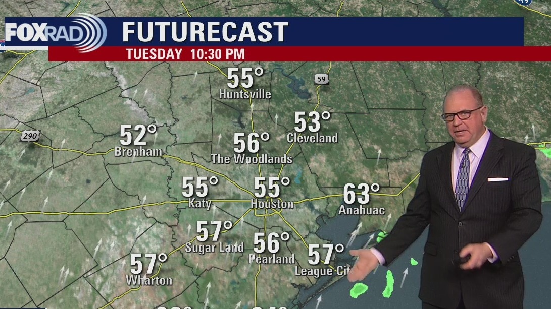
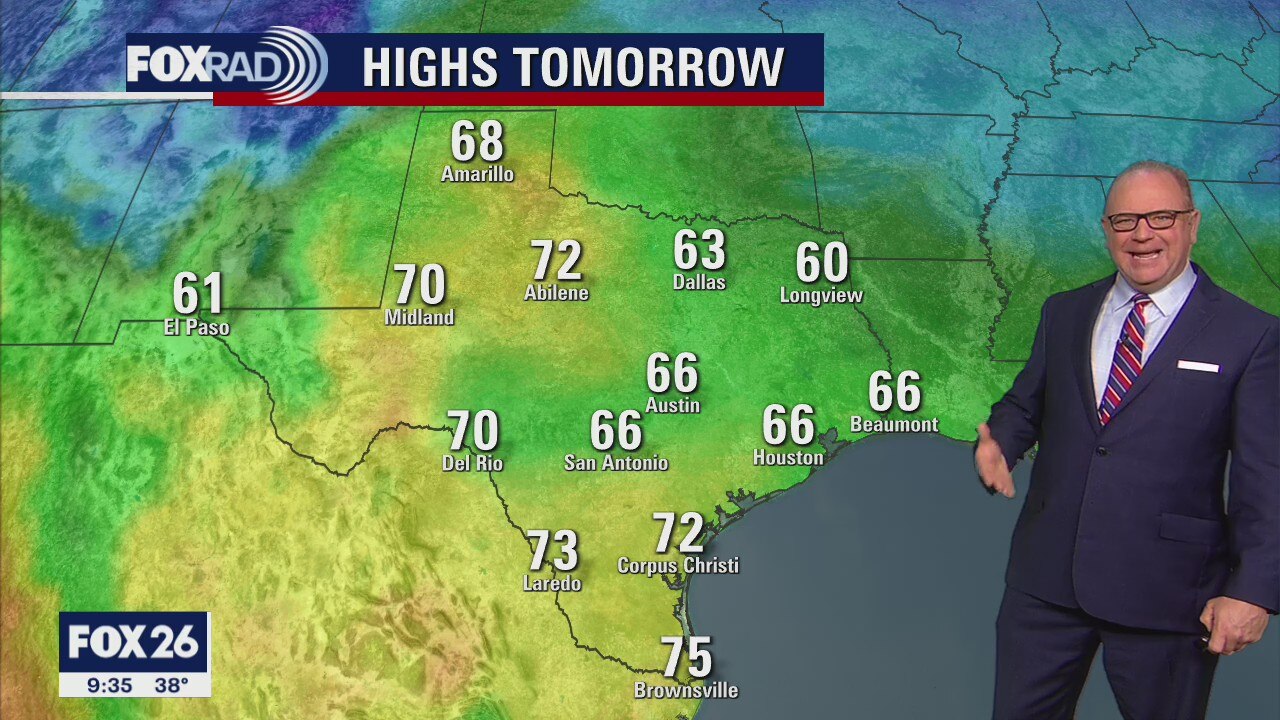
Tuesday morning weather
A slight warming trend will begin today after morning lows in the 30s, look for highs in the mid 60s. Tonight won't be as cold with a south breeze, lows in the 50s and a chance for fog. Wednesday looks spring-like before another minor cooldown late this week. Expect a rainy weekend.
A slight warming trend will begin today after morning lows in the 30s, look for highs in the mid 60s. Tonight won't be as cold with a south breeze, lows in the 50s and a chance for fog. Wednesday looks spring-like before another minor cooldown late this week. Expect a rainy weekend.
Warming up over the next couple of days
It will be cold again Monday night across southeast Texas and the Houston area, but maybe a few degrees warmer than Sunday night. It will start to warm up over the next couple of days, but another less strong cold front will arrive sometime on Thursday. Look for some showers over the weekend.
It will be cold again Monday night across southeast Texas and the Houston area, but maybe a few degrees warmer than Sunday night. It will start to warm up over the next couple of days, but another less strong cold front will arrive sometime on Thursday. Look for some showers over the weekend.
Monday weather forecast
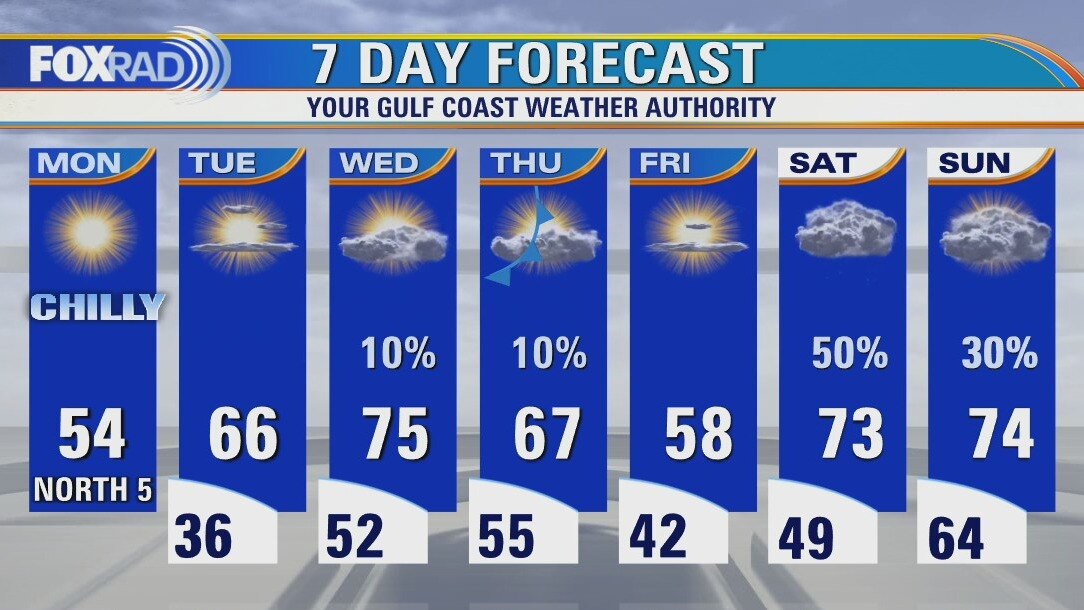
This morning's lows in the 20s and 30s were the coldest in nearly 10 1/2 months! Look for a sunny and chilly Monday afternoon with highs in the mid 50s. Temperatures could get close to freezing Tuesday morning, should warm into the mid 60s by afternoon. Highs will moderate by Wednesday heading into the mid 70s. Rain could return by Saturday.
This morning's lows in the 20s and 30s were the coldest in nearly 10 1/2 months! Look for a sunny and chilly Monday afternoon with highs in the mid 50s. Temperatures could get close to freezing Tuesday morning, should warm into the mid 60s by afternoon. Highs will moderate by Wednesday heading into the mid 70s. Rain could return by Saturday.
Sunday Morning Forecast with Meteorologist Lena Maria Arango
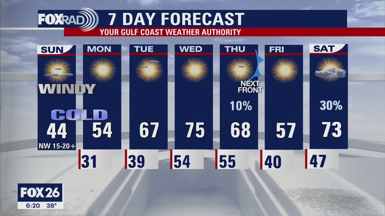
Frigid starts to Sunday and Monday, with many seeing their first Freeze, if not Hard Freeze of the season. Mind you, after our warmest December on record so about a month behind schedule. At least it'll be mainly sunny and dry this week, with temperatures rebounding nicely through Thursday. Another weak front may bring us some showers on Thursday, and a brief cool down Friday.
Frigid starts to Sunday and Monday, with many seeing their first Freeze, if not Hard Freeze of the season. Mind you, after our warmest December on record so about a month behind schedule. At least it'll be mainly sunny and dry this week, with temperatures rebounding nicely through Thursday. Another weak front may bring us some showers on Thursday, and a brief cool down Friday.

New Year's Day weather forecast with Meteorologist Mike Iscovitz
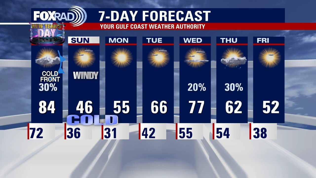
One more record warm afternoon lies ahead on New Year's Day before a strong cold front arrives overnight. Temperatures will fall from the mid-80s today to the mid-30s by Sunday morning. A freeze warning is in effect for counties north of I-10. Wind chills Sunday morning could reach the upper teens and low 20s. Light winds and lows below freezing are expected Monday morning. Highs could return to the mid-70s by mid-week.
One more record warm afternoon lies ahead on New Year's Day before a strong cold front arrives overnight. Temperatures will fall from the mid-80s today to the mid-30s by Sunday morning. A freeze warning is in effect for counties north of I-10. Wind chills Sunday morning could reach the upper teens and low 20s. Light winds and lows below freezing are expected Monday morning. Highs could return to the mid-70s by mid-week.
New Year's Eve weather forecast with Meteorologist John Dawson
Another warm day on New Year's Day in Houston but big changes will follow. The FOX 26 viewing area will see a FREEZE WATCH for Saturday night and Sunday night. Look for gradual warming in Southeast Texas until the next front arrives at the end of the week.
Another warm day on New Year's Day in Houston but big changes will follow. The FOX 26 viewing area will see a FREEZE WATCH for Saturday night and Sunday night. Look for gradual warming in Southeast Texas until the next front arrives at the end of the week.