

Partly cloudy, hot and humid Tuesday with isolated late day storms
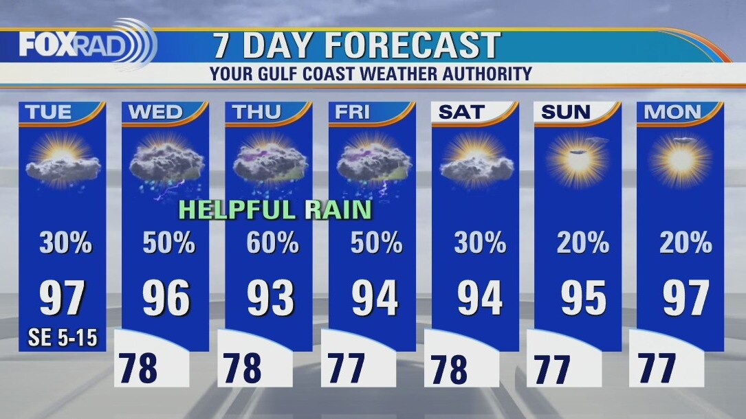
Fortunately, we are entering a pattern which includes a daily round of rain, especially tomorrow through Friday. Expect a hot and humid day today with hit and miss midday and afternoon storms. The rest of the week brings the potential for more widespread rain which should help with our drought. There is one tropical wave in the far eastern Atlantic that is not a threat to our area.
Fortunately, we are entering a pattern which includes a daily round of rain, especially tomorrow through Friday. Expect a hot and humid day today with hit and miss midday and afternoon storms. The rest of the week brings the potential for more widespread rain which should help with our drought. There is one tropical wave in the far eastern Atlantic that is not a threat to our area.
August heat cranks up Tuesday
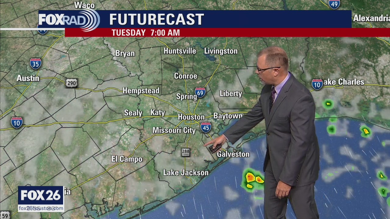
The August heat cranks up for Tuesday across Houston. Plan for afternoon highs to be near the triple digits around Southeast Texas. The pattern then shifts on Wednesday to more clouds with higher rain chances. Look for those daily rain chances to continue into the weekend. There is a tropical wave in the Atlantic, check out our YouTube Channel for the latest.
The August heat cranks up for Tuesday across Houston. Plan for afternoon highs to be near the triple digits around Southeast Texas. The pattern then shifts on Wednesday to more clouds with higher rain chances. Look for those daily rain chances to continue into the weekend. There is a tropical wave in the Atlantic, check out our YouTube Channel for the latest.
August heat cranks up on Tuesday
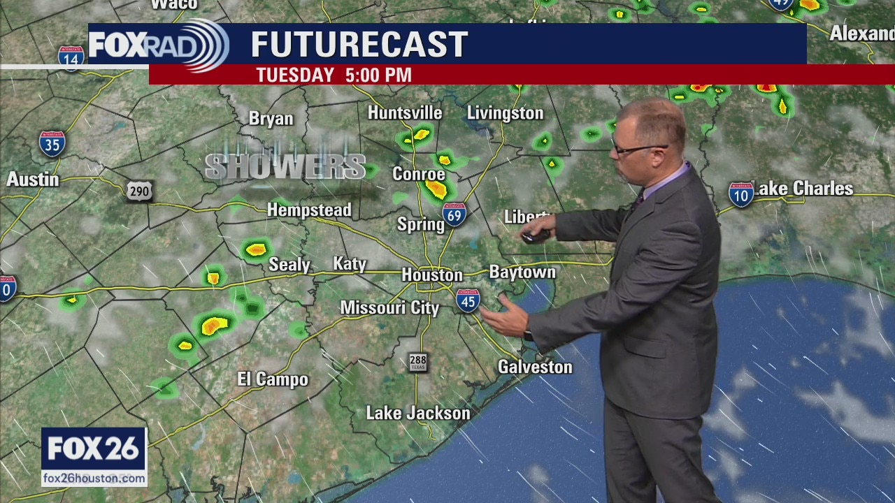
The August heat cranks up for Tuesday across Houston. Plan for afternoon highs to be near the triple digits around Southeast Texas. The pattern then shifts on Wednesday to more clouds with higher rain chances. Look for those daily rain chances to continue into the weekend. There is a tropical wave in the Atlantic, check out our YouTube Channel for the latest.
The August heat cranks up for Tuesday across Houston. Plan for afternoon highs to be near the triple digits around Southeast Texas. The pattern then shifts on Wednesday to more clouds with higher rain chances. Look for those daily rain chances to continue into the weekend. There is a tropical wave in the Atlantic, check out our YouTube Channel for the latest.
Partly cloudy and warm with isolated late day storms possible
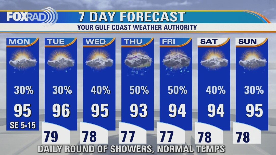
How does a daily round of rain sound? We really need it, not just in the Houston area, but across the state. A pattern change is taking place with the infamous "heat dome" of high pressure going away for now which allows for a more "normal" pattern. Expect highs in the mid 90s (some upper 90s) and scattered showers and storms mainly in the afternoon. In the tropics, a healthy wave is located many thousands of miles away near the west coast of Africa, but has a good chance of becoming a depression or tropical storm this week. No threat to our area.
How does a daily round of rain sound? We really need it, not just in the Houston area, but across the state. A pattern change is taking place with the infamous "heat dome" of high pressure going away for now which allows for a more "normal" pattern. Expect highs in the mid 90s (some upper 90s) and scattered showers and storms mainly in the afternoon. In the tropics, a healthy wave is located many thousands of miles away near the west coast of Africa, but has a good chance of becoming a depression or tropical storm this week. No threat to our area.
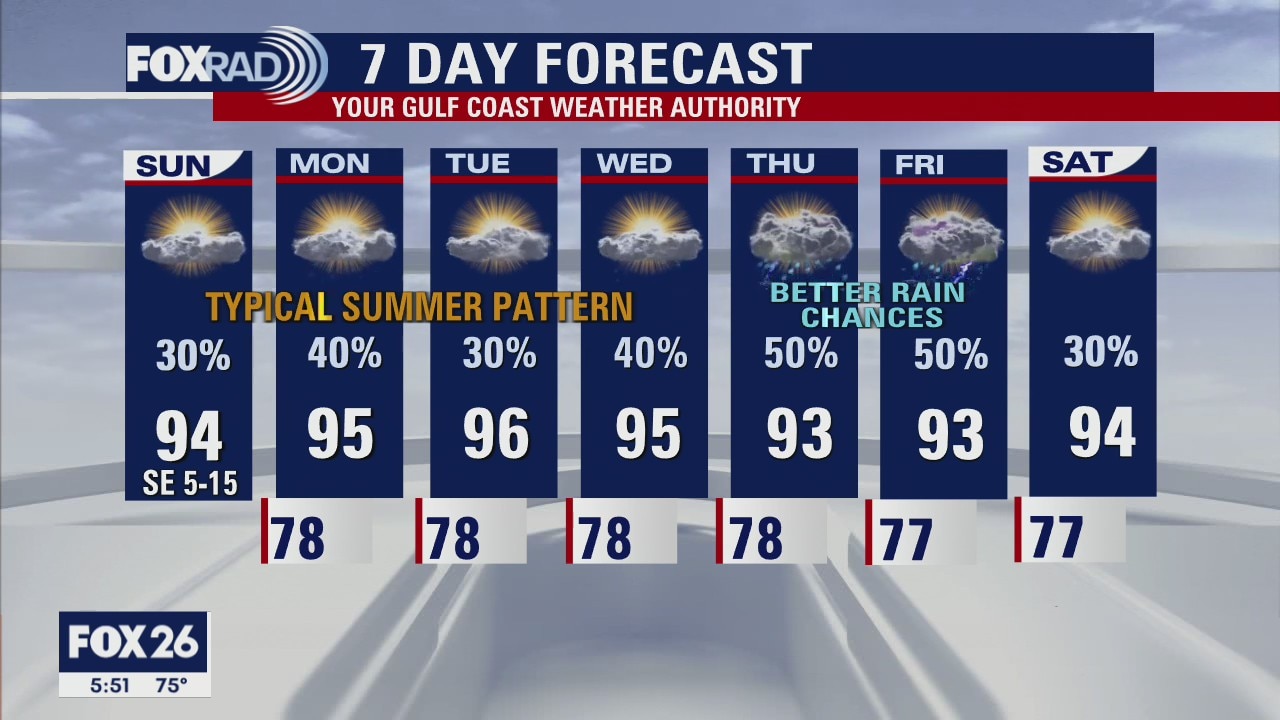
Sunday Morning Forecast with Meteorologist Lena Maria Arango
The weekend ends on a drier note, with normal late-summer conditions lingering through midweek. Another heat dome is building, but it will center itself off to our northwest. That will allow for several shortwaves to pass on the underside toward us, keeping our rain chances moderate throughout the week. Eyeing better rain chances for the Thursday/Friday timeframe. And after weeks of dust and silence in the tropical Atlantic, a wave is now being monitored for development. While there are no concerns for any landmass currently, it may become a Tropical Depression in the open Central Atlantic by midweek.
The weekend ends on a drier note, with normal late-summer conditions lingering through midweek. Another heat dome is building, but it will center itself off to our northwest. That will allow for several shortwaves to pass on the underside toward us, keeping our rain chances moderate throughout the week. Eyeing better rain chances for the Thursday/Friday timeframe. And after weeks of dust and silence in the tropical Atlantic, a wave is now being monitored for development. While there are no concerns for any landmass currently, it may become a Tropical Depression in the open Central Atlantic by midweek.
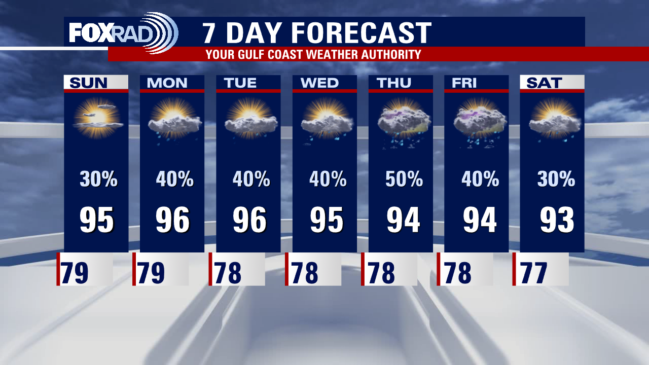
Saturday night leading into Sunday morning weather forecast
A typical August pattern is settling in, bringing daily rain and storm chances through most of next week. With partly cloudy skies and some rain around, high temperatures will largely stay in the low to mid 90s for the week ahead.
A typical August pattern is settling in, bringing daily rain and storm chances through most of next week. With partly cloudy skies and some rain around, high temperatures will largely stay in the low to mid 90s for the week ahead.

Saturday Morning Forecast with Meteorologist Lena Maria Arango
Another round of beneficial rainfall is on the way for Saturday, with scattered showers and storms keeping our temperatures in the lower 90s. Sunday looks to be the drier of the two weekend days, with more sunshine but an isolated shower or storm is still possible. Most of next week looks fairly typical for summer, warm and humid with daily rain chances. A weak front may get close enough to boost rain chances toward the tail end of the week. And, there's finally something to watch in the tropical Atlantic!
Another round of beneficial rainfall is on the way for Saturday, with scattered showers and storms keeping our temperatures in the lower 90s. Sunday looks to be the drier of the two weekend days, with more sunshine but an isolated shower or storm is still possible. Most of next week looks fairly typical for summer, warm and humid with daily rain chances. A weak front may get close enough to boost rain chances toward the tail end of the week. And, there's finally something to watch in the tropical Atlantic!
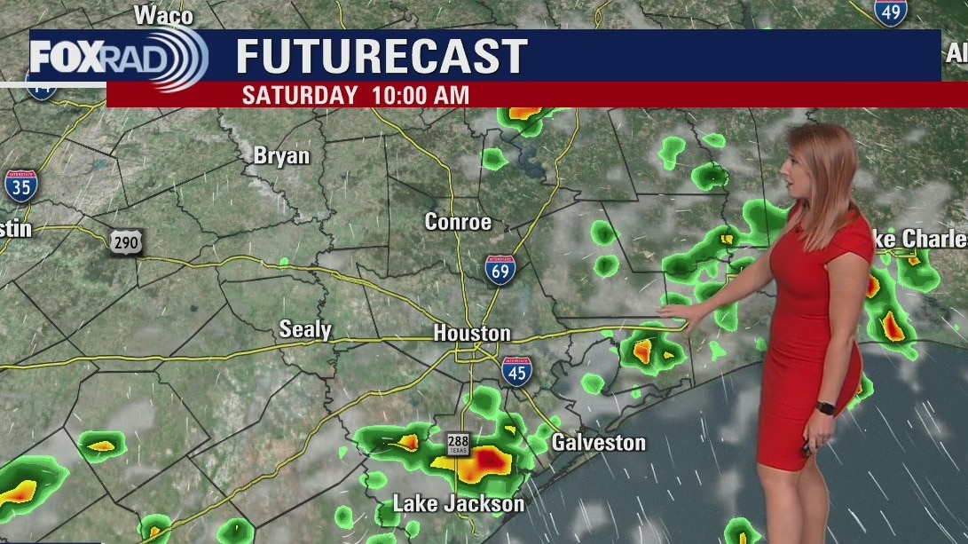
Saturday morning weather forecast
Beneficial rain continues to push into Southeast Texas this weekend. Showers and thunderstorms will be widespread and some could be heavy at times. Remember: if thunder roars, head indoors! A typical August pattern settles in for next week, with daily rain and storm chances.
Beneficial rain continues to push into Southeast Texas this weekend. Showers and thunderstorms will be widespread and some could be heavy at times. Remember: if thunder roars, head indoors! A typical August pattern settles in for next week, with daily rain and storm chances.
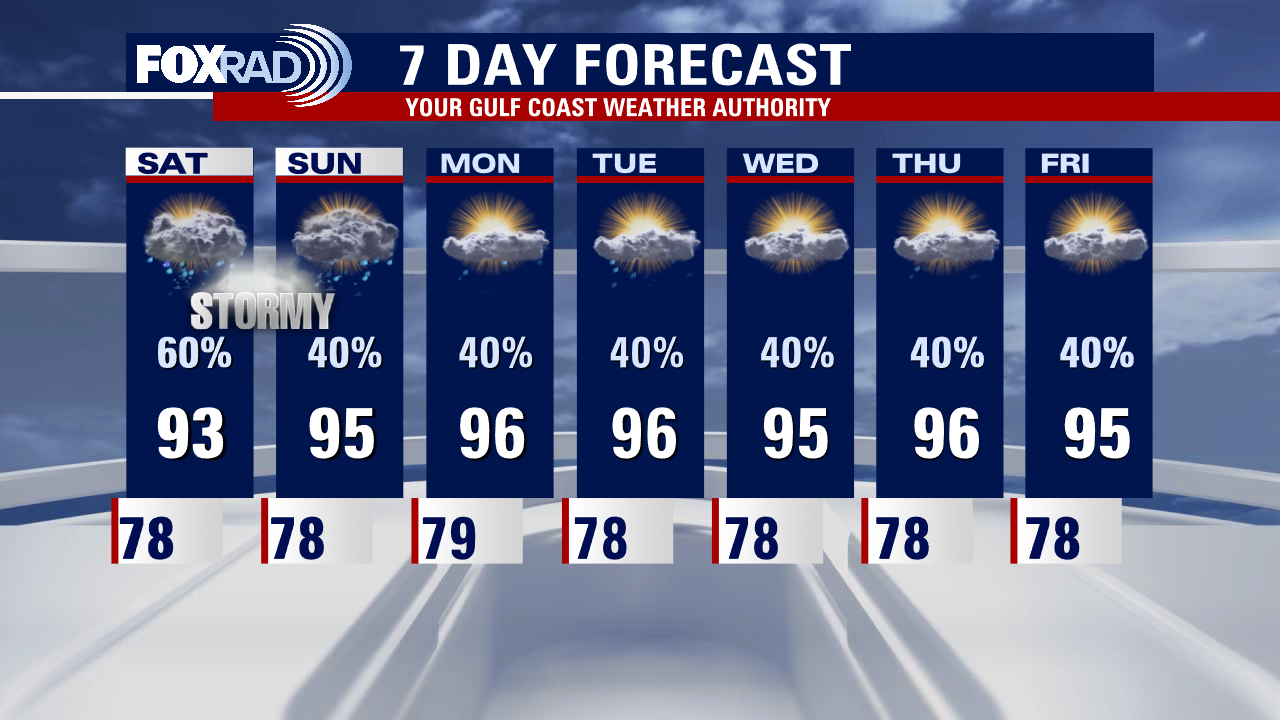
Friday evening weather forecast with Meteorologist Adrienne Vonn
Beneficial rain continues to push into Southeast Texas this weekend. Showers and thunderstorms will be widespread and some could be heavy at times. Remember: if thunder roars, head indoors! A typical August pattern settles in for next week, with daily rain and storm chances.
Beneficial rain continues to push into Southeast Texas this weekend. Showers and thunderstorms will be widespread and some could be heavy at times. Remember: if thunder roars, head indoors! A typical August pattern settles in for next week, with daily rain and storm chances.
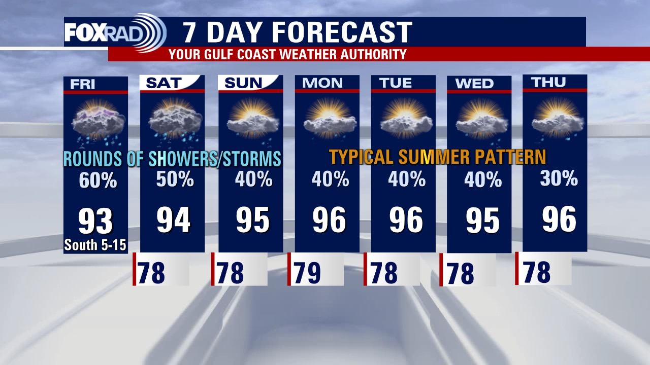
Friday afternoon weather forecast with Meteorologist Lena Maria Arango
Rounds of widespread, beneficial rainfall are on the way area wide today-tomorrow. In general, rain chances will fade some over the weekend so Sunday looks to be the drier of the two weekend days. The FOX26 Weather App can help you navigate the storms for outdoor plans over the weekend. Remember: If thunder roars, go indoors! Next week looks pretty typical for late summer, with temperatures steadily holding near average and daily chances for isolated showers and storms.
Rounds of widespread, beneficial rainfall are on the way area wide today-tomorrow. In general, rain chances will fade some over the weekend so Sunday looks to be the drier of the two weekend days. The FOX26 Weather App can help you navigate the storms for outdoor plans over the weekend. Remember: If thunder roars, go indoors! Next week looks pretty typical for late summer, with temperatures steadily holding near average and daily chances for isolated showers and storms.
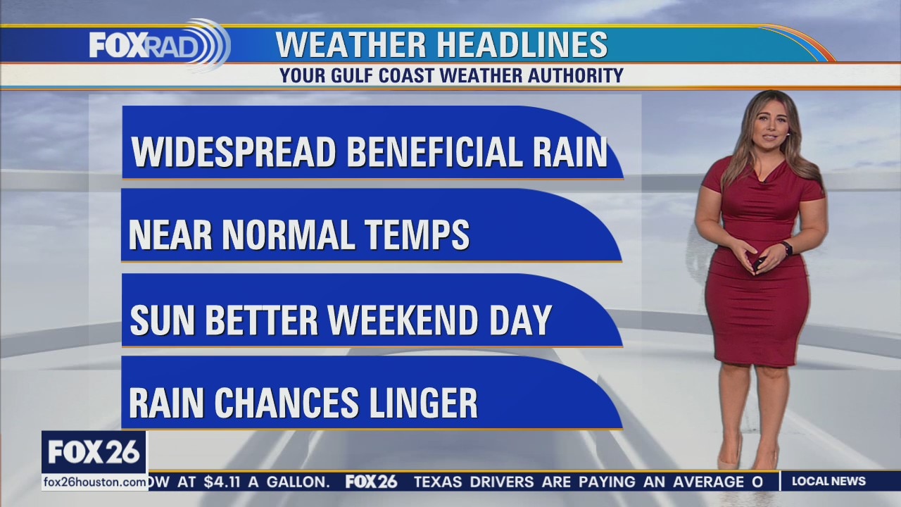
Rainy and cooler days thru the weekend
Rounds of widespread, beneficial rainfall are on the way area-wide for today, tomorrow, and the start of the day Sunday. Rain chances will generally fade over the weekend with cooler daytime highs. Got outdoor plans? The FOX 26 Weather App can help you navigate the storms over the weekend! Next week looks pretty typical for late summer, hanging onto daily chances of isolated showers and storms.
Rounds of widespread, beneficial rainfall are on the way area-wide for today, tomorrow, and the start of the day Sunday. Rain chances will generally fade over the weekend with cooler daytime highs. Got outdoor plans? The FOX 26 Weather App can help you navigate the storms over the weekend! Next week looks pretty typical for late summer, hanging onto daily chances of isolated showers and storms.
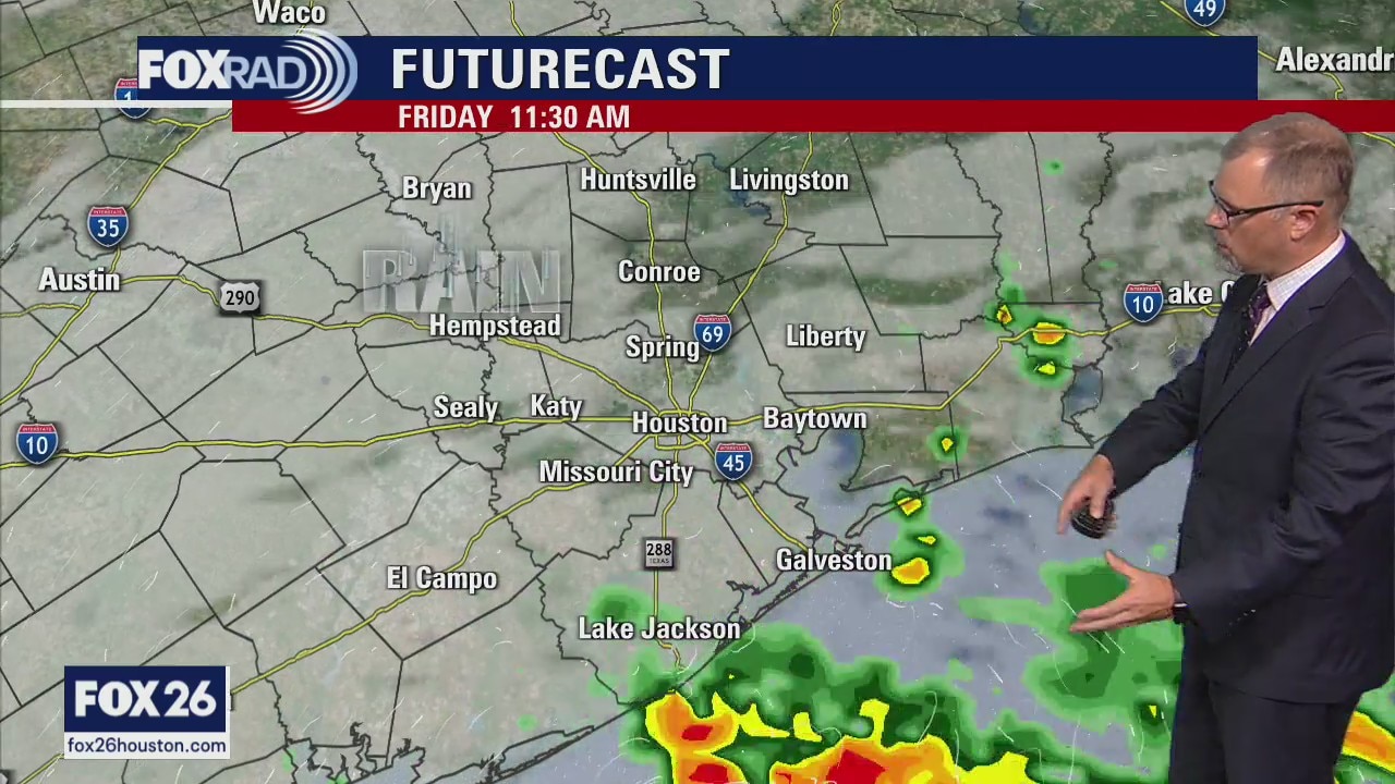
Friday morning weather forecast
Look for several rounds of beneficial rainfall heading into the weekend around Southeast Texas. Rain chances will fade over the weekend but hold steady around 30% for most of next week. Temperatures will be slightly cooler when the rain chances are higher this weekend. Look for a very typical August temperature pattern starting on Monday.
Look for several rounds of beneficial rainfall heading into the weekend around Southeast Texas. Rain chances will fade over the weekend but hold steady around 30% for most of next week. Temperatures will be slightly cooler when the rain chances are higher this weekend. Look for a very typical August temperature pattern starting on Monday.
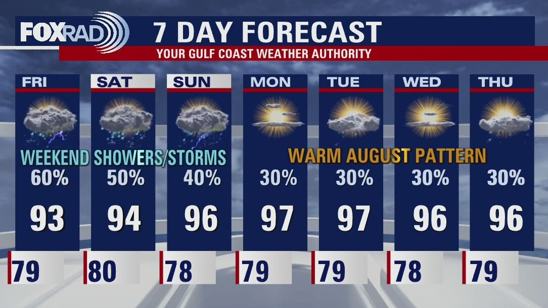
Thursday evening weather forecast
Look for several rounds of beneficial rainfall heading into the weekend around Southeast Texas. Rain chances will fade over the weekend but hold steady at around 30% for most of next week. Temperatures will be slightly cooler when the rain chances are higher this weekend. Look for a very typical August temperature pattern starting on Monday.
Look for several rounds of beneficial rainfall heading into the weekend around Southeast Texas. Rain chances will fade over the weekend but hold steady at around 30% for most of next week. Temperatures will be slightly cooler when the rain chances are higher this weekend. Look for a very typical August temperature pattern starting on Monday.
Thursday Midday Forecast with Meteorologist Lena Maria Arango
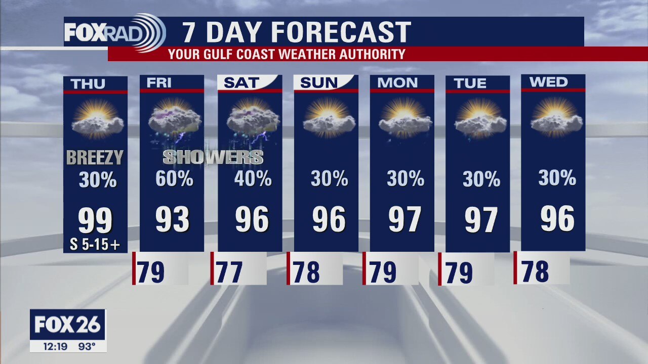
The latest drought monitor shows worsening conditions locally, with extreme drought now across much of Harris and Montgomery counties, including The Woodlands. Some relief is on the way, with multiple rounds of potentially beneficial rainfall beginning on Friday. Rain chances will decrease over the weekend, but hold steady around 30% for much of next week. So if you don't cash in on Friday's batch, isolated daily showers or storms should bring you something at some point in addition to cooler temperatures for most of us.
The latest drought monitor shows worsening conditions locally, with extreme drought now across much of Harris and Montgomery counties, including The Woodlands. Some relief is on the way, with multiple rounds of potentially beneficial rainfall beginning on Friday. Rain chances will decrease over the weekend, but hold steady around 30% for much of next week. So if you don't cash in on Friday's batch, isolated daily showers or storms should bring you something at some point in addition to cooler temperatures for most of us.
Chance for showers next 7 days
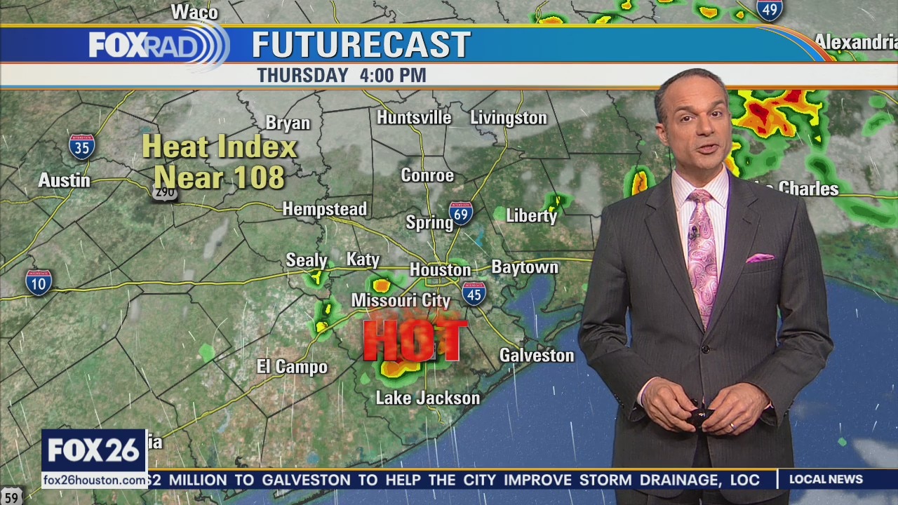
Relief from the heat and some partial drought relief is on the way. Now, we're not expecting cool air or prolonged heavy rain, but at the very least, each of the next 7 days includes a chance for scattered showers and storms with the highest likelihood Friday at 60%. Late afternoon and early evening hit and miss storms are possible today, but will otherwise be very hot again.
Relief from the heat and some partial drought relief is on the way. Now, we're not expecting cool air or prolonged heavy rain, but at the very least, each of the next 7 days includes a chance for scattered showers and storms with the highest likelihood Friday at 60%. Late afternoon and early evening hit and miss storms are possible today, but will otherwise be very hot again.
Thursday morning weather forecast
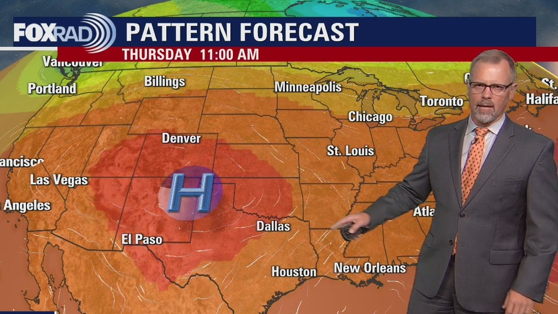
Expect another hot day on Thursday in Southeast Texas. More clouds and rain showers will give Houston some slightly cooler temperatures headed into the weekend. The widespread showers will be welcomed across the area on Friday and Saturday. The typical August pattern returns headed into next week, there will be isolated showers/storms each day with afternoon temperatures in the upper 90s.
Expect another hot day on Thursday in Southeast Texas. More clouds and rain showers will give Houston some slightly cooler temperatures headed into the weekend. The widespread showers will be welcomed across the area on Friday and Saturday. The typical August pattern returns headed into next week, there will be isolated showers/storms each day with afternoon temperatures in the upper 90s.
Wednesday evening weather forecast with Meteorologist John Dawson
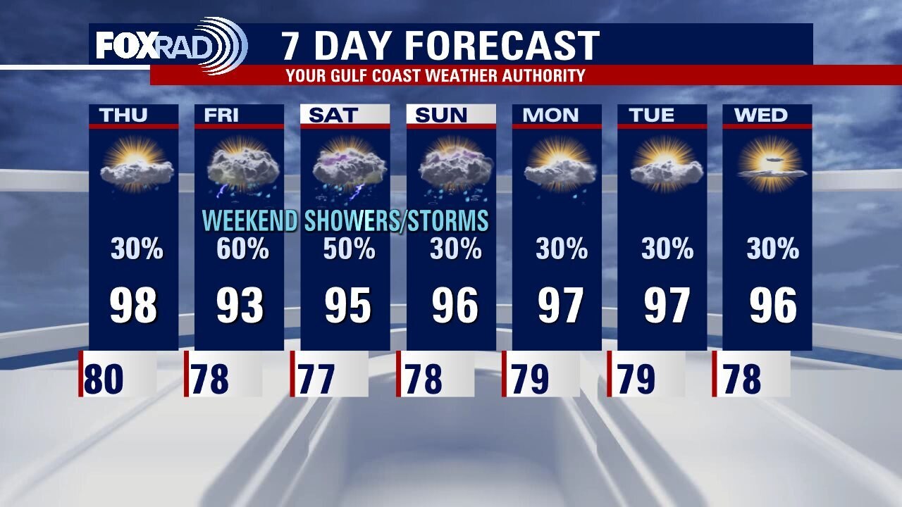
Expect another hot day on Thursday in Southeast Texas. More clouds and rain showers will give Houston some slightly cooler temperatures headed into the weekend. The widespread showers will be welcomed across the area on Friday and Saturday. The typical August pattern returns headed into next week, there will be isolated showers/storms each day with afternoon temperatures in the upper 90s
Expect another hot day on Thursday in Southeast Texas. More clouds and rain showers will give Houston some slightly cooler temperatures headed into the weekend. The widespread showers will be welcomed across the area on Friday and Saturday. The typical August pattern returns headed into next week, there will be isolated showers/storms each day with afternoon temperatures in the upper 90s

Wednesday afternoon weather forecast with Chief Meteorologist Mike Iscovitz
Houston had its 18th 100? day of the year yesterday and today will likely make number 19. Ample sunshine along with hot south breezes should allow for highs of 98-103 and a heat advisory is in effect from Huntsville and Brenham northward. Thursday looks very hot as well, but with the arrival of isolated storms, then we have a great chance for clouds, rain and below normal temps on Friday and Saturday!
Houston had its 18th 100? day of the year yesterday and today will likely make number 19. Ample sunshine along with hot south breezes should allow for highs of 98-103 and a heat advisory is in effect from Huntsville and Brenham northward. Thursday looks very hot as well, but with the arrival of isolated storms, then we have a great chance for clouds, rain and below normal temps on Friday and Saturday!
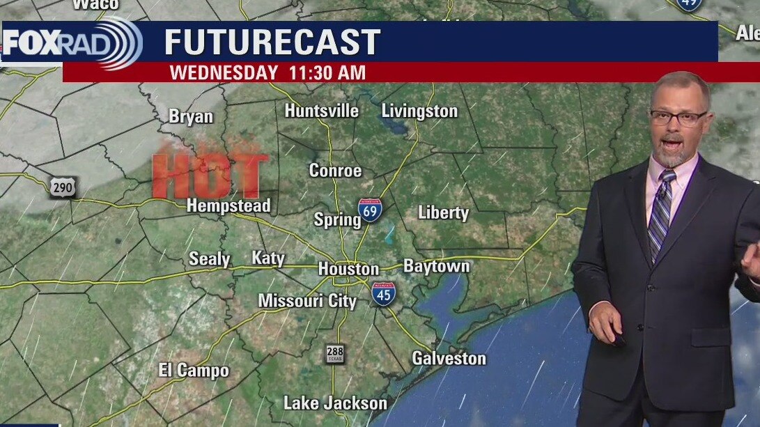
Wednesday morning weather forecast
The heat will be the main story in weather across Houston for the next couple days. Please remember your heat safety if working or playing outside. The overall pattern favors more cloud cover and higher rain chances starting on Friday.
The heat will be the main story in weather across Houston for the next couple days. Please remember your heat safety if working or playing outside. The overall pattern favors more cloud cover and higher rain chances starting on Friday.
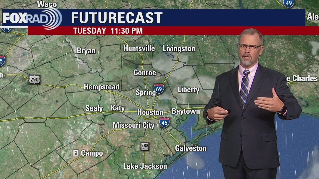
Tuesday evening weather forecast
The heat will be the main story in weather across Houston for the next couple days. Please remember your heat safety if working or playing outside. The overall pattern favors more cloud cover and higher rain chances starting on Friday.
The heat will be the main story in weather across Houston for the next couple days. Please remember your heat safety if working or playing outside. The overall pattern favors more cloud cover and higher rain chances starting on Friday.