

Houston weather: High temps Monday, followed by daily rain chances

Houston weather: Daily rain chances following steamy weekend
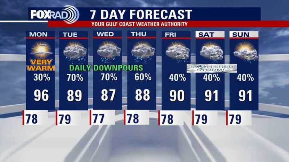
Monday will consist of high temperatures raging around 95-100 inland, but a few storms are possible north of Greater Houston.
HOUSTON - Houston is set for a near-record hot and hazy Sunday, while a significant and dangerous severe weather outbreak with the potential for grapefruit-sized hail is forecast for North Texas later in the day.
Steamy Monday with a few storms
Monday will once again feature afternoon high temperatures ranging from around 95-100 inland and near 90 along the coast. This heat comes along with heat index (feels like) values as high as 106.
Skies will likely remain a little hazy, with some Saharan dust still left in the air. However, it looks like there will be a lot less Saharan dust around for the remainder of the week.
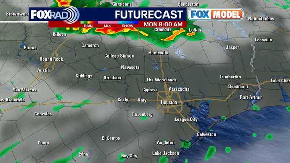
A few storms are possible Monday morning, especially up towards Huntsville and Livingston, with a few additional storms possibly popping up by the evening.
Heat dome breaks next week
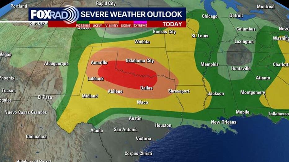
A large area of high pressure has been bringing us heat and steering severe storms to North/West Texas. There is a very high risk of damaging winds, large hail and tornadoes in west/ north Texas tonight.
A complete pattern change with clouds, more thunder, downpours and cooler highs in the 80s move in this week. Expect daily rain & storm chances with the highest Tuesday through Thursday.
Tropics remain quiet for us

Tropical Weather Update - June 8, 2025
So far, so good in the Gulf and Caribbean over the next week or so. The eastern Pacific Ocean (south and west coast of Mexico) looks very active over the next week or two. Tropical Storm Barbara & Tropical Storm Cosme formed Sunday along with 1 additional area being monitored for possible tropical development.
On this eighth day of the 2025 hurricane season, the Atlantic basin remains very quiet.
We are still expecting an above-average hurricane season so don't let your guard down.
The Eastern Pacific is already getting very busy with two new tropical storms named Barbara & Cosme that have formed. Both should stay off of the Western/Southwestern Mexican coast. But Barbara could dump 2 to 4 inches of rain and bring high surf to parts of SW Mexico.
7-Day Forecast
The Source: Your Gulf Coast Weather Authority