

Houston weather: Another stormy day possible on Wednesday
HOUSTON - Another stormy day could be on the way for Wednesday, which will result in another hot and humid day.
Houston weather: Scattered storms possible for Wednesday
HOT, HUMID, SHOWERY
Typical June heat and humidity will remain in place all week with daily highs ranging from 90-95 degrees. Meanwhile, a plume of moisture is being steered in our direction underneath a major "heat dome" over the East Coast of the country. This plume should provide conditions for scattered showers and storms the rest of today and tomorrow. A few could be briefly heavy, nothing looks severe at this time.
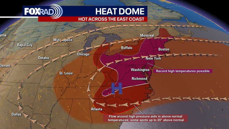
RECORD-BREAKING HEAT ACROSS THE COUNTRY
A heat dome to our north (that is steering rain in our direction) continues to bring extreme heat for cities like Washington, DC, Philly, New York, Pittsburgh, Detroit and Chicago. Record highs are possible, and heat index values will be dangerous. A friendly reminder to drink plenty of water, use sunscreen and take breaks inside the a/c.
TROPICAL STORM ANDREA FORMS
A small area of low pressure in the middle of the Atlantic Ocean has formed into Tropical Storm Andrea. Andrea is tracking NE and the system will have no effects on the US. Andrea will be a short-lived tropical storm due to moving into cooler waters and stronger wind shear.
The Source: Information above from Your Gulf Coast Weather Authority Team.