

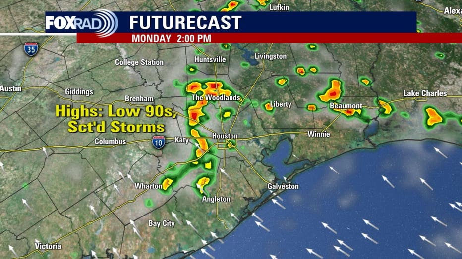
Houston weather: Steamy, humid Monday with scattered showers

Houston weather: Humid Monday in the 90s
A moisture plume is moving across Florida, and will just start to arrive to the Texas coast today. It will add to the scattered storms expected in the afternoon. Temperature highs will reach low to mid-90s.
HOUSTON - Monday morning starts off partly cloudy, but will soon turn hot and humid with scattered storms mainly in the afternoon.
Hot, humid, showery
Typical June heat and humidity will remain in place all week with daily highs ranging from 90 to 95 degrees.
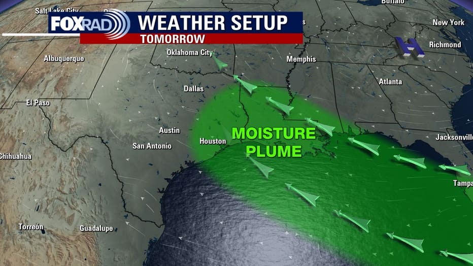
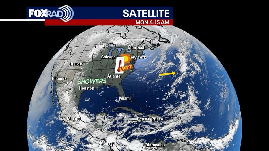
Meanwhile, a plume of moisture if being steering in our direction underneath a major "heat dome" over the East Coast of the country. This plume should provide conditions for scattered showers and storms today, tomorrow and Wednesday. A few could be briefly heavy.
Record-breaking heat across the country
A heat dome to our north (that is steering rain in our direction) is going to bring extreme heat for cities like Washington, D.C., Philly, New York, Pittsburgh, Detroit and Chicago. Record highs are possible and heat index values will be dangerous.
In fact, the National Weather Service in Washington is warning that the heat index could hit 110 there today.
Area of interest in the Atlantic is no threat
A small area of low pressure in the middle of the Atlantic Ocean could spin-up into the tropical depression or storm (or possibly a sub-tropical storm) over the next 48 hours or so. The first name on the list this year is Andrea, but just know that this system will have no effects on the US.
The Source: Your Gulf Coast Weather Authority