

Houston weather: Warm Monday afternoon, drought concerns despite recent rain
Houston weather: Cool Monday morning ahead of a warm afternoon
A sweater might be needed when you're heading out the door Monday morning for President's Day. We'll have warmer afternoon with temps increasing into the 70s and drought concerns continue.
HOUSTON - Heading out the door this morning for President's Day? Be sure to grab a sweater or jacket, but no worries, in the afternoon you'll barely need it for the warm highs near the 70s.
Great start to the week

Today will be very pleasant with temperatures rising into the low 70s along with some high cirrus clouds and a return of a Gulf breeze by the afternoon. Overall, today looks great, but overnight tonight, some fog is possible along with a few sprinkles.
Warming trend with morning drizzles

As high pressure shifts eastward, return flow from the Gulf will usher in a warming trend starting Tuesday. High temperatures will climb into the upper 70s tomorrow before rising into the low 80s on Wednesday and Thursday. These values will be well above normal and could get within a few degrees of record highs. The return of a southeast breeze could bring low clouds each morning with a few drizzles.
Dry pattern in place

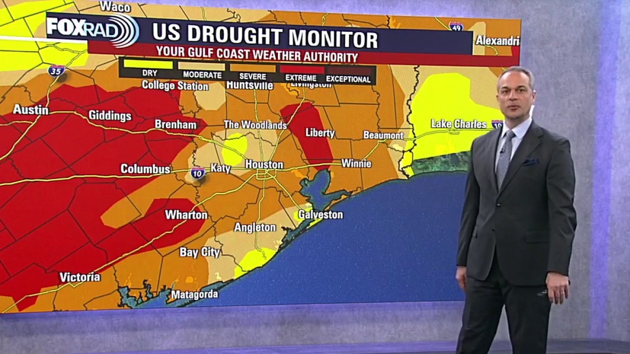
Despite the 1 to 1.5" of rain from Saturday's severe storms, we are still locked into a concerning drought. There will be a gradual increase in humidity, but meaningful rain relief remains elusive for Southeast Texas. Overall rain chances for the next seven days are low, with only few light showers each morning and a slightly higher rain chance by Saturday. This dry pattern continues to exacerbate the widespread drought conditions across the region, from out area westward to Austin and San Antonio.
The Source: Your Gulf Coast Weather Authority