

Houston weather: Severe storms expected for Valentine's Day, FOX 26 Storm Alert
Heavy rain, damaging winds in the forecast for Valentine's Day
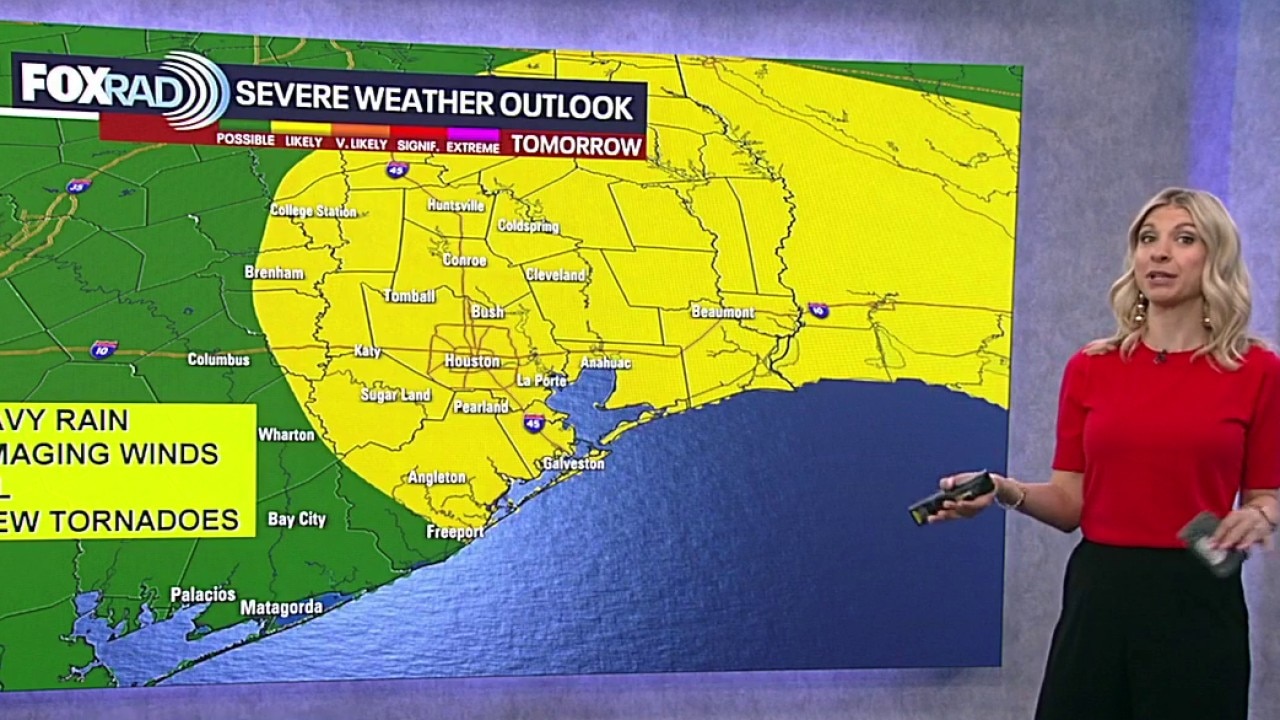
Southeast Texas is now under a 2/5 Likely risk for severe storms Saturday evening. Look out for damaging wind gusts, as well as the threat for hail and possible tornadoes.
HOUSTON - Friday we'll have warm weather and partly cloudy skies, but what Houstonians should pay attention to is the incoming storms for Valentine's Day.
FOX 26 Storm Alert Saturday evening
Southeast Texas has been upgraded to a 2/5 Likely risk for severe storms Saturday evening. The main weather threat will be damaging wind gusts, but we can't rule out the threat for hail and a tornado or two. Make sure you have a way to receive severe weather alerts.

We will bring you the latest weather updates on FOX Local.
It feels more like April than February. Spring-like temperatures will help set the stage for strong to severe storms and heavy rain Saturday as a strong system rolls in.

Main window for the strongest storms appears to be 8 p.m. Saturday until 2 a.m. Sunday. Damaging wind gusts near 60-70 mph will be the main threat although an isolated, brief tornado and small hail can't be ruled out.
Impacts to Valentine's and Mardi Gras plans
There will be a high chance of showers much of Saturday morning and Saturday afternoon for Mardi Gras in Galveston and Valentine's plans. The threat of storms increases on Saturday night, especially between 8 p.m. and midnight for Houston and 10 p.m. and 2 a.m. for Galveston.

Mardi Gras parades, concerts and parties could be impacted. So plan on delays and make sure to have a way to get alerts in case you need to get inside quickly.
Crisp and clear afterward

Behind the front, cooler and much drier air settles in. Expect crisp mornings and clear, pleasant afternoons beginning Sunday and carrying into early next week — a refreshing return to more comfortable conditions.
The Source: Your Gulf Coast Weather Authority