

Houston weather: Another very warm day on the way for Thursday
RECORD HEAT ON WEDNESDAY
HOUSTON - It’s been another unseasonably hot September day, with temperatures climbing into the upper 90s. A few showers and thunderstorms are possible through early evening, but most areas stay dry. Yesterday's high of 99° was 1° away from the record high of 100, and we set a new record high today of 99 in Houston. Today’s previous record high was 97 in 2023.
A LITTLE RELIEF ON THE WAY
A weak boundary arrives late this week and should knock down humidity somewhat Friday. Don’t expect a real fall cooldown, but temperatures could drop to the upper 60s in spots early Friday and Saturday.
STORMS NEXT WEEK
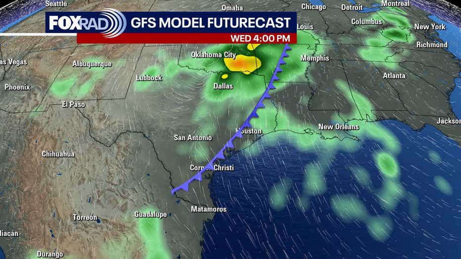
The weekend still looks warm, but the bigger change comes early next week as rain chances return and temperatures trend lower. A decent cold front could move through by Tuesday/Wednesday. The chance for scattered storms will increase during this timeframe with cooler temperatures building in behind the front.
WATCHING THE TROPICS
There are a few areas to watch in the Atlantic basin. Fay had fallen apart in the middle of the Atlantic on Tuesday. But has regained tropical characteristics and is a tropical depression again. It is no threat to land as it drifts to the west. Another area near the west coast of Africa has a medium 50% chance to turn into a tropical depression or tropical storm over the next week. The next name on the list is Gonzalo. Neither of these systems should be a threat to Texas.
The Source: Information for this story provided by Your Gulf Coast Weather Authority Team