

Houston weather: Increasing storm chances for the weekend
Houston weather: March 5 evening forecast
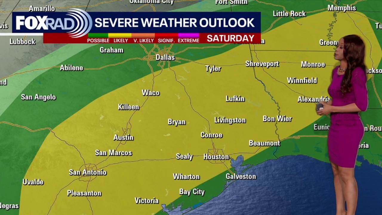
Rain and storm chances ramp up late Saturday into Sunday as a front stalls nearby. Those heading to the Houston Rodeo should prepare for wet conditions and potential severe storm development.
HOUSTON - Rain and storm chances ramp up Saturday afternoon into Sunday as a front stalls nearby.
Feeling more like late April or May
Southerly flow from the Gulf keeps Southeast Texas unseasonably warm and sticky through the end of the work week.
Expect breezy southeast winds gusting to 25 mph and afternoon highs climbing into the lower to middle 80s under mostly cloudy skies.
Isolated storms are possible on Friday evening.

Weekend storms and rodeo impacts
Rain and storm chances ramp up Saturday afternoon into Sunday as a front stalls nearby.
Those heading to the Houston Rodeo should prepare for wet conditions and potential severe storm development, including the risk of heavy rain and gusty winds, as the most active weather arrives late Saturday and lingers into Sunday.
This weekend's severe storm threat has increased to a level 2 out of 5 for Houston and the flash flood threat has increased to a level 2 out of 4 for Saturday.
Please stay alert and have a plan to get indoors quickly if you are heading out to the rodeo or other outdoor plans.
Slight cold down next week
The unsettled pattern lingers into early next week before a stronger cold front finally pushes through by Wednesday. This boundary will scour out the humidity and usher in a brief chill, returning temperatures to more seasonable levels for the middle of March.

The Source: Your Gulf Coast Weather Authority