


Tropical Weather Update: Medium Alert 40% Chance of Tropical Development Near Lesser Antilles
Some Saharan dust is still hindering major tropical weather development across the Atlantic basin. One area of showers and storms is still being monitored for possible development in the central Atlantic. It now has a MEDIUM 40% chance for development by early next week as it moves close to the Lesser Antilles. The disturbance in the Gulf bringing rounds of rain to Houston is not expected to turn into a tropical system.
Some Saharan dust is still hindering major tropical weather development across the Atlantic basin. One area of showers and storms is still being monitored for possible development in the central Atlantic. It now has a MEDIUM 40% chance for development by early next week as it moves close to the Lesser Antilles. The disturbance in the Gulf bringing rounds of rain to Houston is not expected to turn into a tropical system.


Tropical disturbance being watched in Southeast Texas: National Hurricane Center
The National Hurricane Center is monitoring a disturbance off the coast of Southeast Texas with a very low chance for further development.
The National Hurricane Center is monitoring a disturbance off the coast of Southeast Texas with a very low chance for further development.
Birds of the World Exhibit, Labor Day weather
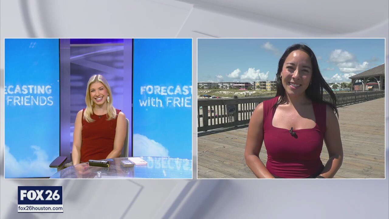
In this episode of Forecasting with Friends, Allison takes a look at Labor Day travel expectations in Houston and across the country. Plus, the Birds of the World exhibit has opened here in Houston!
In this episode of Forecasting with Friends, Allison takes a look at Labor Day travel expectations in Houston and across the country. Plus, the Birds of the World exhibit has opened here in Houston!

FOX 26 Houston Weather Forecast
Heading into the long Labor Day weekend, our rainy and stormy pattern will continue. It does not look like any of the days will be complete washouts, but there will be a daily round or two of scattered heavy storms. There is a chance for isolated areas of street flooding, especially near the coast and east of Houston. The unsettled weather pattern is expected to last until at least the middle of next week. It's the first big Friday of the high school football season and you should be on the lookout for hit and miss showers and storms with pleasant temperatures. In the tropics, activity is picking up a bit with a tropical wave getting a little stronger heading toward the Caribbean and has about a 50% chance of becoming a tropical depression or storms and looks like a concern for the Yucatan in a week or so.
Heading into the long Labor Day weekend, our rainy and stormy pattern will continue. It does not look like any of the days will be complete washouts, but there will be a daily round or two of scattered heavy storms. There is a chance for isolated areas of street flooding, especially near the coast and east of Houston. The unsettled weather pattern is expected to last until at least the middle of next week. It's the first big Friday of the high school football season and you should be on the lookout for hit and miss showers and storms with pleasant temperatures. In the tropics, activity is picking up a bit with a tropical wave getting a little stronger heading toward the Caribbean and has about a 50% chance of becoming a tropical depression or storms and looks like a concern for the Yucatan in a week or so.

Another wet day ahead on Friday | FOX 26 Houston Weather Forecast
Threat for street flooding will remain elevated over the next few days as more rounds of heavy rain roll through. Houston remains in a 1 of 4 risk of street flooding through the holiday weekend with a higher 2 of 4 risk around Galveston & Texas City. Rain may cause some delays for your holiday weekend plans. But temperatures at least remain more comfortable and below average for the next several days. One disturbance in the central Atlantic now has a higher Medium 40% chance to develop into a tropical system over the next week. So we could have a tropical depression or Tropical Storm Francine by Monday or Tuesday.
Threat for street flooding will remain elevated over the next few days as more rounds of heavy rain roll through. Houston remains in a 1 of 4 risk of street flooding through the holiday weekend with a higher 2 of 4 risk around Galveston & Texas City. Rain may cause some delays for your holiday weekend plans. But temperatures at least remain more comfortable and below average for the next several days. One disturbance in the central Atlantic now has a higher Medium 40% chance to develop into a tropical system over the next week. So we could have a tropical depression or Tropical Storm Francine by Monday or Tuesday.

FOX 26 Houston Weather Forecast
Threat for street flooding will remain elevated over the next few days as more rounds of heavy rain roll through. Houston remains in a 1 of 4 risk of street flooding through the holiday weekend with a higher 2 of 4 risk around Galveston & Texas City. Rain may cause some delays for your holiday weekend plans. But temperatures at least remain more comfortable and below average for the next several days. One disturbance in the central Atlantic now has a higher Medium 40% chance to develop into a tropical system over the next week. So we could have a typical depression or Tropical Storm Francine by Monday or Tuesday.
Threat for street flooding will remain elevated over the next few days as more rounds of heavy rain roll through. Houston remains in a 1 of 4 risk of street flooding through the holiday weekend with a higher 2 of 4 risk around Galveston & Texas City. Rain may cause some delays for your holiday weekend plans. But temperatures at least remain more comfortable and below average for the next several days. One disturbance in the central Atlantic now has a higher Medium 40% chance to develop into a tropical system over the next week. So we could have a typical depression or Tropical Storm Francine by Monday or Tuesday.

Watching development in the Atlantic | FOX 26 Tropical Weather Update
Some Saharan dust is still hindering major tropical weather development across the Atlantic basin. One area of showers and storms is still being monitored for possible development in the central Atlantic. It now has a MEDIUM 40% chance for development by early next week as it moves close to the Lesser Antilles. The disturbance in the Gulf bringing rounds of rain to Houston is not expected to turn into a tropical system
Some Saharan dust is still hindering major tropical weather development across the Atlantic basin. One area of showers and storms is still being monitored for possible development in the central Atlantic. It now has a MEDIUM 40% chance for development by early next week as it moves close to the Lesser Antilles. The disturbance in the Gulf bringing rounds of rain to Houston is not expected to turn into a tropical system
Preventing boat thefts for Labor Day weekend
In this episode of Forecasting with Friends, they're talking about how to prevent boat thefts and monitoring possible developments in the tropics
In this episode of Forecasting with Friends, they're talking about how to prevent boat thefts and monitoring possible developments in the tropics

STORM ALERT DAY | Fox 26 Houston Weather Forecast
Today is a Fox 26 Storm Alert Day. As a precaution, we want everyone to be aware of the potential for heavy rain, especially for coastal counties today with more than 2-3" possible for Galveston, Brazoria and parts of Harris and Fort Bend Counties. Nothing is guaranteed, but chances are high enough that we need to stay weather aware today. NOAA has our area classified with a level 1-2 threat for "excessive rain" today, so isolated street flooding. In the extended forecast, we should stay humid and unsettled each day through the Labor Day weekend and possibly even beyond into next week. The tropics remain unusually quiet for now, but should get busy in September.
Today is a Fox 26 Storm Alert Day. As a precaution, we want everyone to be aware of the potential for heavy rain, especially for coastal counties today with more than 2-3" possible for Galveston, Brazoria and parts of Harris and Fort Bend Counties. Nothing is guaranteed, but chances are high enough that we need to stay weather aware today. NOAA has our area classified with a level 1-2 threat for "excessive rain" today, so isolated street flooding. In the extended forecast, we should stay humid and unsettled each day through the Labor Day weekend and possibly even beyond into next week. The tropics remain unusually quiet for now, but should get busy in September.

FOX 26 Houston Weather Forecast | Rain is here to stay this week
Weather pattern is about to get super soggy with a 70-80% chance for rain through Labor Day. The threat for street flooding will also increase for Houston tomorrow with the highest chance along the coast near Galveston. 3-6" of rain is expected for Houston through early next week with 6-10" possible near the coast! Avoid any flooded roads and be prepared to alter outdoor holiday plans. At least temperatures will continue to remain below normal for the next seven days! There's one disturbance in the central Atlantic with a low 20% chance to become our next tropical system over the next 7 days. This could happen as it gets close to the Lesser Antilles.
Weather pattern is about to get super soggy with a 70-80% chance for rain through Labor Day. The threat for street flooding will also increase for Houston tomorrow with the highest chance along the coast near Galveston. 3-6" of rain is expected for Houston through early next week with 6-10" possible near the coast! Avoid any flooded roads and be prepared to alter outdoor holiday plans. At least temperatures will continue to remain below normal for the next seven days! There's one disturbance in the central Atlantic with a low 20% chance to become our next tropical system over the next 7 days. This could happen as it gets close to the Lesser Antilles.

FOX 26 Houston Weather Forecast
Weather pattern is about to get super soggy with a 70-80% chance for rain through Labor Day. The threat for street flooding will also increase for Houston tomorrow with the highest chance along the coast near Galveston. 3-6" of rain is expected for Houston through early next week with 6-10" possible near the coast! Avoid any flooded roads and be prepared to alter outdoor holiday plans. At least temperatures will continue to remain below normal for the next seven days! There's one disturbance in the central Atlantic with a low 20% chance to become our next tropical system over the next seven days. This could happen as it gets close to the Lesser Antilles.
Weather pattern is about to get super soggy with a 70-80% chance for rain through Labor Day. The threat for street flooding will also increase for Houston tomorrow with the highest chance along the coast near Galveston. 3-6" of rain is expected for Houston through early next week with 6-10" possible near the coast! Avoid any flooded roads and be prepared to alter outdoor holiday plans. At least temperatures will continue to remain below normal for the next seven days! There's one disturbance in the central Atlantic with a low 20% chance to become our next tropical system over the next seven days. This could happen as it gets close to the Lesser Antilles.

Tropical update: Area in Atlantic being watched
An area of showers and storms in the Central Atlantic is still being monitored for possible tropical development. Development, if any will be slow with a low 20% chance to turn into our next tropical depression, storm or hurricane over the next week. This could happen by the middle of next week near the Lesser Antilles. The next name up would be Francine. Very small and weak disturbance SE of Bermuda now is down to a 0% chance for tropical development.
An area of showers and storms in the Central Atlantic is still being monitored for possible tropical development. Development, if any will be slow with a low 20% chance to turn into our next tropical depression, storm or hurricane over the next week. This could happen by the middle of next week near the Lesser Antilles. The next name up would be Francine. Very small and weak disturbance SE of Bermuda now is down to a 0% chance for tropical development.
Hurricane preparedness and air safety
In this episode of Forecasting with Friends, John Dawson is taking a look at how to stay hurricane ready and hears from Air Alliance on how to prevent air pollution.
In this episode of Forecasting with Friends, John Dawson is taking a look at how to stay hurricane ready and hears from Air Alliance on how to prevent air pollution.


Shocking video captures moment falling tree narrowly misses bicyclist in Wisconsin
Dramatic video shows a bicyclist in Milwaukee narrowly avoiding being hit by a falling tree.
Dramatic video shows a bicyclist in Milwaukee narrowly avoiding being hit by a falling tree.

Labor Day weekend rain | Fox 26 Houston Weather Forecast
Get ready for more rain today and even more tomorrow through the Labor Day weekend. We are locked into a pattern with a deep layer of tropical moisture and a plume of humid air streaming in from the Gulf of Mexico. Expect a daily round of downpours with the heavier storms dropping 2" of rain or more and other areas seeing only short-lived showers. Overall rain accumulations through the end of the week could hit the 5-10" range, especially for coastal counties. The tropics remain surprisingly quiet with only weak tropical waves a disturbances that currently have about a 20% chance of developing further over the next 7 days. We still expect a substantial increase in September.
Get ready for more rain today and even more tomorrow through the Labor Day weekend. We are locked into a pattern with a deep layer of tropical moisture and a plume of humid air streaming in from the Gulf of Mexico. Expect a daily round of downpours with the heavier storms dropping 2" of rain or more and other areas seeing only short-lived showers. Overall rain accumulations through the end of the week could hit the 5-10" range, especially for coastal counties. The tropics remain surprisingly quiet with only weak tropical waves a disturbances that currently have about a 20% chance of developing further over the next 7 days. We still expect a substantial increase in September.

More rain possible in Houston | FOX 26 Houston Weather Forecast
Are you enjoying the cooler temperatures? We are not expecting any heat alerts through the rest of the week with a wet and stormy weather pattern trending over the area. An "upper low" over south Texas will bring more rounds of rain and thunder. In fact, we'll stay stuck in this unsettled weather pattern through the Labor Day holiday weekend. Best chance for widespread heavy rain appears to be Friday and Saturday. Disturbance in the central Atlantic has a low 20% chance to become our next tropical system over the next week. Francine is the next name on the list. Keep checking back for updates on your holiday weekend forecast where you live!
Are you enjoying the cooler temperatures? We are not expecting any heat alerts through the rest of the week with a wet and stormy weather pattern trending over the area. An "upper low" over south Texas will bring more rounds of rain and thunder. In fact, we'll stay stuck in this unsettled weather pattern through the Labor Day holiday weekend. Best chance for widespread heavy rain appears to be Friday and Saturday. Disturbance in the central Atlantic has a low 20% chance to become our next tropical system over the next week. Francine is the next name on the list. Keep checking back for updates on your holiday weekend forecast where you live!

FOX 26 Houston Weather Forecast
Are you enjoying the cooler temperatures? We are not expecting any heat alerts through the rest of the week with a wet and stormy weather pattern trending over the area. An "upper low" over south Texas will bring more rounds of rain and thunder. In fact, we'll stay stuck in this unsettled weather pattern through the Labor Day holiday weekend. Best chance for widespread heavy rain appears to be Friday and Saturday. Disturbance in the central Atlantic has a low 20% chance to become our next tropical system over the next week. Francine is the next name on the list. Keep checking back for updates on your holiday weekend forecast where you live!
Are you enjoying the cooler temperatures? We are not expecting any heat alerts through the rest of the week with a wet and stormy weather pattern trending over the area. An "upper low" over south Texas will bring more rounds of rain and thunder. In fact, we'll stay stuck in this unsettled weather pattern through the Labor Day holiday weekend. Best chance for widespread heavy rain appears to be Friday and Saturday. Disturbance in the central Atlantic has a low 20% chance to become our next tropical system over the next week. Francine is the next name on the list. Keep checking back for updates on your holiday weekend forecast where you live!

Watching new area of development in Atlantic | FOX 26 Tropical Weather Forecast
Atlantic basin remains fairly quiet as we get closer to what is typically the busiest part of hurricane season. There's one disturbance in the central Atlantic that has a low chance to turn into a tropical system over the next 7 days as it gets closer to some of the Caribbean Islands by the middle of next week. But Houston is not in danger of being impacted from any tropical system at least through the end of the week.
Atlantic basin remains fairly quiet as we get closer to what is typically the busiest part of hurricane season. There's one disturbance in the central Atlantic that has a low chance to turn into a tropical system over the next 7 days as it gets closer to some of the Caribbean Islands by the middle of next week. But Houston is not in danger of being impacted from any tropical system at least through the end of the week.

Houston's green push | Forecasting With Friends
Join us on Forecasting with Friends as we dive into Houston's efforts to go green?discover what's being done to cut carbon emissions and promote sustainability!
Join us on Forecasting with Friends as we dive into Houston's efforts to go green?discover what's being done to cut carbon emissions and promote sustainability!

More rainy days head | Fox 26 Houston Weather Forecast
Our plume of tropical moisture and upper-level area of low pressure continue to dominate our weather outlook today all the way through the Labor Day weekend. Look for scattered showers and storms each day with a few heavy downpours as well. Total rain accumulations could exceed 5" over the next 7 days. The good news is that temperatures will be held to below normal in most locations, in fact yesterday's high at Bush Airport was 89 degrees making it the "coolest" since late July. In the tropics, everything is still relatively quiet for this time of year, but a tropical wave has been given a 20% chance for development into a depression or storm over the next 7 days,
Our plume of tropical moisture and upper-level area of low pressure continue to dominate our weather outlook today all the way through the Labor Day weekend. Look for scattered showers and storms each day with a few heavy downpours as well. Total rain accumulations could exceed 5" over the next 7 days. The good news is that temperatures will be held to below normal in most locations, in fact yesterday's high at Bush Airport was 89 degrees making it the "coolest" since late July. In the tropics, everything is still relatively quiet for this time of year, but a tropical wave has been given a 20% chance for development into a depression or storm over the next 7 days,