


Tuesday weather forecast
We'll have one more pleasant day today with highs close to 70, but an area of low pressure and a front will likely bring us a round of showers and a few storms Wednesday afternoon. Chilly air will move in from Thursday through the weekend and a disturbance on Sunday could produce some wintry precipitation for parts of East Texas and northern Louisiana. We'll continue to watch the models for the Sunday system for any changes thought could increase our chances for light sleet.
We'll have one more pleasant day today with highs close to 70, but an area of low pressure and a front will likely bring us a round of showers and a few storms Wednesday afternoon. Chilly air will move in from Thursday through the weekend and a disturbance on Sunday could produce some wintry precipitation for parts of East Texas and northern Louisiana. We'll continue to watch the models for the Sunday system for any changes thought could increase our chances for light sleet.
Tuesday morning weather forecast
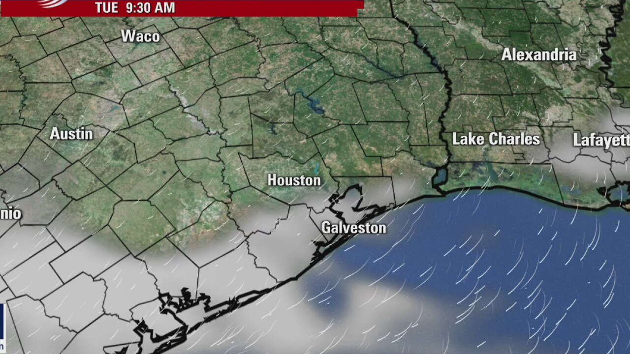
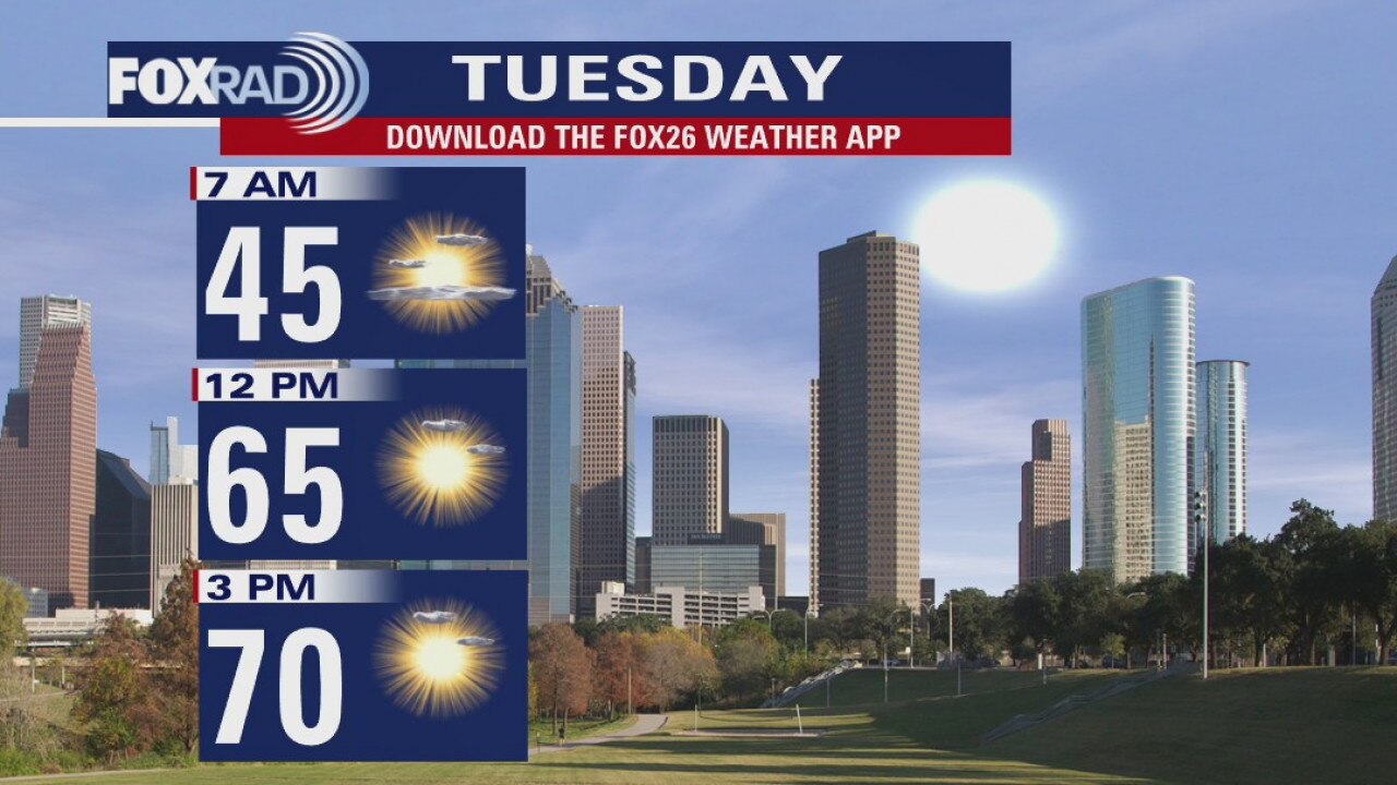
Tuesday will be another beautiful day with lots of sunshine and highs in the low 70s. Rain will become more likely in the afternoon on Wed as another front moves in. It will be cooler for the rest of the week with highs in the low 60s and even upper 50s.
Tuesday will be another beautiful day with lots of sunshine and highs in the low 70s. Rain will become more likely in the afternoon on Wed as another front moves in. It will be cooler for the rest of the week with highs in the low 60s and even upper 50s.
Monday Evening Weather Forecast
Tuesday will be another beautiful day with lots of sunshine and highs in the low 70s. Rain will become more likely in the afternoon on Wed as another front moves in. It will be cooler for the rest of the week with highs in the low 60s and even upper 50s.
Tuesday will be another beautiful day with lots of sunshine and highs in the low 70s. Rain will become more likely in the afternoon on Wed as another front moves in. It will be cooler for the rest of the week with highs in the low 60s and even upper 50s.
Monday weather forecast
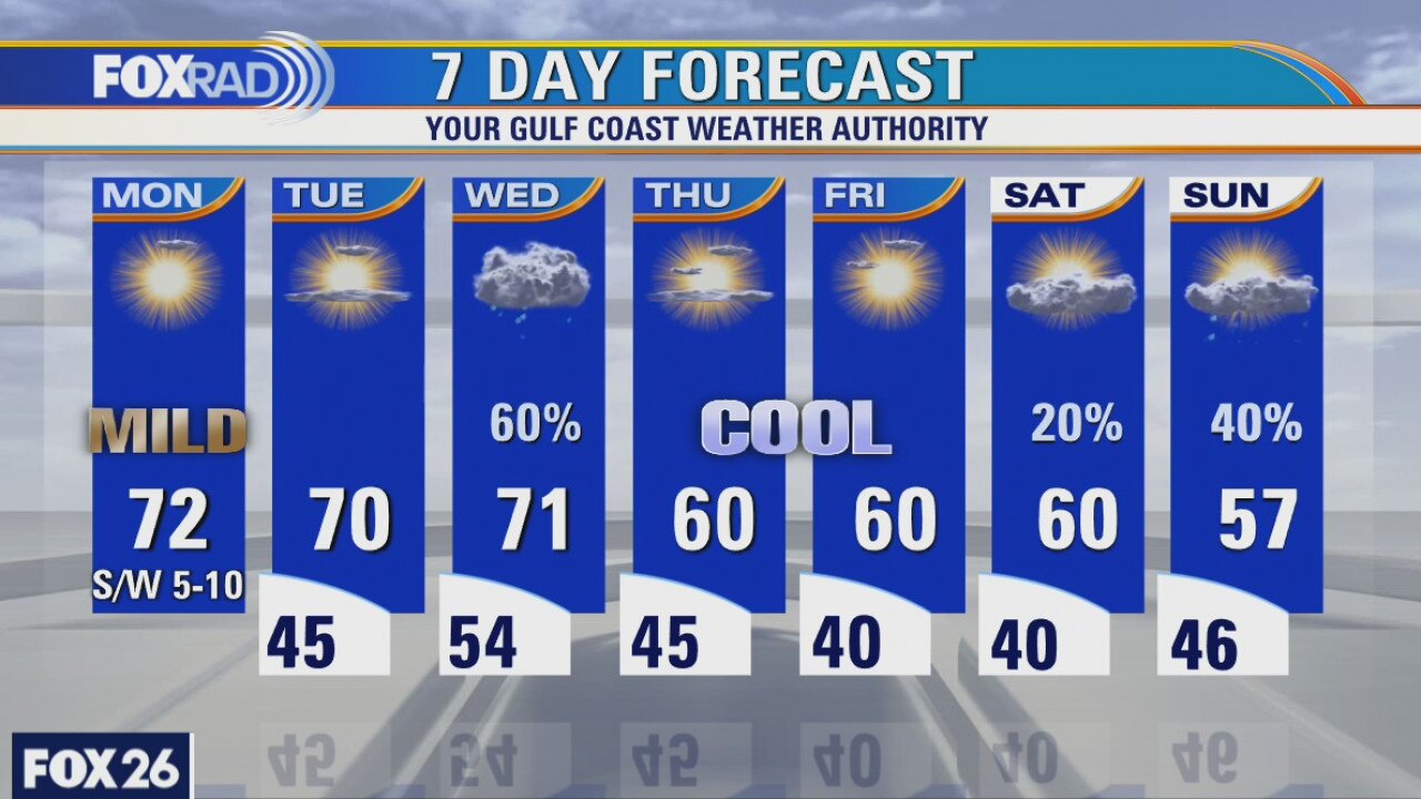
A cool front will pass through the area this afternoon, but with dry air in place, there won't be any rain. Look for mild highs in the low 70s. Tuesday is looking pleasantly cool with lows in the 40s and highs in the upper 60s. Wednesday will bring rainy weather followed by seasonably chilly air to wrap up the week.
A cool front will pass through the area this afternoon, but with dry air in place, there won't be any rain. Look for mild highs in the low 70s. Tuesday is looking pleasantly cool with lows in the 40s and highs in the upper 60s. Wednesday will bring rainy weather followed by seasonably chilly air to wrap up the week.
Sunday morning weather
The morning cold will warm up this afternoon and the week is looking good with milder temperatures
The morning cold will warm up this afternoon and the week is looking good with milder temperatures
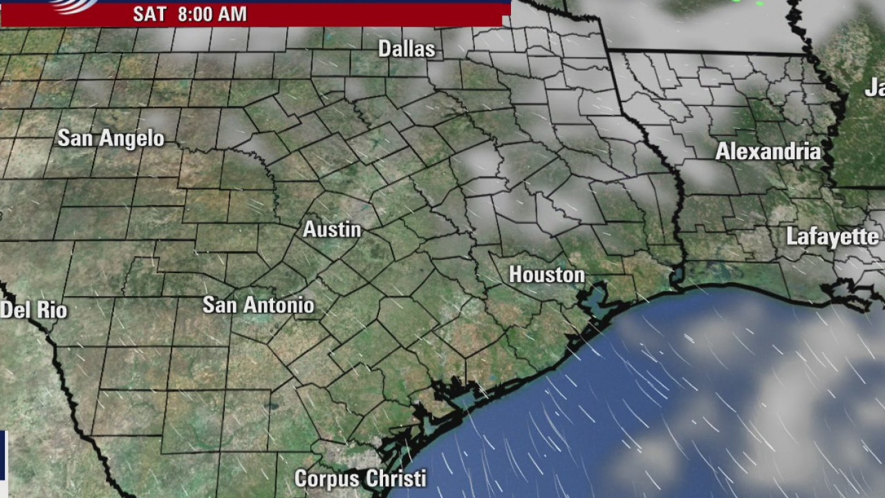
Saturday morning weather forecast
The mornings will be chilly and Saturday will be cool even though it will be sunny. Highs will reach back into the 60s on Sunday. The weather looks great until another front approaches SE Texas around Wednesday.
The mornings will be chilly and Saturday will be cool even though it will be sunny. Highs will reach back into the 60s on Sunday. The weather looks great until another front approaches SE Texas around Wednesday.
Friday evening weather forecast
The mornings will be chilly and Saturday will be cool even though it will be sunny. Highs will reach back into the 60s on Sunday. The weather looks great until another front approaches SE Texas around Wednesday
The mornings will be chilly and Saturday will be cool even though it will be sunny. Highs will reach back into the 60s on Sunday. The weather looks great until another front approaches SE Texas around Wednesday
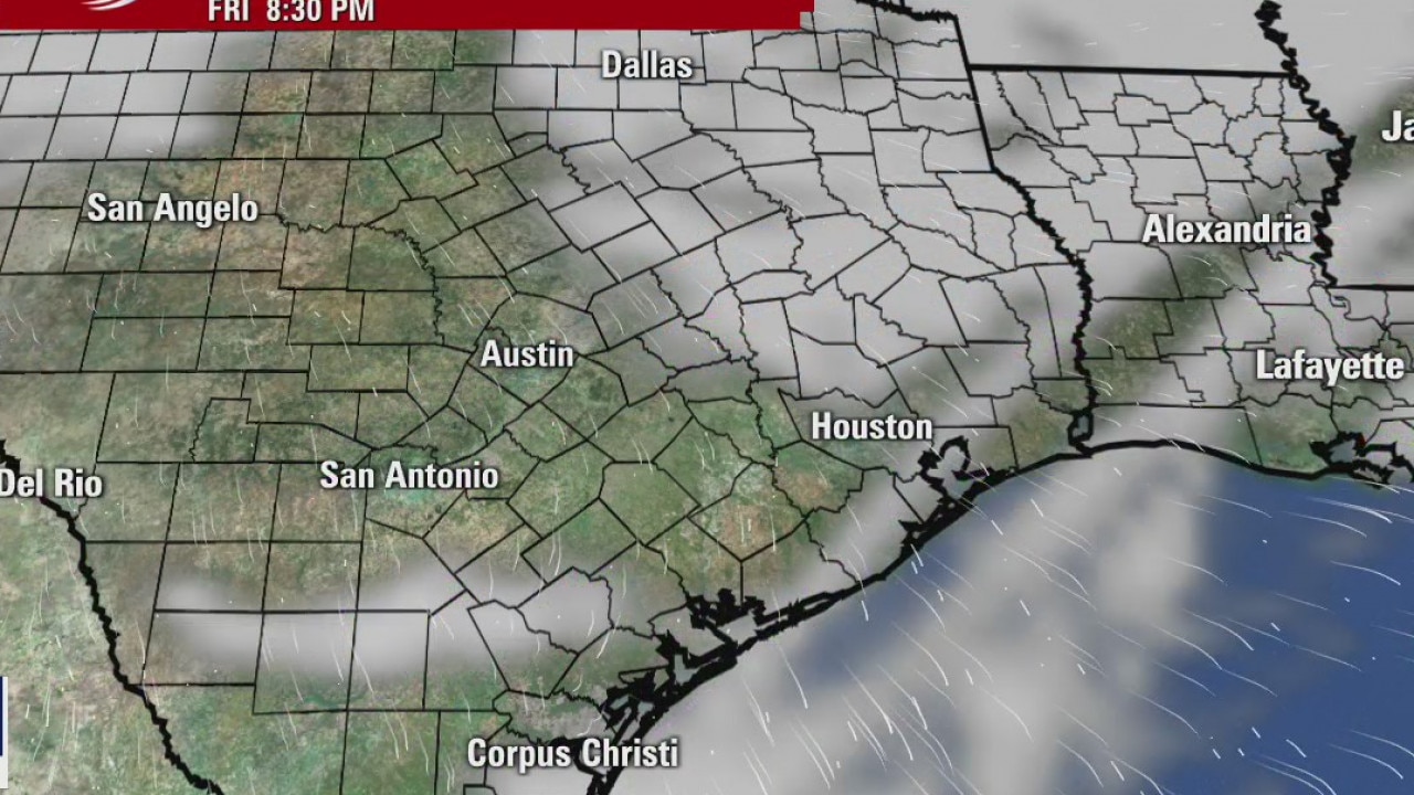
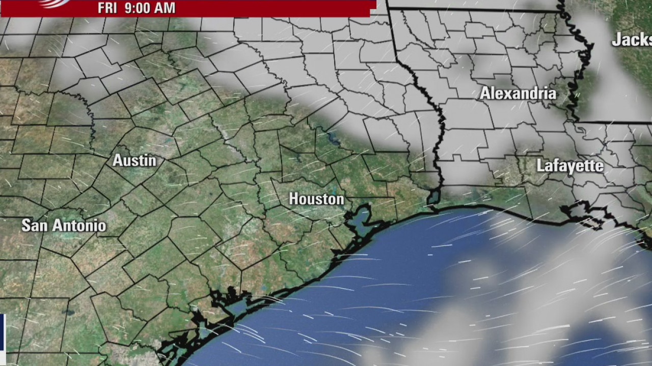
Friday weather forecast
Blustery this morning with wind chills in the 30s, then partly sunny with highs in the mid 50s.
Blustery this morning with wind chills in the 30s, then partly sunny with highs in the mid 50s.
Friday morning weather forecast
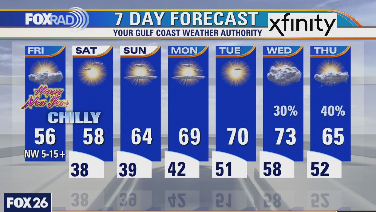
The bad storms are moving away and a more settled weather pattern is starting. It will be cool in the mornings with lows in the 30s, but it will slowly warm into the coming week. The first weekend of 2021 looks beautiful and is a nice start for the new year.
The bad storms are moving away and a more settled weather pattern is starting. It will be cool in the mornings with lows in the 30s, but it will slowly warm into the coming week. The first weekend of 2021 looks beautiful and is a nice start for the new year.
Thursday weather forecast
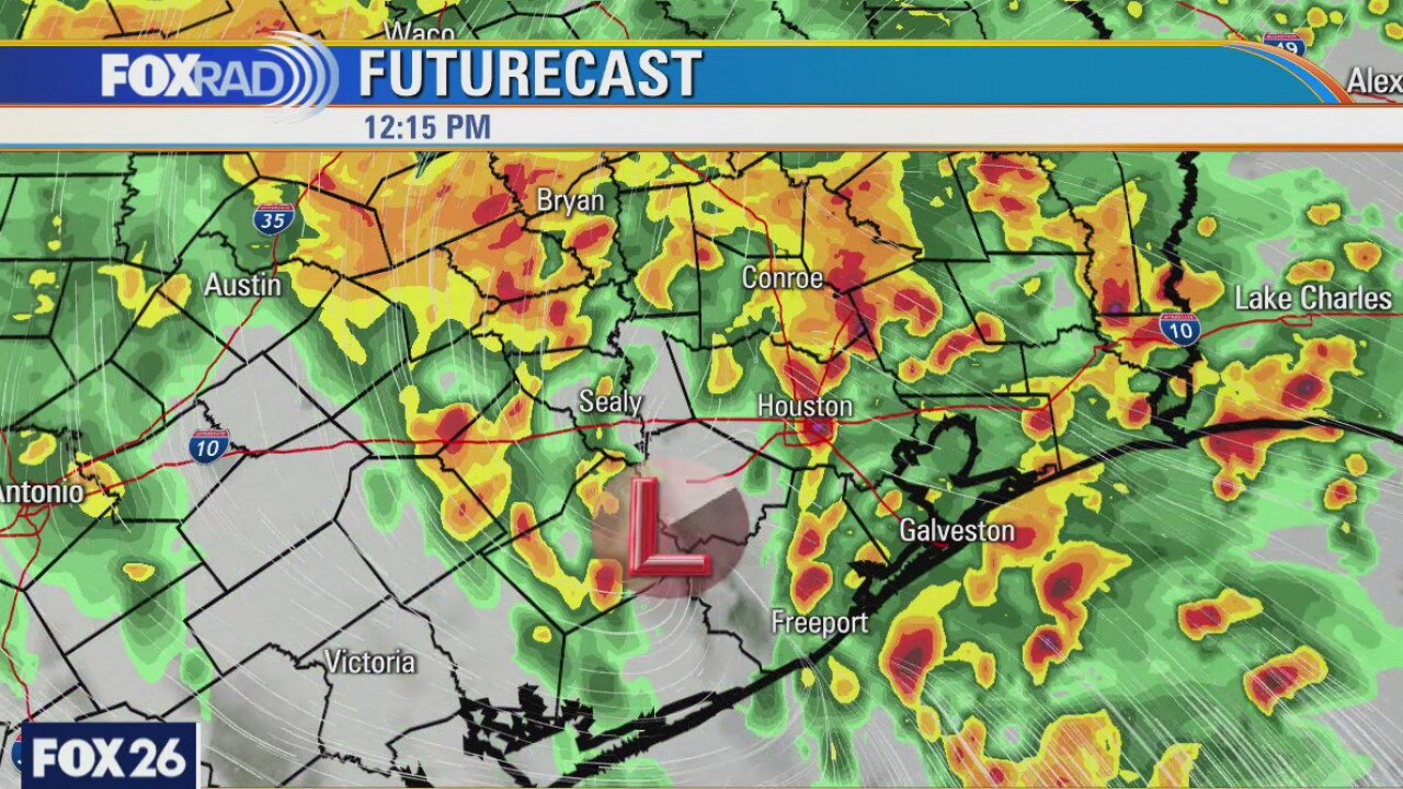
Rain and storms will continue to build and move through the area as we wait for a surface low pressure to 'kick' everything out of here by later this afternoon. The heaviest of rain has already fallen west of Houston, through portions of Wharton, Colorado, Austin, and Waller counties. We've also seen a couple of inches accumulate in northwestern Harris and Montgomery counties. An additional 1 to 3" of rain is likely as a Flash Flood Watch remains in effect for much of the area until 3PM. As the rain leaves, windier conditions will prevail and temperatures will be cooling off as we head into the new year. As 2020 comes to an end, it will be chilly with temperatures likely in the low to mid 40s at midnight.
Rain and storms will continue to build and move through the area as we wait for a surface low pressure to 'kick' everything out of here by later this afternoon. The heaviest of rain has already fallen west of Houston, through portions of Wharton, Colorado, Austin, and Waller counties. We've also seen a couple of inches accumulate in northwestern Harris and Montgomery counties. An additional 1 to 3" of rain is likely as a Flash Flood Watch remains in effect for much of the area until 3PM. As the rain leaves, windier conditions will prevail and temperatures will be cooling off as we head into the new year. As 2020 comes to an end, it will be chilly with temperatures likely in the low to mid 40s at midnight.
Thursday weather forecast
Rain and storms will continue to build and move through the area as we wait for a surface low pressure to 'kick' everything out of here by later this afternoon. The heaviest of rain has already fallen west of Houston, through portions of Wharton, Colorado, Austin, and Waller counties. We've also seen a couple of inches accumulate in northwestern Harris and Montgomery counties. An additional 1 to 3" of rain is likely as a Flash Flood Watch remains in effect for much of the area until 3PM. As the rain leaves, windier conditions will prevail and temperatures will be cooling off as we head into the new year. As 2020 comes to an end, it will be chilly with temperatures likely in the low to mid 40s at midnight.
Rain and storms will continue to build and move through the area as we wait for a surface low pressure to 'kick' everything out of here by later this afternoon. The heaviest of rain has already fallen west of Houston, through portions of Wharton, Colorado, Austin, and Waller counties. We've also seen a couple of inches accumulate in northwestern Harris and Montgomery counties. An additional 1 to 3" of rain is likely as a Flash Flood Watch remains in effect for much of the area until 3PM. As the rain leaves, windier conditions will prevail and temperatures will be cooling off as we head into the new year. As 2020 comes to an end, it will be chilly with temperatures likely in the low to mid 40s at midnight.
Storms rolling in across Houston area
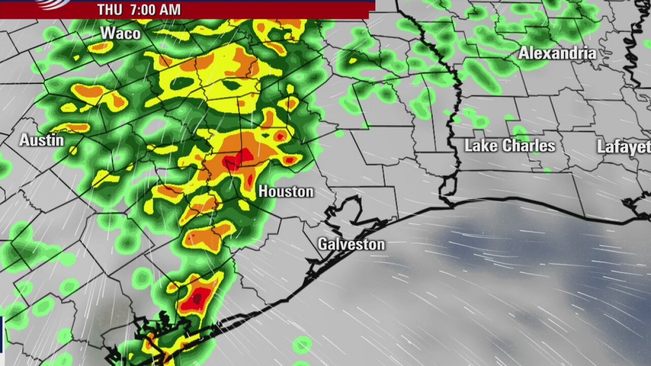
Additional rainfall is expected overnight and into Thursday. A Flash Flood Watch is in effect until Thursday afternoon.
Additional rainfall is expected overnight and into Thursday. A Flash Flood Watch is in effect until Thursday afternoon.
Severe weather in Houston area
Mother Nature is leaving behind some severe weather for the Houston area on Wednesday afternoon. A Flash Flood Watch is also in effect from 6 p.m. Wednesday night until 3 p.m. Thursday afternoon.
Mother Nature is leaving behind some severe weather for the Houston area on Wednesday afternoon. A Flash Flood Watch is also in effect from 6 p.m. Wednesday night until 3 p.m. Thursday afternoon.
Wednesday weather forecast
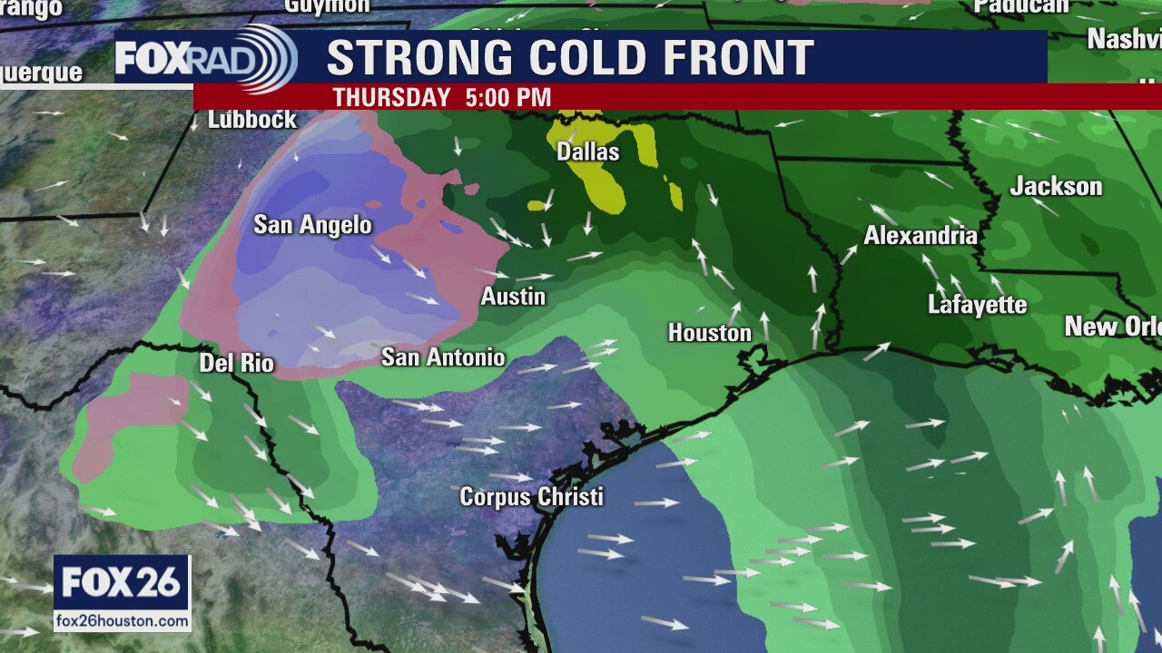
Get ready for a wild weather ride over the next 24 to 36 hours as a strong cold front will be moving through the area, bringing the threat for showers and storms...a few of which could be strong. The main threat will be heavy rain, but pinpointing exactly where the heaviest will fall is tough to determine. Right now, it appears the heaviest will fall north of I-10 and west of I-45. Prime time for rain will be later this evening, after sunset, and lasting until about noon on New Year's Eve. Once the rain exits, it will be chilly and windy as we ring in 2021. The good news is quiet weather will welcome us this weekend with a gradual warming trend as we head toward the first full week of the New Year.
Get ready for a wild weather ride over the next 24 to 36 hours as a strong cold front will be moving through the area, bringing the threat for showers and storms...a few of which could be strong. The main threat will be heavy rain, but pinpointing exactly where the heaviest will fall is tough to determine. Right now, it appears the heaviest will fall north of I-10 and west of I-45. Prime time for rain will be later this evening, after sunset, and lasting until about noon on New Year's Eve. Once the rain exits, it will be chilly and windy as we ring in 2021. The good news is quiet weather will welcome us this weekend with a gradual warming trend as we head toward the first full week of the New Year.
Wednesday morning weather forecast
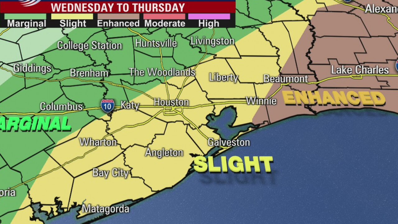
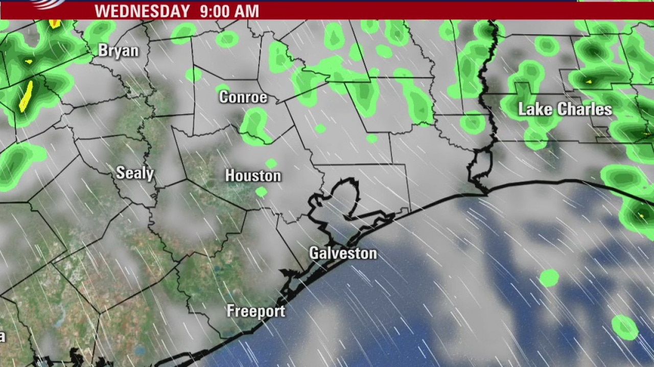
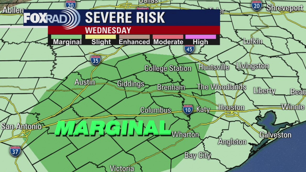
Rain becomes likely by Wed evening as a strong front arrives in SE Texas. An area of low pressure will then move across the area bringing more showers into early Thur. There is a marginal to slight risk for severe storms, but the risk looks higher east of the Houston area. No snow for us...sorry.
Rain becomes likely by Wed evening as a strong front arrives in SE Texas. An area of low pressure will then move across the area bringing more showers into early Thur. There is a marginal to slight risk for severe storms, but the risk looks higher east of the Houston area. No snow for us...sorry.
Tuesday Evening Weather Forecast
Here?s a look at the rainfall estimates for SE Texas over the next few days. The heaviest rain of 3 inches or more is expected in our NE counties, but most of us can expect 1-2 inches between now and Thursday afternoon.
Here?s a look at the rainfall estimates for SE Texas over the next few days. The heaviest rain of 3 inches or more is expected in our NE counties, but most of us can expect 1-2 inches between now and Thursday afternoon.
Tuesday weather forecast
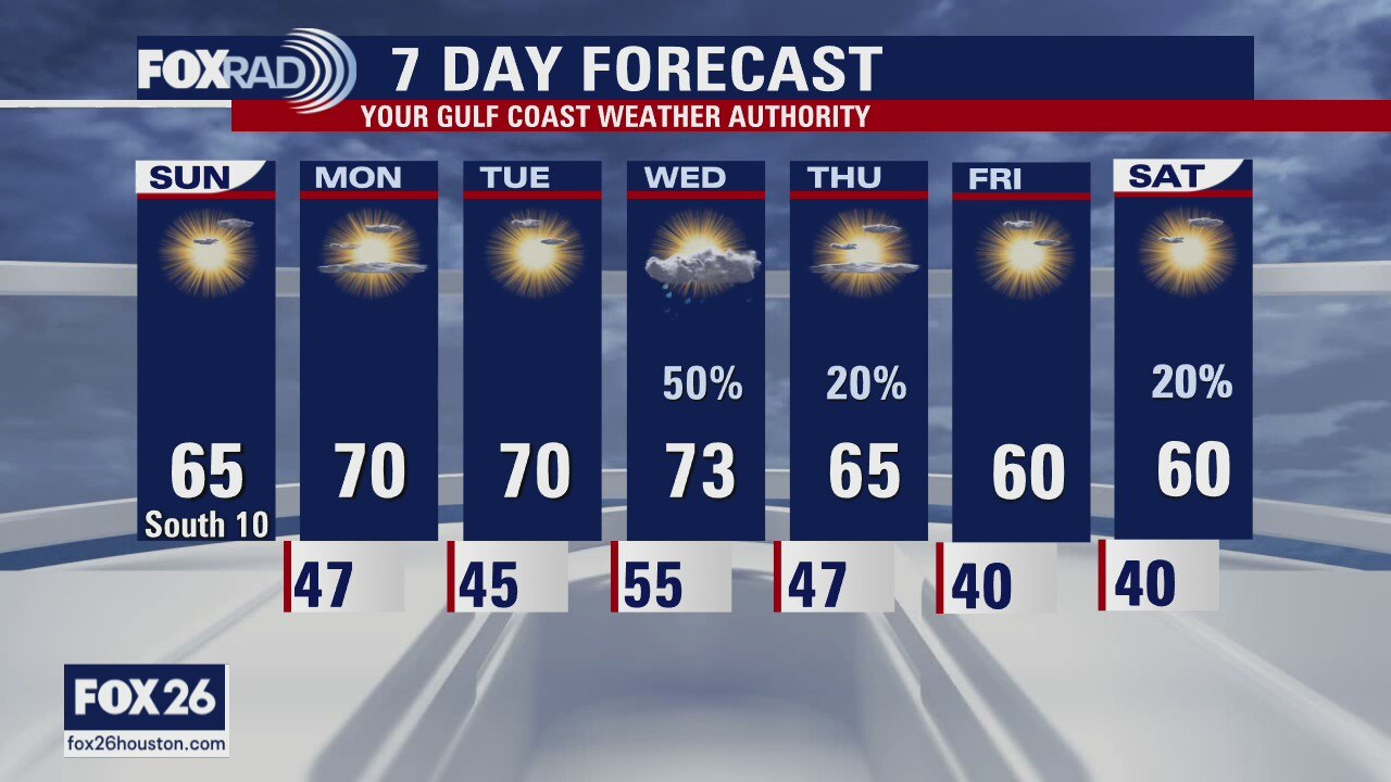
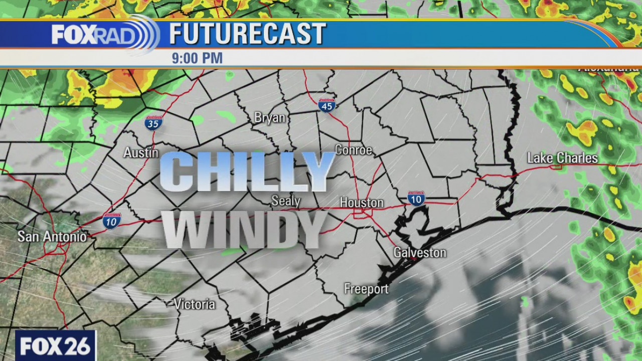
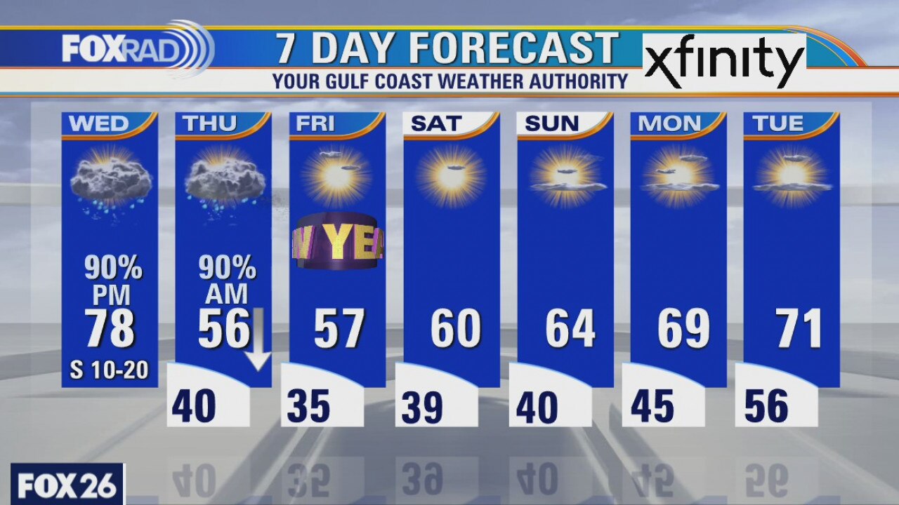
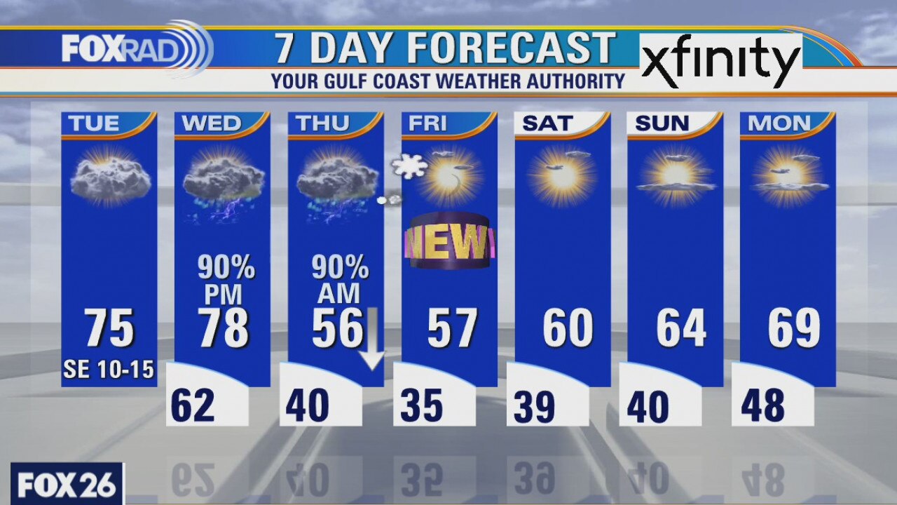
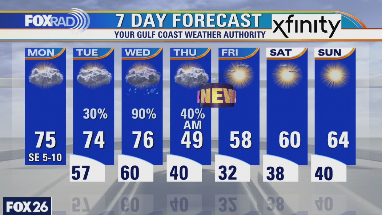
We're starting off on the milder side this morning with temperatures, this afternoon, expected to rise into the mid 70s with a mix of sun and clouds. Shower chances will increase late tonight and Wednesday as a cold front moves in our direction. Our best shot at rain and storms will be Wednesday night into Thursday morning where pockets of heavy rain will also be possible. A few storms could be on the stronger side, but severe weather is expected to be limited. The rain should all move out by Thursday afternoon and much cooler air will filter in behind it. Temperatures will drop throughout the day on Thursday and chilly weather will continue into the new year. Some warming is expected by the weekend.
We're starting off on the milder side this morning with temperatures, this afternoon, expected to rise into the mid 70s with a mix of sun and clouds. Shower chances will increase late tonight and Wednesday as a cold front moves in our direction. Our best shot at rain and storms will be Wednesday night into Thursday morning where pockets of heavy rain will also be possible. A few storms could be on the stronger side, but severe weather is expected to be limited. The rain should all move out by Thursday afternoon and much cooler air will filter in behind it. Temperatures will drop throughout the day on Thursday and chilly weather will continue into the new year. Some warming is expected by the weekend.
Strong storms on the way
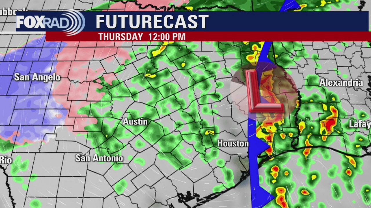
There will be a margin risk for a few strong to severe storms mainly west of Houston on Wednesday as an area of low pressure and cold front move into southeast Texas. Most of us can expect rain with some areas getting some scattered heavy showers. It all clears out early Thursday and the chilly air will set in.
There will be a margin risk for a few strong to severe storms mainly west of Houston on Wednesday as an area of low pressure and cold front move into southeast Texas. Most of us can expect rain with some areas getting some scattered heavy showers. It all clears out early Thursday and the chilly air will set in.
Monday Evening Weather Forecast
There will be a margin risk for a few strong to severe storms mainly west of Houston Wed as an area of low pressure and cold front move into SE Texas. Most of us can expect rain with some areas getting some scattered heavy showers. It all clears out early Thursday and the chilly air will set in.
There will be a margin risk for a few strong to severe storms mainly west of Houston Wed as an area of low pressure and cold front move into SE Texas. Most of us can expect rain with some areas getting some scattered heavy showers. It all clears out early Thursday and the chilly air will set in.
Monday weather forecast
A south wind and a few clouds, even fog, have kept temperatures from dropping too much and once the fog dissipates later this morning, we should see those temps warm into the low and mid 70s. Our attention then turns to a cold front that will be sliding through the area on Wednesday into Thursday. While a few showers are possible on Tuesday, the best shot at rain and storms is Wednesday into Thursday; a few storms may be strong to severe, capable of producing gusty winds. An isolated tornado is also possible as the storms move through. The storms should be gone by Thursday with improving conditions, albeit much cooler, as we head into the new year.
A south wind and a few clouds, even fog, have kept temperatures from dropping too much and once the fog dissipates later this morning, we should see those temps warm into the low and mid 70s. Our attention then turns to a cold front that will be sliding through the area on Wednesday into Thursday. While a few showers are possible on Tuesday, the best shot at rain and storms is Wednesday into Thursday; a few storms may be strong to severe, capable of producing gusty winds. An isolated tornado is also possible as the storms move through. The storms should be gone by Thursday with improving conditions, albeit much cooler, as we head into the new year.