


FOX 26 Houston Weather Forecast
Wednesday will look very similar to yesterday with near record high temperatures in the afternoon. But changes start to happen in southeast Texas on Thursday as a cold front approaches Houston dropping highs into the lower 80s. The heaviest of the rainfall from this front will happen early on Friday morning with rain chances extending into the weekend. Temperatures look more like November this weekend and into the start of next week.
Wednesday will look very similar to yesterday with near record high temperatures in the afternoon. But changes start to happen in southeast Texas on Thursday as a cold front approaches Houston dropping highs into the lower 80s. The heaviest of the rainfall from this front will happen early on Friday morning with rain chances extending into the weekend. Temperatures look more like November this weekend and into the start of next week.

FOX 26 Houston Weather Forecast
Wednesday will look very similar to yesterday with near record high temperatures in the afternoon. But changes start to happen in Southeast Texas on Thursday as a cold front approaches Houston dropping highs into the lower 80s. The heaviest of the rainfall from this front will happen early on Friday morning with rain chances extending into the weekend. Temperatures look more like November this weekend and into the start of next week.
Wednesday will look very similar to yesterday with near record high temperatures in the afternoon. But changes start to happen in Southeast Texas on Thursday as a cold front approaches Houston dropping highs into the lower 80s. The heaviest of the rainfall from this front will happen early on Friday morning with rain chances extending into the weekend. Temperatures look more like November this weekend and into the start of next week.

FOX 26 Houston Weather Forecast
After near record heat today, get ready for some changes to end the work week. Look for a few more warm days in the 80s followed by a cold front arriving Thursday night. That front will bring in some rounds of rain Thursday night and Friday with some of it heavy. 1-2.5" of rain is expected through Friday night. Front may stall SE of us this weekend which would allow for additional showers to linger that could impact your weekend plans. Fall weather returns Friday with high temperatures dropping back down to the 60s. Have a great night!
After near record heat today, get ready for some changes to end the work week. Look for a few more warm days in the 80s followed by a cold front arriving Thursday night. That front will bring in some rounds of rain Thursday night and Friday with some of it heavy. 1-2.5" of rain is expected through Friday night. Front may stall SE of us this weekend which would allow for additional showers to linger that could impact your weekend plans. Fall weather returns Friday with high temperatures dropping back down to the 60s. Have a great night!

FOX 26 Houston Weather Forecast
It's a quiet start to the work week with the most significant changes taking place this Thursday and Friday with a cold front. First though, temperatures will get warmer. Look for a few areas of fog early Tuesday with afternoon temperatures soaring to the middle to upper 80s for election day. Wednesday will be another warm and humid day with temperatures near 90 by the afternoon. Next cold front will start to push in Thursday evening and will bring a few big rounds of rain. Right now, models are indicating anywhere from 1-3" from Thursday afternoon to Friday morning with the heaviest south of I-10. Severe storms are not expected but the flood threat will be elevated during this time. So plan ahead for what could possibly be a messy and slow Friday AM Drive. It will feel like fall again this weekend with highs in the 60s.
It's a quiet start to the work week with the most significant changes taking place this Thursday and Friday with a cold front. First though, temperatures will get warmer. Look for a few areas of fog early Tuesday with afternoon temperatures soaring to the middle to upper 80s for election day. Wednesday will be another warm and humid day with temperatures near 90 by the afternoon. Next cold front will start to push in Thursday evening and will bring a few big rounds of rain. Right now, models are indicating anywhere from 1-3" from Thursday afternoon to Friday morning with the heaviest south of I-10. Severe storms are not expected but the flood threat will be elevated during this time. So plan ahead for what could possibly be a messy and slow Friday AM Drive. It will feel like fall again this weekend with highs in the 60s.

Tropical Weather Forecast - November 7, 2023
There's more good news today concerning the tropics. No tropical cyclones are anticipated across the Atlantic Basin or central/eastern Pacific for the rest of this week! That means the tropics are quiet for now. But hurricane season is still officially here until the end of November. But as expected towards the end of the season, things are finally calming down! Let's hope it stays that way for a few more weeks!
There's more good news today concerning the tropics. No tropical cyclones are anticipated across the Atlantic Basin or central/eastern Pacific for the rest of this week! That means the tropics are quiet for now. But hurricane season is still officially here until the end of November. But as expected towards the end of the season, things are finally calming down! Let's hope it stays that way for a few more weeks!

FOX 26 Houston Weather Forecast
The quiet and warm week continues until a cold front brings changes to southeast Texas. Look for rain to start arriving Thursday afternoon with heavier downpours possible early on Friday morning. Cooler temperatures will move into the Houston area for the weekend behind the cold front.
The quiet and warm week continues until a cold front brings changes to southeast Texas. Look for rain to start arriving Thursday afternoon with heavier downpours possible early on Friday morning. Cooler temperatures will move into the Houston area for the weekend behind the cold front.
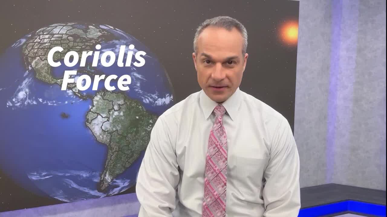
Monday's With Mike - What is the Coriolis Force?
FOX 26 Chief Meteorologist Mike Iscovitz explains in this episode of "Monday's With Mike."
FOX 26 Chief Meteorologist Mike Iscovitz explains in this episode of "Monday's With Mike."

FOX 26 Houston Weather Forecast
It's a quiet start to the work week with the most significant changes taking place this Thursday and Friday with a cold front. First though, temperatures will get warmer. Look for a few areas of fog early Tuesday with afternoon temperatures soaring to the middle to upper 80s for election day. Wednesday will be another warm and humid day with temperatures near 90 by the afternoon. Next cold front will start to push in Thursday evening and will bring a few big rounds of rain. Right now, models are indicating anywhere from 1-3" from Thursday afternoon to Friday morning with the heaviest south of I-10. Severe storms are not expected but the flood threat will be elevated during this time. So plan ahead for what could possibly be a messy and slow Friday AM Drive. It will feel like fall again this weekend with highs in the 60s.
It's a quiet start to the work week with the most significant changes taking place this Thursday and Friday with a cold front. First though, temperatures will get warmer. Look for a few areas of fog early Tuesday with afternoon temperatures soaring to the middle to upper 80s for election day. Wednesday will be another warm and humid day with temperatures near 90 by the afternoon. Next cold front will start to push in Thursday evening and will bring a few big rounds of rain. Right now, models are indicating anywhere from 1-3" from Thursday afternoon to Friday morning with the heaviest south of I-10. Severe storms are not expected but the flood threat will be elevated during this time. So plan ahead for what could possibly be a messy and slow Friday AM Drive. It will feel like fall again this weekend with highs in the 60s.

FOX 26 Houston Weather Forecast
It's a quiet start to the work week with the most significant changes taking place this Thursday and Friday with a cold front. First though, temperatures will get warmer. Look for a few areas of fog early Tuesday with afternoon temperatures soaring to the middle to upper 80s for election day. Wednesday will be another warm and humid day with temperatures near 90 by the afternoon. Next cold front will start to push in Thursday evening and will bring a few big rounds of rain. Right now, models are indicating anywhere from 1-3" from Thursday afternoon to Friday morning with the heaviest south of I-10. Severe storms are not expected but the flood threat will be elevated during this time. So plan ahead for what could possibly be a messy and slow Friday AM Drive. It will feel like fall again this weekend with highs in the 60s.
It's a quiet start to the work week with the most significant changes taking place this Thursday and Friday with a cold front. First though, temperatures will get warmer. Look for a few areas of fog early Tuesday with afternoon temperatures soaring to the middle to upper 80s for election day. Wednesday will be another warm and humid day with temperatures near 90 by the afternoon. Next cold front will start to push in Thursday evening and will bring a few big rounds of rain. Right now, models are indicating anywhere from 1-3" from Thursday afternoon to Friday morning with the heaviest south of I-10. Severe storms are not expected but the flood threat will be elevated during this time. So plan ahead for what could possibly be a messy and slow Friday AM Drive. It will feel like fall again this weekend with highs in the 60s.

Tropical Weather Forecast - November 6, 2023
As we go into our last three weeks of the 2023 hurricane season, things have finally calmed down! At this time, there's no tropical activity in the Atlantic, Gulf of Mexico, Caribbean or Eastern Pacific. No tropical cyclone formation is expected in the next 7 days. Water temperatures are starting to get cooler in parts of the Gulf of Mexico which signals that the end is getting closer! Hurricane season ends on November 30th! So far, we've had 20 names storms, 7 hurricanes and 3 major hurricanes.
As we go into our last three weeks of the 2023 hurricane season, things have finally calmed down! At this time, there's no tropical activity in the Atlantic, Gulf of Mexico, Caribbean or Eastern Pacific. No tropical cyclone formation is expected in the next 7 days. Water temperatures are starting to get cooler in parts of the Gulf of Mexico which signals that the end is getting closer! Hurricane season ends on November 30th! So far, we've had 20 names storms, 7 hurricanes and 3 major hurricanes.

FOX 26 Houston Weather Forecast
We will enjoy a very pleasant, relatively warm pattern for most of this week with highs in the mid 80s and lows in the 60s. Trouble could arrive on Friday with a strong upper-level system sweep across Texas bringing the chance for heavy rain and storms. Temps will cool a bit following the stormy weather.
We will enjoy a very pleasant, relatively warm pattern for most of this week with highs in the mid 80s and lows in the 60s. Trouble could arrive on Friday with a strong upper-level system sweep across Texas bringing the chance for heavy rain and storms. Temps will cool a bit following the stormy weather.

FOX 26 Houston Weather Forecast
We will enjoy a very pleasant, relatively warm pattern for most of this week with highs in the mid 80s and lows in the 60s. Trouble could arrive on Friday with a strong upper-level system sweep across Texas bringing the chance for heavy rain and storms. Temps will cool a bit following the stormy weather.
We will enjoy a very pleasant, relatively warm pattern for most of this week with highs in the mid 80s and lows in the 60s. Trouble could arrive on Friday with a strong upper-level system sweep across Texas bringing the chance for heavy rain and storms. Temps will cool a bit following the stormy weather.


Monday's With Mike -What is the Coriolis Force?
A Super Science-y edition of Mondays with Mike
A Super Science-y edition of Mondays with Mike

FOX 26 Houston Weather Forecast
Southeast Texas is locked into a warming trend for most of the week climbing up close to 90 degrees before the next front arrives. This late week surge of cooler air will also bring showers and possible heavy rains. Stay connected to the forecast during this week for the latest on this potential stormy weather.
Southeast Texas is locked into a warming trend for most of the week climbing up close to 90 degrees before the next front arrives. This late week surge of cooler air will also bring showers and possible heavy rains. Stay connected to the forecast during this week for the latest on this potential stormy weather.


Watch: Mom scoops baby moments before Storm Ciarán’s 100-mph winds shatter bedroom window
Video from her baby monitor shows the moment Jessica O'Reilly quickly scooped up her little one out of harm's way when hurricane-force winds from Storm Ciarán blasted through their window.
Video from her baby monitor shows the moment Jessica O'Reilly quickly scooped up her little one out of harm's way when hurricane-force winds from Storm Ciarán blasted through their window.

FOX 26 Houston Weather Forecast
Southeast Texas is locked into a warming trend for most of the week climbing up close to 90 degrees before the next front arrives. This late week surge of cooler air will also bring showers and possible heavy rains. Stay connected to the forecast during this week for the latest on this potential stormy weather.
Southeast Texas is locked into a warming trend for most of the week climbing up close to 90 degrees before the next front arrives. This late week surge of cooler air will also bring showers and possible heavy rains. Stay connected to the forecast during this week for the latest on this potential stormy weather.

Tropical Weather Forecast - November 5, 2023
In the Eastern Pacific Pilar remains a tropical storm but not for long. In the western Caribbean, a large area of disorganized showers and storms brings heavy rain to parts of Central America.
In the Eastern Pacific Pilar remains a tropical storm but not for long. In the western Caribbean, a large area of disorganized showers and storms brings heavy rain to parts of Central America.

FOX 26 Weather Forecast
Happy Sunday, everyone. Today looks great, so enjoy. We'll have a warming trend this week taking us into the mid and upper 80s by Tuesday and Wednesday. Patchy fog is possible each night. Now, a front will move in late this week, most likely Friday and heavy rain is looking possible, so stay tuned for updates.
Happy Sunday, everyone. Today looks great, so enjoy. We'll have a warming trend this week taking us into the mid and upper 80s by Tuesday and Wednesday. Patchy fog is possible each night. Now, a front will move in late this week, most likely Friday and heavy rain is looking possible, so stay tuned for updates.

FOX 26 Houston Weather Forecast
It's going to be a beautiful weekend across the Texas Gulf Coast with highs near 80 and lows near 60. Watch for patchy overnight fog each morning through early next week. Rain chances are limited this weekend to just few small showers mainly near the coast. Next week, a warmer pattern kicks in and highs could reach the mid to upper 80s before a late week cold front brings storms by Thursday and Friday.
It's going to be a beautiful weekend across the Texas Gulf Coast with highs near 80 and lows near 60. Watch for patchy overnight fog each morning through early next week. Rain chances are limited this weekend to just few small showers mainly near the coast. Next week, a warmer pattern kicks in and highs could reach the mid to upper 80s before a late week cold front brings storms by Thursday and Friday.

FOX 26 Houston Weather Forecast
It's going to be a beautiful weekend across the Texas Gulf Coast with highs near 80 and lows near 60. Watch for patchy overnight fog each morning through early next week. Rain chances are limited this weekend to just few small showers mainly near the coast. Next week, a warmer pattern kicks in and highs could reach the mid to upper 80s before a late week cold front brings storms by Thursday and Friday.
It's going to be a beautiful weekend across the Texas Gulf Coast with highs near 80 and lows near 60. Watch for patchy overnight fog each morning through early next week. Rain chances are limited this weekend to just few small showers mainly near the coast. Next week, a warmer pattern kicks in and highs could reach the mid to upper 80s before a late week cold front brings storms by Thursday and Friday.