


FOX 26 Houston Weather Forecast
Heat Advisory is back for Houston! Heat Advisory will be in effect for Houston & most of SE Texas Monday from 11 AM until 9 PM. That means heat index values could soar up to 110 Monday PM. Make sure to drink plenty of water, take breaks in the shade and stay in the AC as much as you can! Also look before you lock - always check your car for your pets and kids before you walk away! More heat advisories are likely on the way for the rest of this week with temperatures staying near 100 and plenty of humidity. Isolated rain and thunder will stick around the next few afternoons with the best chance north of Houston. But we should dry things out for the middle and end of the week. Stay cool and safe and have a great week!
Heat Advisory is back for Houston! Heat Advisory will be in effect for Houston & most of SE Texas Monday from 11 AM until 9 PM. That means heat index values could soar up to 110 Monday PM. Make sure to drink plenty of water, take breaks in the shade and stay in the AC as much as you can! Also look before you lock - always check your car for your pets and kids before you walk away! More heat advisories are likely on the way for the rest of this week with temperatures staying near 100 and plenty of humidity. Isolated rain and thunder will stick around the next few afternoons with the best chance north of Houston. But we should dry things out for the middle and end of the week. Stay cool and safe and have a great week!

Tropical Weather Forecast - July 9, 2023
Things are still quiet in the Gulf of Mexico and the Caribbean. But there's one area in the Central Atlantic being monitored for possible development. There's a 30% chance of a tropical or subtropical cyclone developing NE of Bermuda over the next 7 days. Eastern Pacific is still fairly active with a system south of the southern Mexican coast with a high chance of development over the next 7 days. Another system offshore of SW Mexico has a medium chance for development over the next few days. But it is moving away from the US and Mexico.
Things are still quiet in the Gulf of Mexico and the Caribbean. But there's one area in the Central Atlantic being monitored for possible development. There's a 30% chance of a tropical or subtropical cyclone developing NE of Bermuda over the next 7 days. Eastern Pacific is still fairly active with a system south of the southern Mexican coast with a high chance of development over the next 7 days. Another system offshore of SW Mexico has a medium chance for development over the next few days. But it is moving away from the US and Mexico.

El Tiempo 9 de Julio de 2023
#FOX26 Meteor?loga Lena Maria Arango tiene su pron?stico para la semana laboral.
#FOX26 Meteor?loga Lena Maria Arango tiene su pron?stico para la semana laboral.

Houston Weather: Triple-digit conditions possibly returning
Plan for highs in the upper 90s all week long, with a few isolated triple-digit temps possible. Humidity-fueled heat indices will be about 5-10 degrees above that, with heat alerts likely throughout the week. Plan ahead to limit your time outside during the hottest parts of the day, especially for strenuous activity. A few isolated showers or storms are possible for the next few days, but past that rain looks slim to none through the weekend.
Plan for highs in the upper 90s all week long, with a few isolated triple-digit temps possible. Humidity-fueled heat indices will be about 5-10 degrees above that, with heat alerts likely throughout the week. Plan ahead to limit your time outside during the hottest parts of the day, especially for strenuous activity. A few isolated showers or storms are possible for the next few days, but past that rain looks slim to none through the weekend.

FOX 26 Houston Weather Forecast
Heat Advisories have been issued to the west of Houston over around Austin and San Antonio. There area no heat advisories for the Houston area yet but they could be issued early next week on Monday or Tuesday. That's when heat index values will likely approach 108-110. Temperatures will gradually increase over the next week with triple digits likely by Thursday. Few showers and storms will linger the next few afternoons before they go away completely. So plan on a little rain and a lot of heat over the coming days. Drink lots of water and take it easy in the heat!
Heat Advisories have been issued to the west of Houston over around Austin and San Antonio. There area no heat advisories for the Houston area yet but they could be issued early next week on Monday or Tuesday. That's when heat index values will likely approach 108-110. Temperatures will gradually increase over the next week with triple digits likely by Thursday. Few showers and storms will linger the next few afternoons before they go away completely. So plan on a little rain and a lot of heat over the coming days. Drink lots of water and take it easy in the heat!

Tropical Weather Forecast - July 8, 2023
The Gulf of Mexico, Caribbean and Atlantic are still very quiet with no tropical cyclone activity expected over the next 7 days. Saharan dust continues to hinder development even though water temperatures are extremely warm. We are expecting things to get more active over the next month or two so stay alert! In the eastern Pacific, two systems have a high chance of developing into a tropical depression or storm. One could become a named storm tonight or tomorrow while the other will likely take a little longer. Calvin and Dora are the next two names on the list for eastern Pacific storms.
The Gulf of Mexico, Caribbean and Atlantic are still very quiet with no tropical cyclone activity expected over the next 7 days. Saharan dust continues to hinder development even though water temperatures are extremely warm. We are expecting things to get more active over the next month or two so stay alert! In the eastern Pacific, two systems have a high chance of developing into a tropical depression or storm. One could become a named storm tonight or tomorrow while the other will likely take a little longer. Calvin and Dora are the next two names on the list for eastern Pacific storms.


Saildrone deploying record 12 drones to hunt hurricanes in Atlantic, Gulf of Mexico
The dozen unmanned vehicles will be storm chasing in the tropical Atlantic Ocean and Gulf of Mexico.
The dozen unmanned vehicles will be storm chasing in the tropical Atlantic Ocean and Gulf of Mexico.
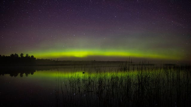

Solar storm forecasted for Thursday could bring Northern Lights to 17 states
This solar storm is part of an 11-year solar cycle that’s making the Northern Lights visible in places farther to the south. Here's where auroral activity is forecast.
This solar storm is part of an 11-year solar cycle that’s making the Northern Lights visible in places farther to the south. Here's where auroral activity is forecast.


Dolphin and her baby rescued after being trapped in pond for 2 years
Video shows a group of rescuers gently capture the dolphins and bring them safely back to the open waters where they belong.
Video shows a group of rescuers gently capture the dolphins and bring them safely back to the open waters where they belong.
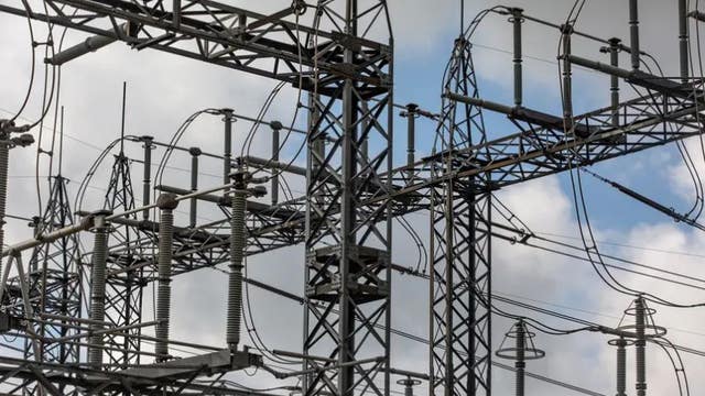

Texas gets $60 million in federal funds to strengthen power grid against extreme weather
The Texas Division of Emergency Management will decide how to use the money.
The Texas Division of Emergency Management will decide how to use the money.

Possible showers but mainly hot, humid temperatures
Heat & humidity will be the "entree" this weekend, with a side of scattered afternoon downpours/storms. If you're lucky enough to get under a cooling shower, it'll provide a brief dip in temps but could drop a quick 1-2". Otherwise, we'll be hovering near heat-alert criteria once again. By early next week, dependent on the placement of the heat dome rain chances drop and temperatures rise. So, expect a hot and dry end to the week and be ready to make adjustments to plans as needed to keep heat safety in check.
Heat & humidity will be the "entree" this weekend, with a side of scattered afternoon downpours/storms. If you're lucky enough to get under a cooling shower, it'll provide a brief dip in temps but could drop a quick 1-2". Otherwise, we'll be hovering near heat-alert criteria once again. By early next week, dependent on the placement of the heat dome rain chances drop and temperatures rise. So, expect a hot and dry end to the week and be ready to make adjustments to plans as needed to keep heat safety in check.

FOX 26 Houston Weather Forecast
Watch out for a few heavy downpours possible through the early evening. After sunset, we should be drying out. We will repeat this pattern Saturday and Sunday PM with widely scattered showers and storms that could impact your outdoor plans temporarily. By next week, rain chances really start to drop off as the heat builds with our next heat dome. High pressure will sit across west Texas but get close enough to bring us a possible stretch of triple digit temperatures and possible heat advisories next week. So enjoy the rain and break from the really intense heat because it's back next week!
Watch out for a few heavy downpours possible through the early evening. After sunset, we should be drying out. We will repeat this pattern Saturday and Sunday PM with widely scattered showers and storms that could impact your outdoor plans temporarily. By next week, rain chances really start to drop off as the heat builds with our next heat dome. High pressure will sit across west Texas but get close enough to bring us a possible stretch of triple digit temperatures and possible heat advisories next week. So enjoy the rain and break from the really intense heat because it's back next week!


Summer heat is the 'No. 1 weather-related killer,' doctor warns
States in the Southwest and West have been under Excessive Heat Warnings and heat advisories for the past two weeks
States in the Southwest and West have been under Excessive Heat Warnings and heat advisories for the past two weeks

Tropical Weather Forecast - July 7, 2023
All is quiet in the Gulf of Mexico, Caribbean and Atlantic with Saharan dust helping to hinder tropical cyclone development for now. But water temperatures are very warm and that could aid in development over the next few weeks. There are two areas of low pressure in the eastern Pacific that have a high chance for development over the next week. But they are moving away from Mexico and the US for now.
All is quiet in the Gulf of Mexico, Caribbean and Atlantic with Saharan dust helping to hinder tropical cyclone development for now. But water temperatures are very warm and that could aid in development over the next few weeks. There are two areas of low pressure in the eastern Pacific that have a high chance for development over the next week. But they are moving away from Mexico and the US for now.

FOX 26 Houston Weather Forecast
Heavy rain yesterday held the high temp to just 89? which was the "coolest" in a month. Today looks like a typical early July day with low 90s and scattered afternoon storms. This weekend will bring mid to upper 90s with isolated rain. Next week is a bit tricky with another heat dome setting up over Texas, but likely to stay to our west. This will bring more extreme heat to Texas, but will put Houston on the edge of heat to our west and rain to our east.
Heavy rain yesterday held the high temp to just 89? which was the "coolest" in a month. Today looks like a typical early July day with low 90s and scattered afternoon storms. This weekend will bring mid to upper 90s with isolated rain. Next week is a bit tricky with another heat dome setting up over Texas, but likely to stay to our west. This will bring more extreme heat to Texas, but will put Houston on the edge of heat to our west and rain to our east.
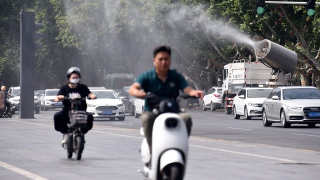

Chinese cities open air raid shelters for relief amid deadly heat wave
Cities across China opened their air raid shelters to offer residents relief from the heat Friday as unusually high temperatures across parts of the country started claiming lives.
Cities across China opened their air raid shelters to offer residents relief from the heat Friday as unusually high temperatures across parts of the country started claiming lives.

FOX 26 Houston Weather
Heavy rain yesterday held the high temp to just 89? which was the "coolest" in a month. Today looks like a typical early July day with low 90s and a scattered of afternoon storms. This weekend will bring mid to upper 90s with isolated rain. Next week is a bit tricky with another heat dome setting up over Texas, but likely to stay to our west. This will bring more extreme heat to Texas, but will put Houston on the edge of heat to our west and rain to our east.
Heavy rain yesterday held the high temp to just 89? which was the "coolest" in a month. Today looks like a typical early July day with low 90s and a scattered of afternoon storms. This weekend will bring mid to upper 90s with isolated rain. Next week is a bit tricky with another heat dome setting up over Texas, but likely to stay to our west. This will bring more extreme heat to Texas, but will put Houston on the edge of heat to our west and rain to our east.

FOX 26 Houston Weather Forecast
Today has been an unusual summer day in Houston with refreshing cooler temperatures due to clouds and some heavy downpours. We also set a new record for daily maximum rainfall at Houston Bush Intercontinental Airport with 2.13"! Parts of SE Texas enjoyed the 70s this afternoon with rain-cooled air. Many areas have picked up 1-3" of rain today with a few showers lingering through early tonight. Watch out for some street flooding where the heavy rain has come down. Look for a 40% chance for showers and storms Friday afternoon with rain chances gradually dropping over the weekend. Another heat dome is set to push in early next week which could mean more heat alerts and another stretch of triple digits temperatures.
Today has been an unusual summer day in Houston with refreshing cooler temperatures due to clouds and some heavy downpours. We also set a new record for daily maximum rainfall at Houston Bush Intercontinental Airport with 2.13"! Parts of SE Texas enjoyed the 70s this afternoon with rain-cooled air. Many areas have picked up 1-3" of rain today with a few showers lingering through early tonight. Watch out for some street flooding where the heavy rain has come down. Look for a 40% chance for showers and storms Friday afternoon with rain chances gradually dropping over the weekend. Another heat dome is set to push in early next week which could mean more heat alerts and another stretch of triple digits temperatures.

Tropical Weather Forecast - July 6, 2023
The big news today is that the official Colorado State University hurricane season outlook was updated for a second time since April. Forecasters are now calling for 18 named storms, 9 hurricanes and 4 major hurricanes due to the unusually warm waters of the tropical Atlantic 4-6 degrees above normal. At this point, the Atlantic, Gulf of Mexico & Caribbean are quiet with no tropical cyclone formation expected for the next 7 days. But things are expected to get a lot more active in August and September which is usually the most active period of hurricane season. The eastern pacific is more active with two broad areas of low pressure off the S/SW Mexican coast. They both have a shot to become a tropical depression or storm over the next 7 days.
The big news today is that the official Colorado State University hurricane season outlook was updated for a second time since April. Forecasters are now calling for 18 named storms, 9 hurricanes and 4 major hurricanes due to the unusually warm waters of the tropical Atlantic 4-6 degrees above normal. At this point, the Atlantic, Gulf of Mexico & Caribbean are quiet with no tropical cyclone formation expected for the next 7 days. But things are expected to get a lot more active in August and September which is usually the most active period of hurricane season. The eastern pacific is more active with two broad areas of low pressure off the S/SW Mexican coast. They both have a shot to become a tropical depression or storm over the next 7 days.

Flood advisory issued for Houston-area
FOX 26 Meteorologist Remeisha Shade has the latest on the very heavy rain moving over the Houston area and the increasing flood threat.
FOX 26 Meteorologist Remeisha Shade has the latest on the very heavy rain moving over the Houston area and the increasing flood threat.